In making the Lukla scenery, Sascha shows great insight into why you might want to be there, and how you’d go about it.
In the sim, a helicopter ride can follow what the diehards do on the ground.
The screenshots of that trek are
here.
No screenshots here: This is the backstory of what I found while asking questions about the region.
You might want to come back here, if you have the time or inclination to discover more.
Where did Everest come from?
The Himalayan mountain range and Tibetan plateau have formed as a result of the collision between the Indian Plate and Eurasian Plate which began 50 million years ago and continues today.
https://www.geolsoc.org.uk/Plate-Tecton ... es%20today.
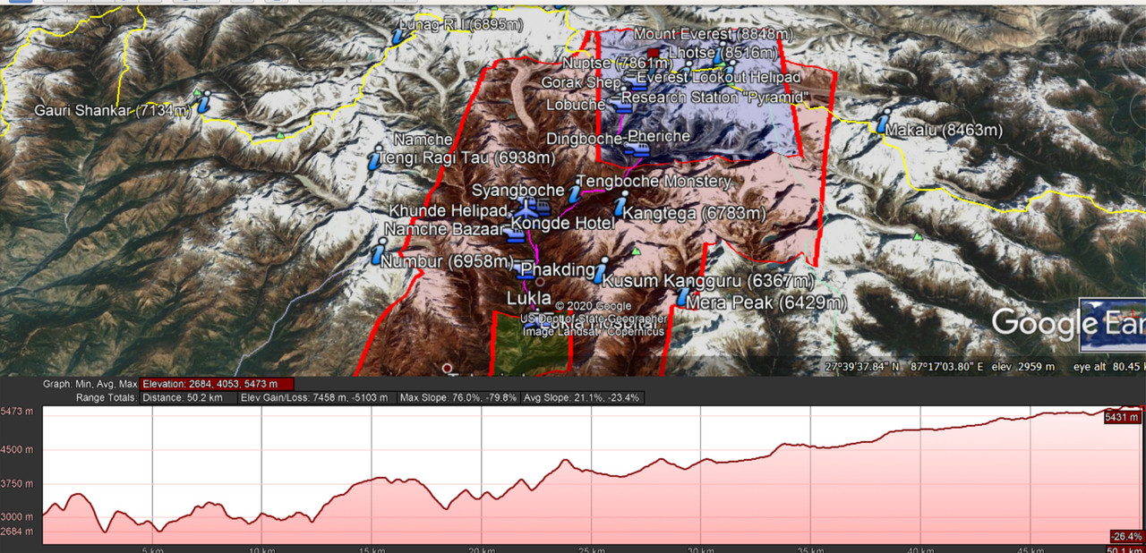
So it’s all high. You start out high, it’s not as if Everest sticks out of the ground by 30,000ft.
Tenzing–Hillary Airport Elevation AMSL: 9,334 ft / 2,845 m
South Base Camp is in Nepal at an altitude of 5,364 metres (17,598 ft)
The Everest Base Camp trek on the south side, at an altitude of 17,900 feet (5,500 m), is one of the most popular trekking routes in the Himalayas and about 40,000 people per year make the trek there from Lukla airport.
Trekkers usually fly from Kathmandu to Lukla to save time and energy before beginning the trek to the base camp.
However, trekking to Lukla is possible.
There are no roads from Kathmandu to Lukla and as a result, the only method of transporting large and heavy goods is by plane.
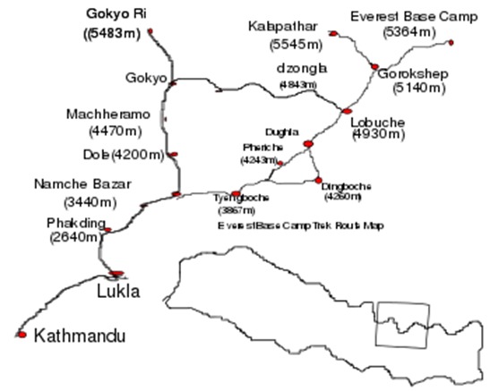
Everest Base Trek Route Map from Nepal side
From Lukla, climbers trek upward to the Sherpa capital of Namche Bazaar, 3,440 metres (11,290 ft), following the valley of the Dudh Kosi river.
It takes about two days to reach the village, which is the central hub of the area.
Typically at this point, climbers allow a day of rest for acclimatization.
They then trek for another two days to Dingboche, 4,260 metres (13,980 ft) before resting for another day for further acclimatization.
Another two days takes them to Everest Base Camp via Gorakshep, the flat field below Kala Patthar, 5,545 metres (18,192 ft) and Mt. Pumori.
There are helicopters in the area of course. Many would choose the flightseeing trip just for the views.
You do need a pretty good turbine helicopter for this:


