Trolly's VLC Tour

Share your simulated flights around NZ here. The place to post your flight reports, flight plan instructions and progress on tours

Postby ardypilot » Sat Sep 17, 2011 6:26 pm

It would be plain rude not for me not to jump on the bandwagon and tour the country with my system and fresh install of VLC. I aim to do this through 11 legs, visiting other major addon scenery areas from north to south, as follows:

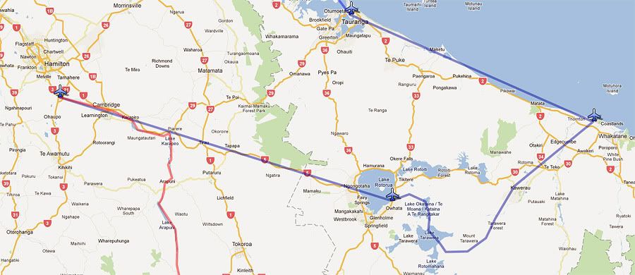
Leg 1: Kaipara Flats to Tauranga, via Auckland Supercity
Leg 2: Tauranga to Hamilton, via Whakatane, Mt Tarawera and Rotorua
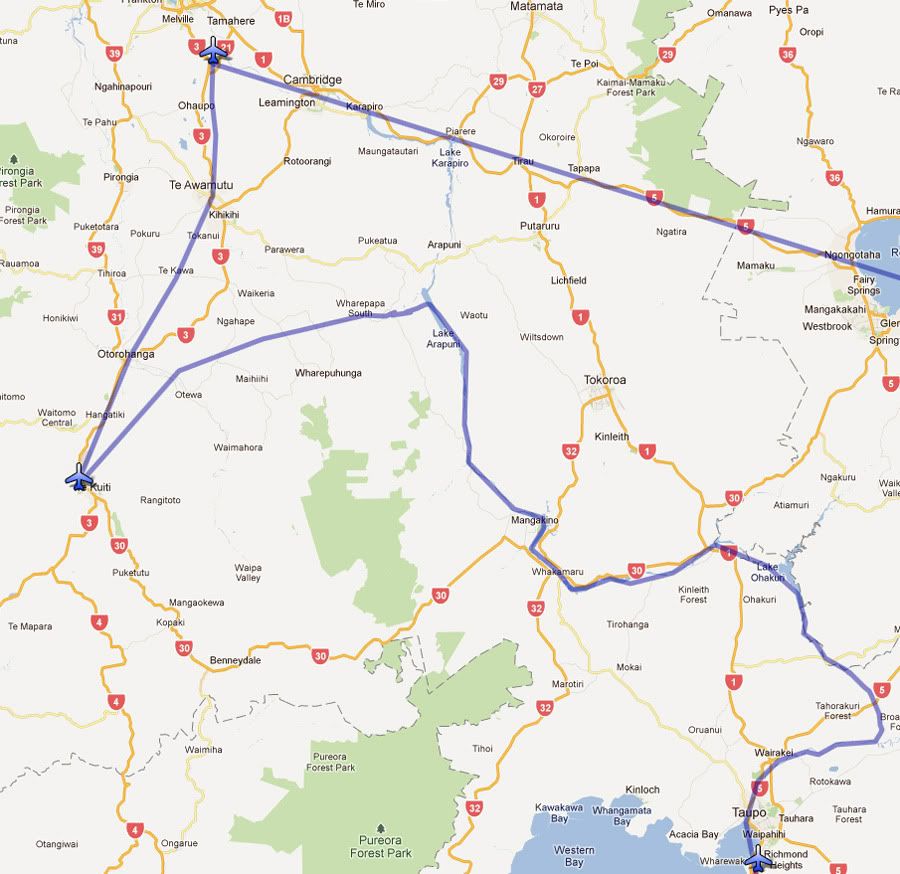
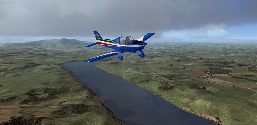
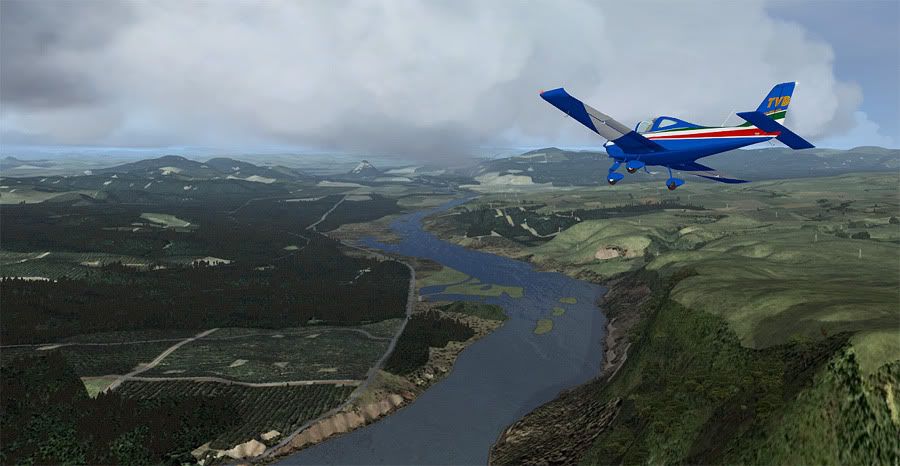
Leg 3: Hamilton to Taupo, following the Waikato River
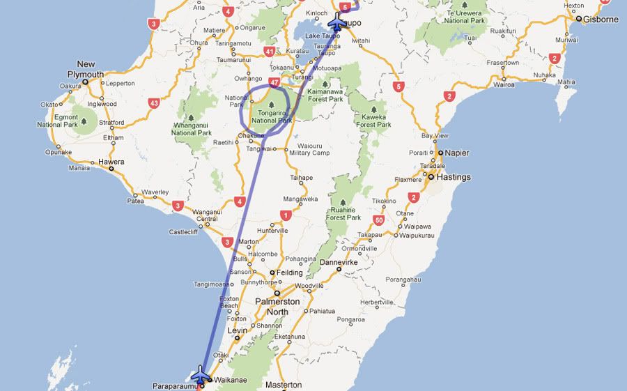
Leg 4: Taupo to Paraparaumu, via Mt Ruapehu
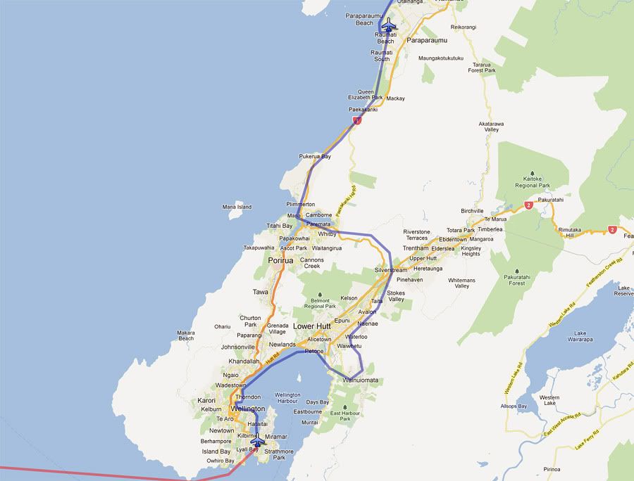
Leg 5: Paraparaumu to Wellington, via Hutt City
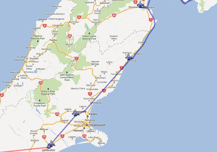
Leg 6: Wellington to Woodbourne, via Port Underwood
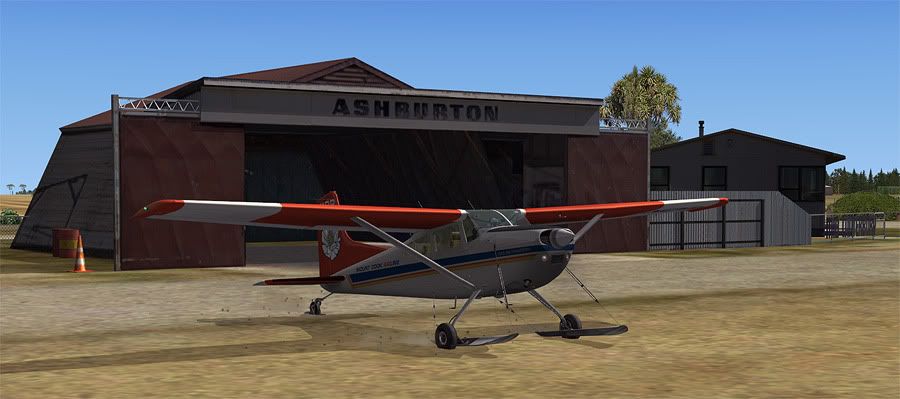
Leg 7: Woodbourne to Ashburton, via Kaikoura and Forest Field
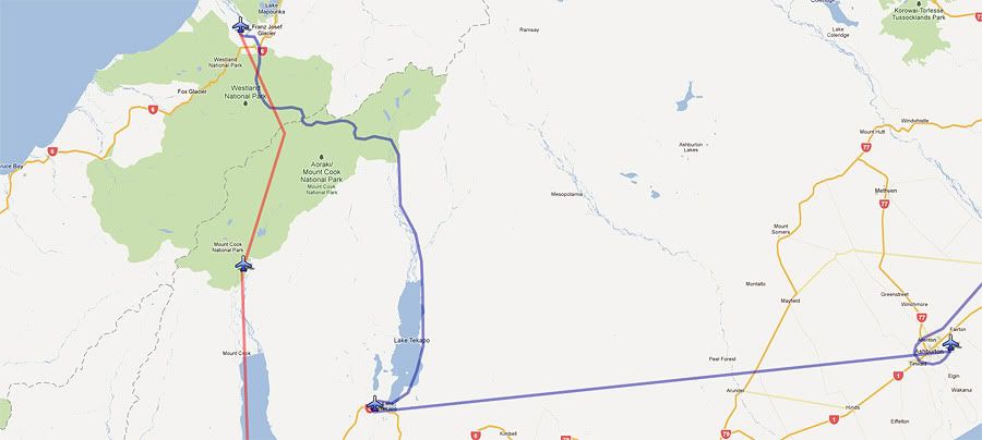
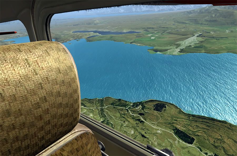
Leg 8: Ashburton to Franz Joseph via Tekapo
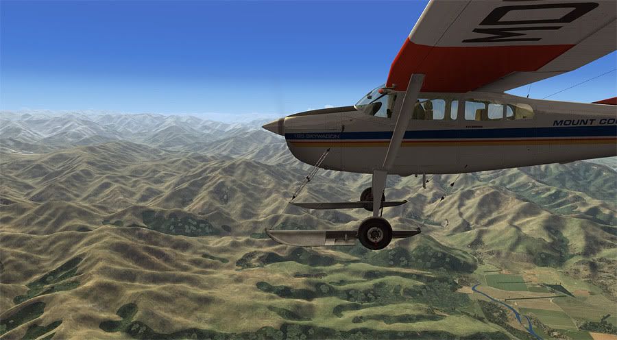
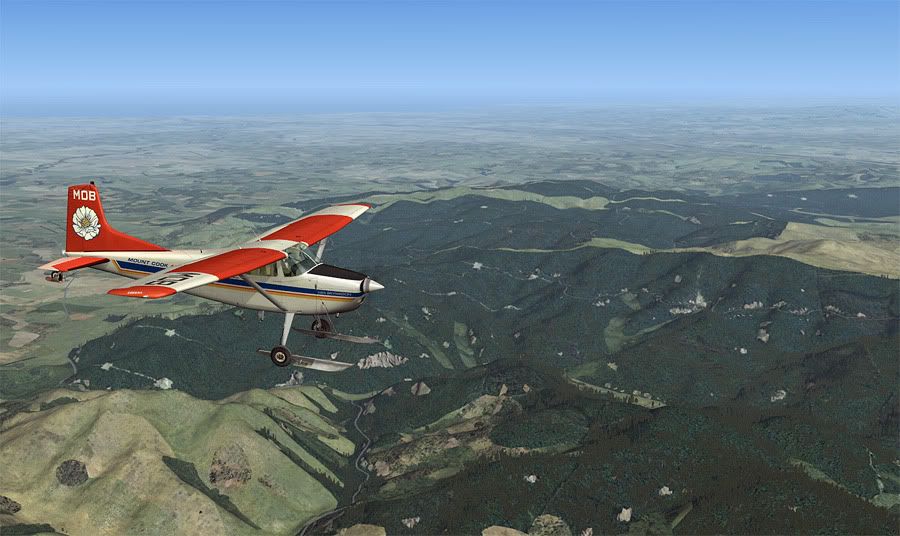
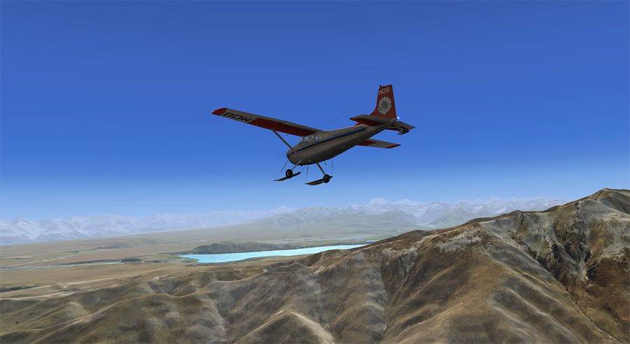
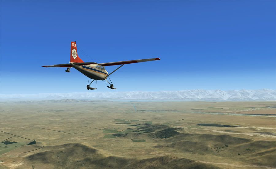
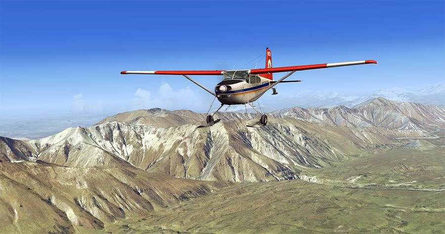
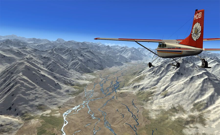
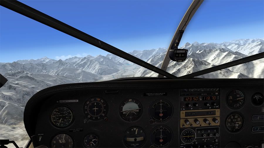
Leg 9: Franz Joseph to Queenstown, via Mount Cook and Wanaka
Leg 10: Queenstown to Milford Sound
Leg 11: Milford Sound to Manapouri


All up, the way I've planned it VFR, the flight distance is 2120.6 km with an estimated time en route of 9 hours 51 mins based on the Tecnam P2002 Sierra which I'll be completing the first three legs in.

However, I've got another further six aircraft changes up my sleeve, with a planned little storyline for each one. The idea is to use local aircraft in belivable flight scenarios, and compare what I'm seeing virtually to what I've seen in real life. I've flown overhead or landed at most of the airports I plan to visit apart from the a few of the more remote South Island fields. You can view the interactive version of my flight map here: http://g.co/maps/uvxq5

Leg One

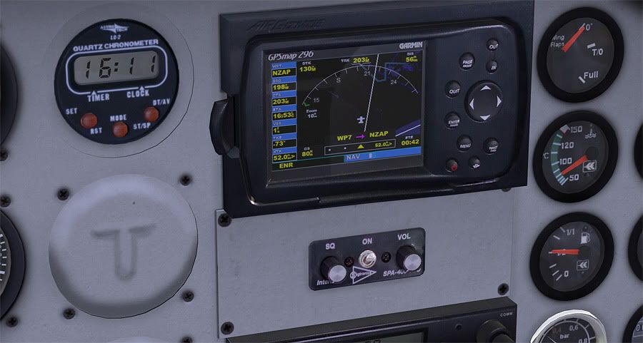
Leg Distance: 146nm, Leg Time: 1:05
Total Distance: 146nm, Total Time: 1:05

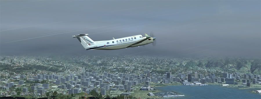
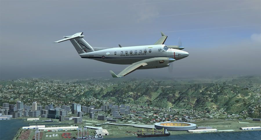
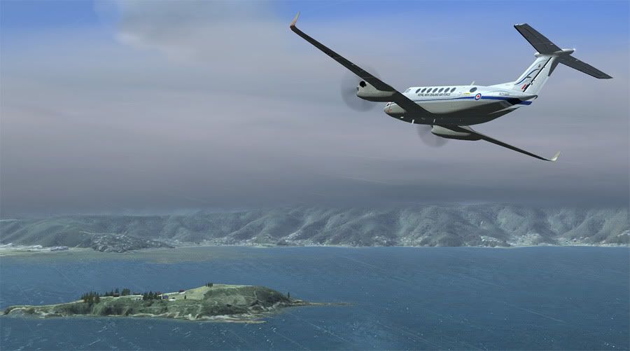
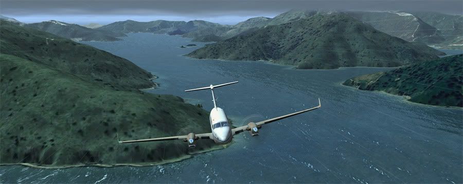
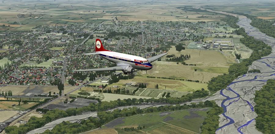
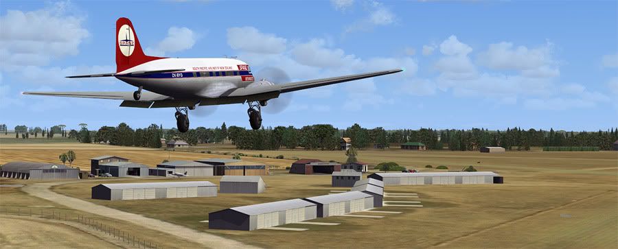
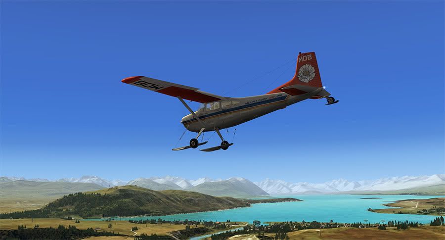
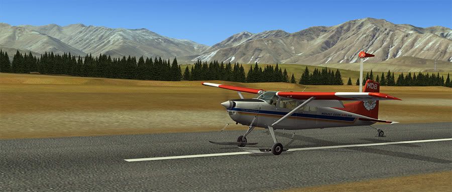
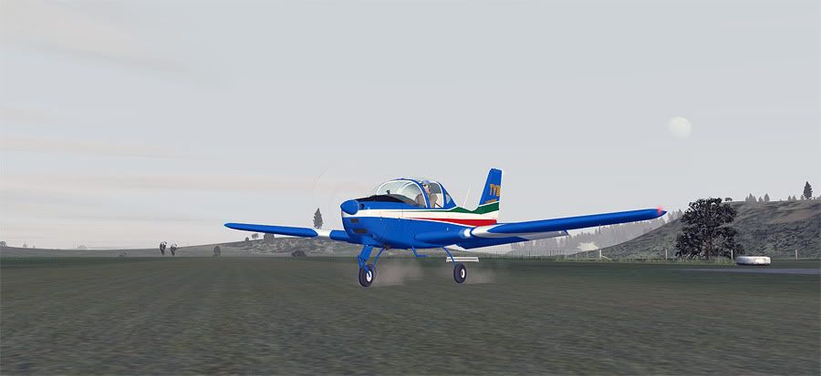
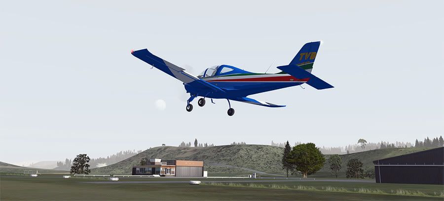
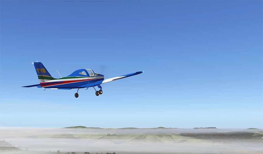
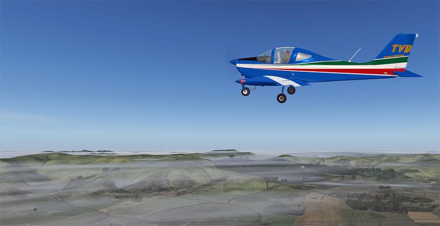
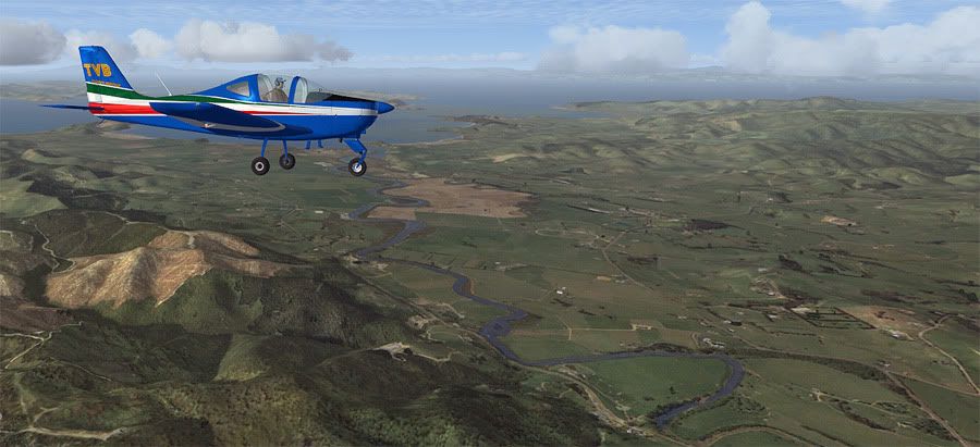
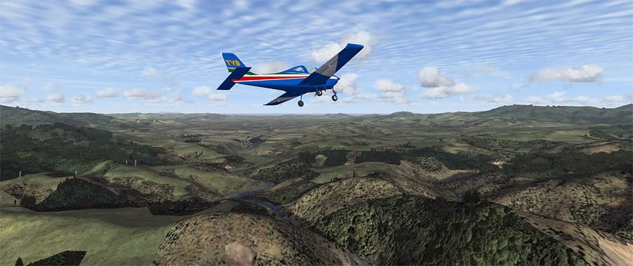
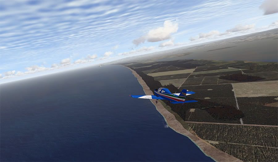
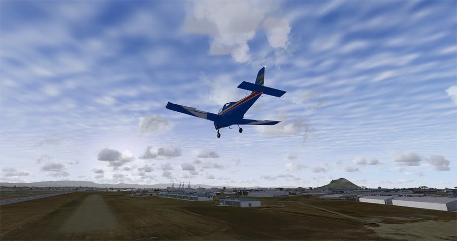
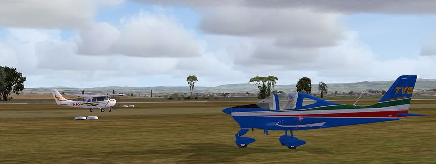
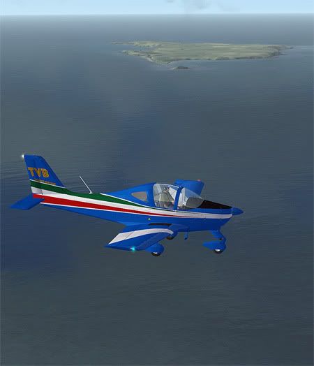
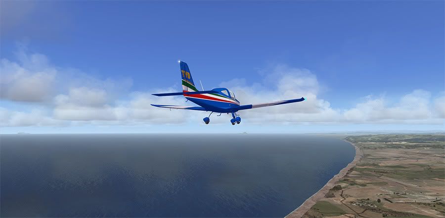
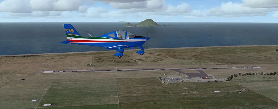
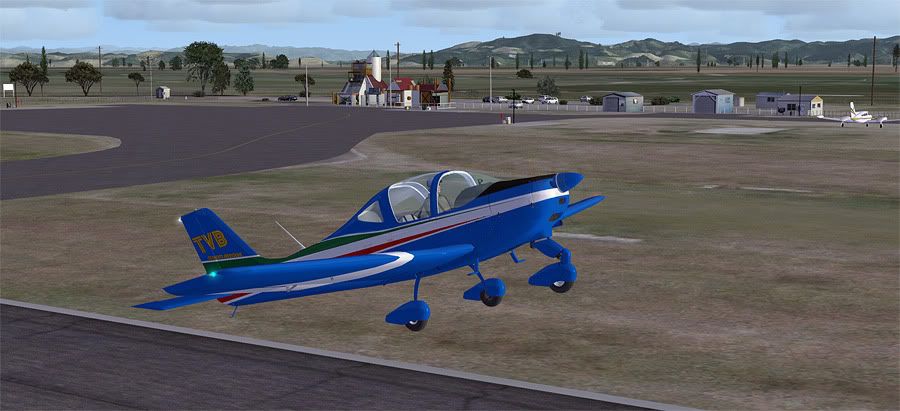
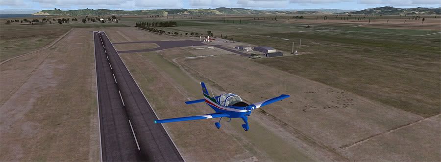
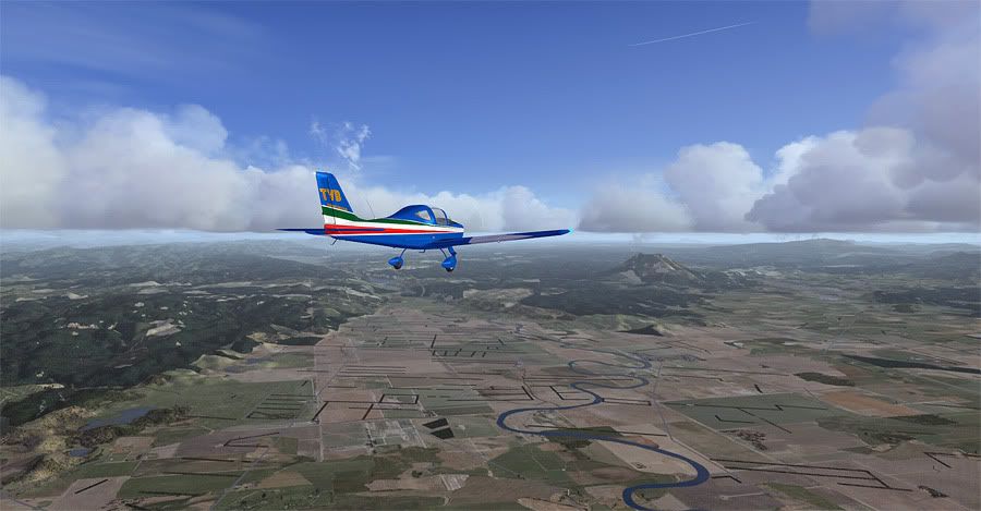
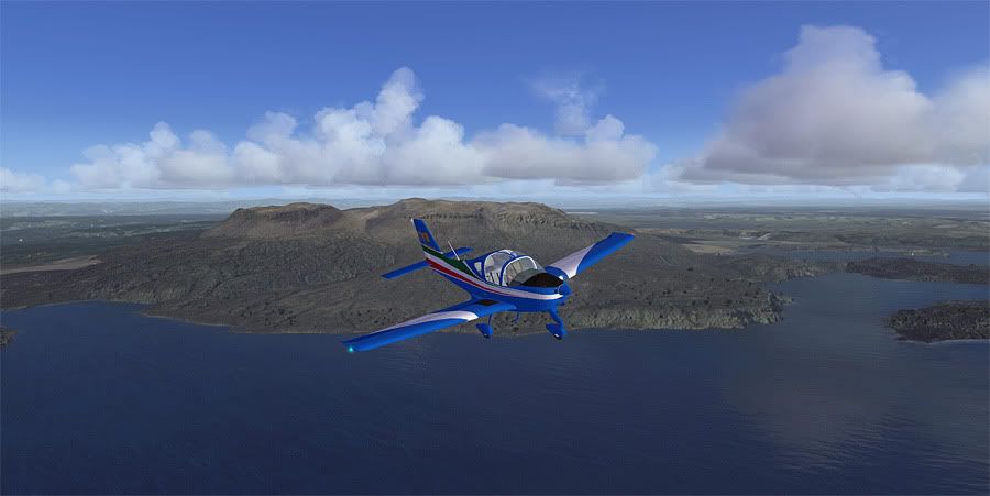
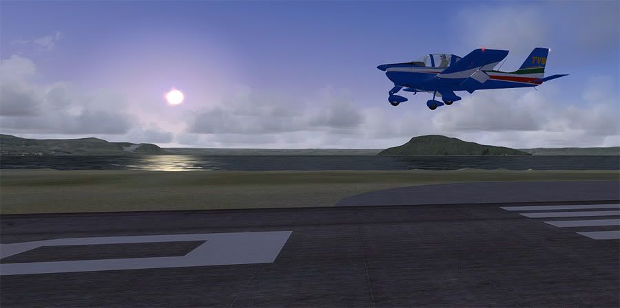
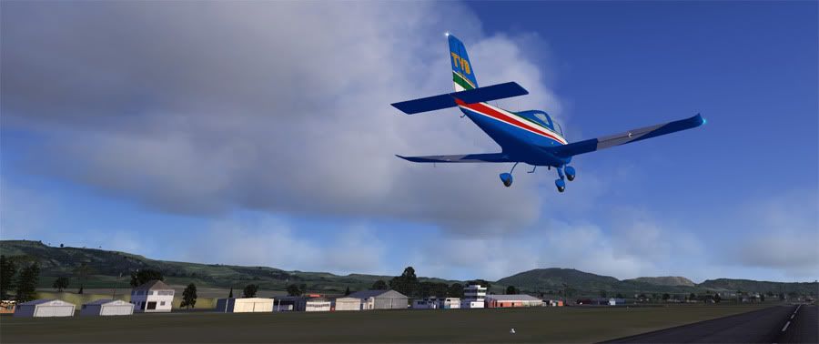
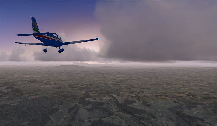
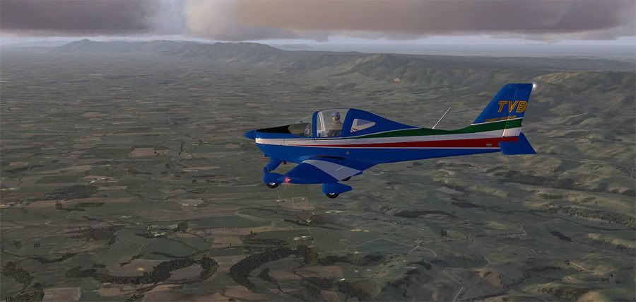
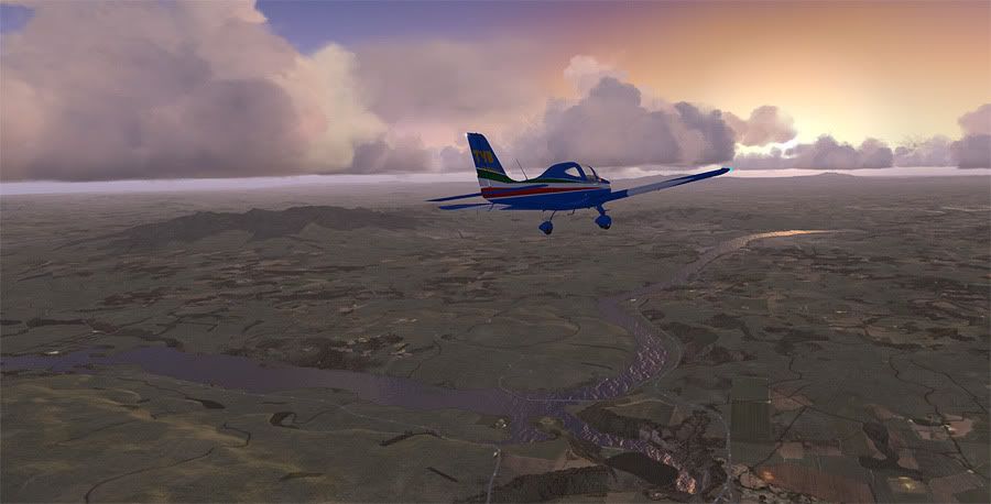
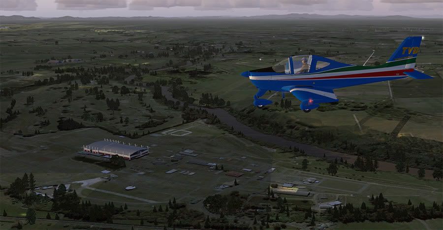
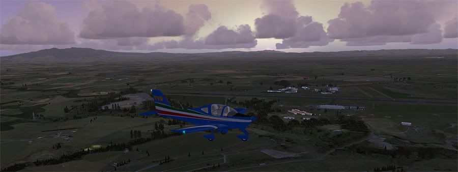
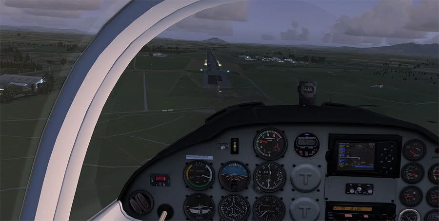
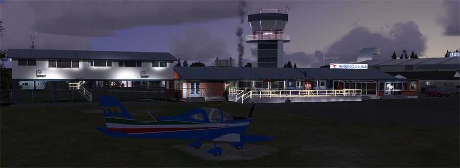
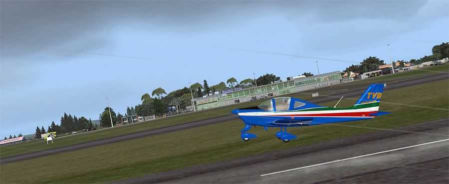
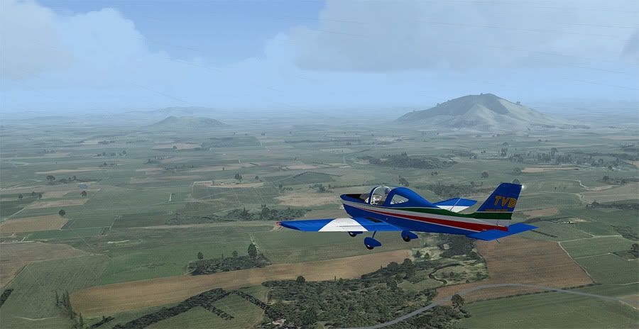
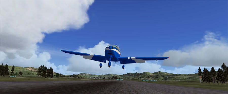
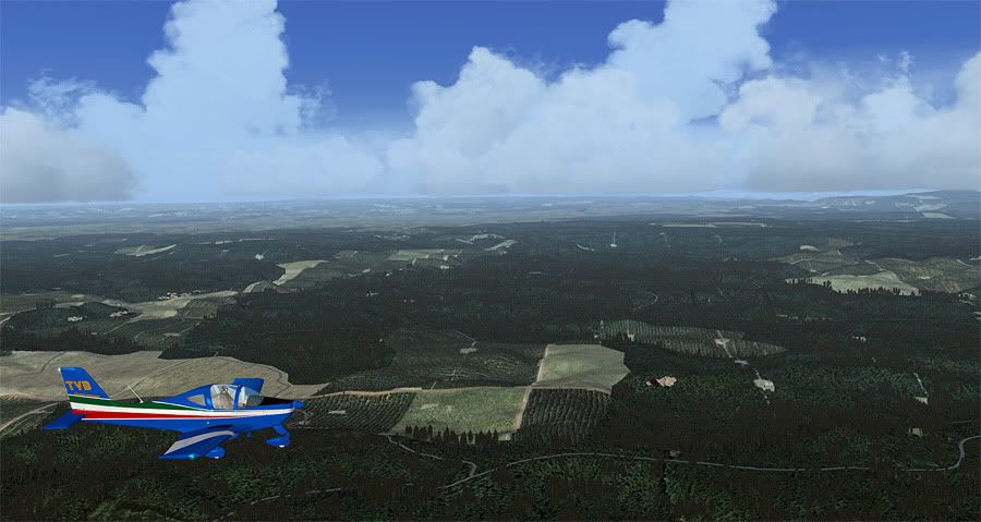
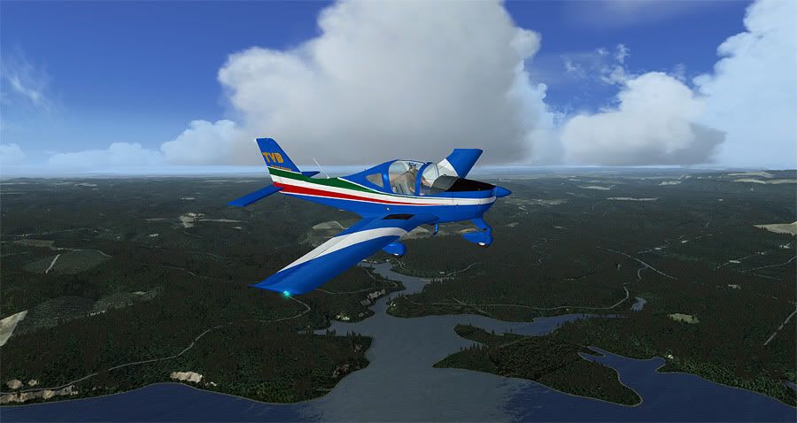
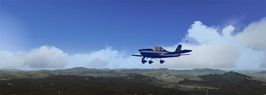
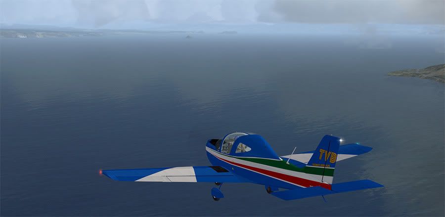
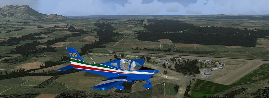
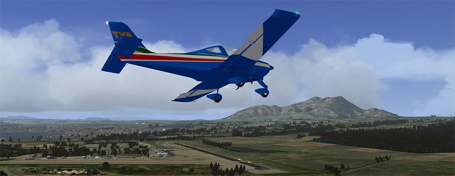
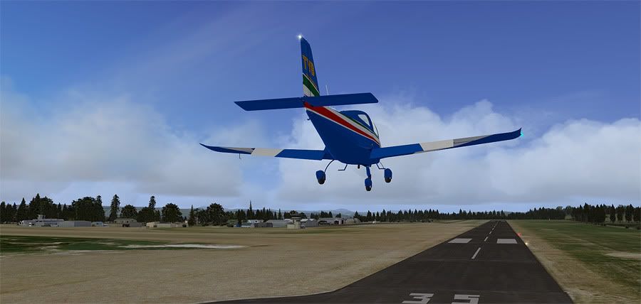
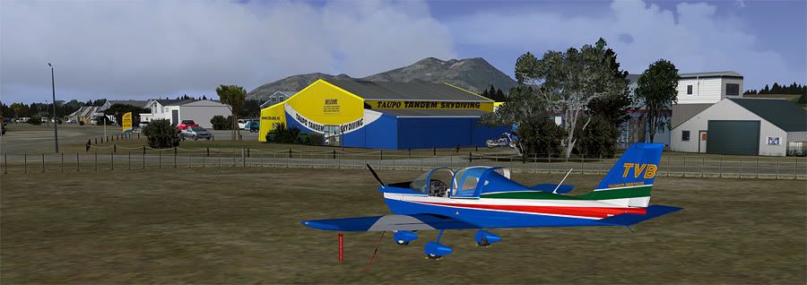
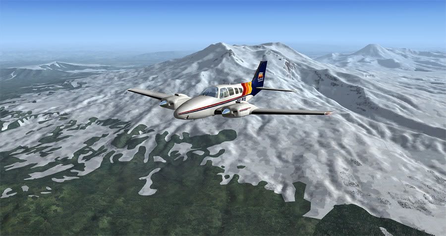
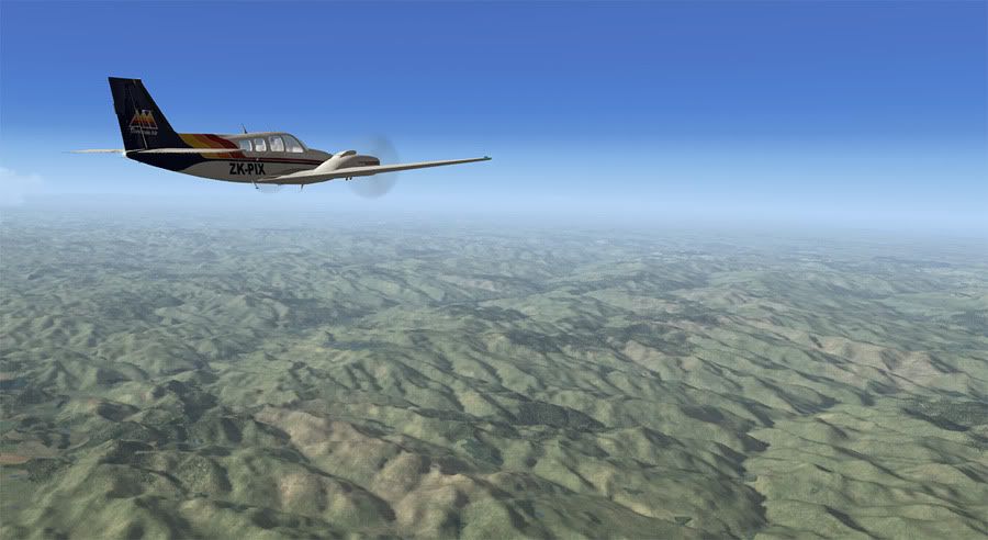
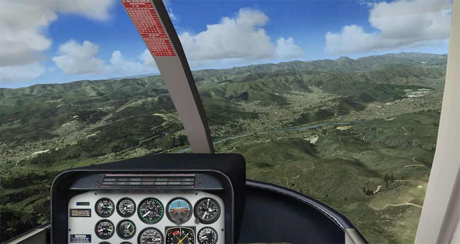
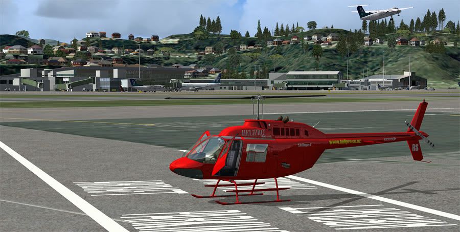
I managed to complete the first leg today, but not without a few hickups. I'd preloaded some atmospheric foggy weather and loaded ZK-TVB with full tanks, all ready for the hour long leg. Time was set to early dawn and with light nor'wester, I took off from runway 25, then banked left for a south bound track. TVB is a 'real world' Tecnam based close to home, and today I'd hired it for a joy ride, taking it down country where I'd be handing it over to another private pilot who'd return it north for me, whilst I continued on my way towards the Mainland.

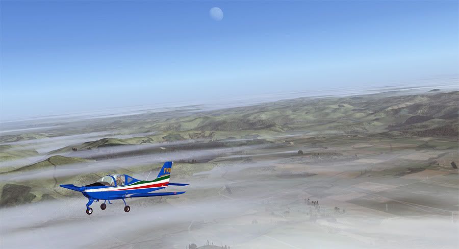
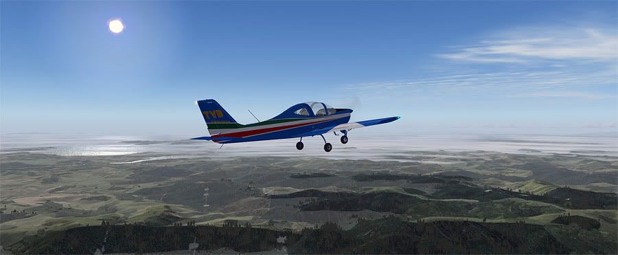
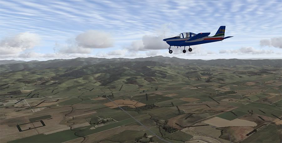
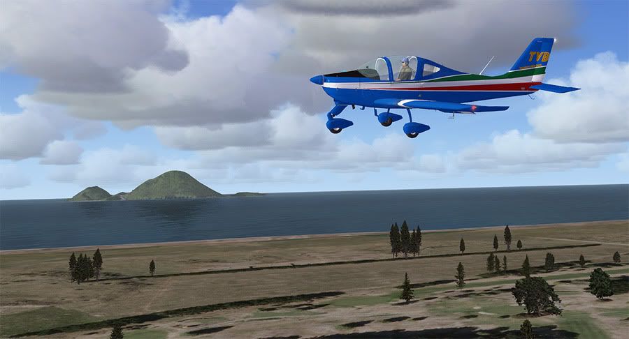
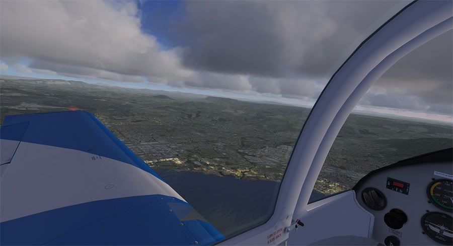
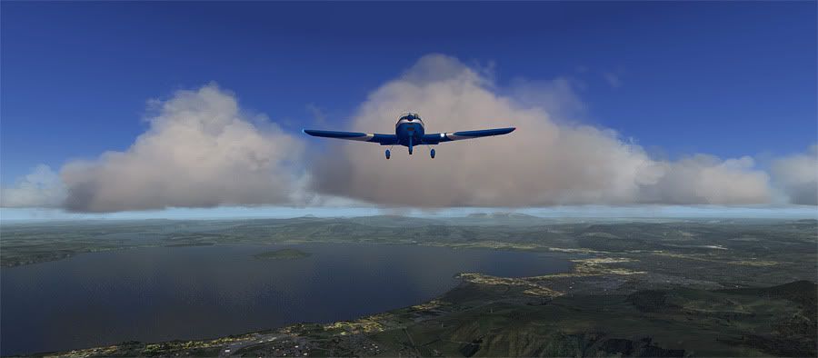
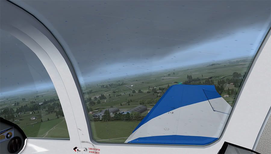
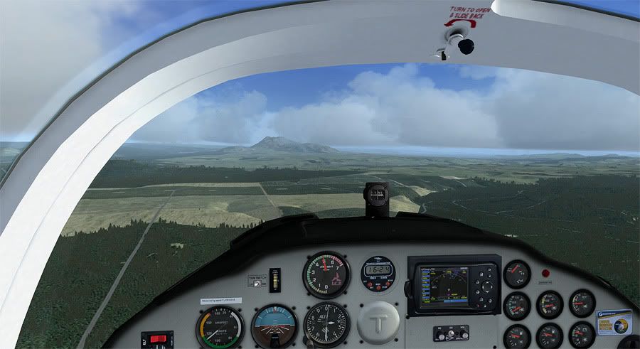
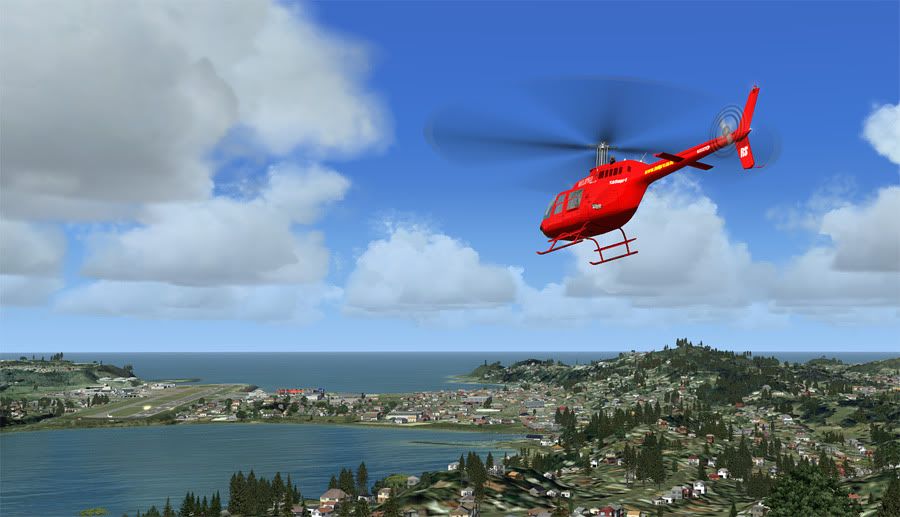
I'd set myself up to cruise down the coast at 3000', and decided to open up DBS Walk and Follow to experiment with camera angles. Unfortunately, the combo of FSX+full screen+windows 7 with Walk and Follow resulted in a crash to desktop. When I reloaded in my approximate position, I forgot to change the time of day back to dawn, as well as turn the aircaft lights back on- both things I realised once I'd finished my flight and was reviewing the screenshots I'd snapped afterwards. The locals among you will be able to tell the suns shining from the wrong side of the sky in most of the pictures below! I also set my cirrus clouds to a low 14,000 ft rather than 24,000 ft ny mistake resulting in blurry looking textures. However, it wasn't all bad. With a gentle 5 knot tailwind and good visability, the flight was smooth and the scenery looked great from the virtual cockpit.


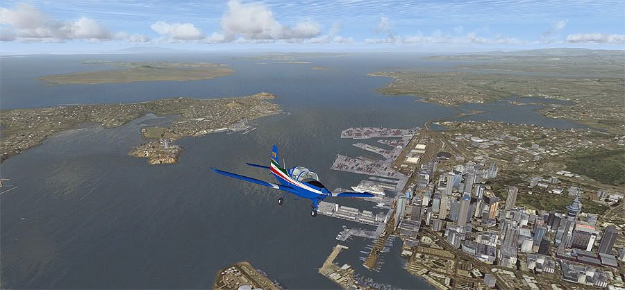
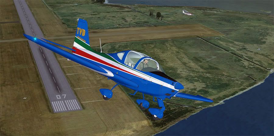
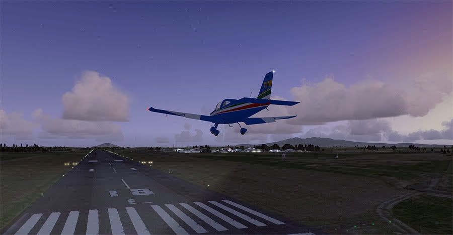
Departure and climbout


The fog clearing up over town


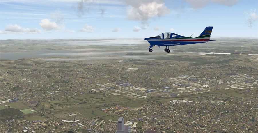
Overhead my neighbourhood- the sea fog still settled in the background


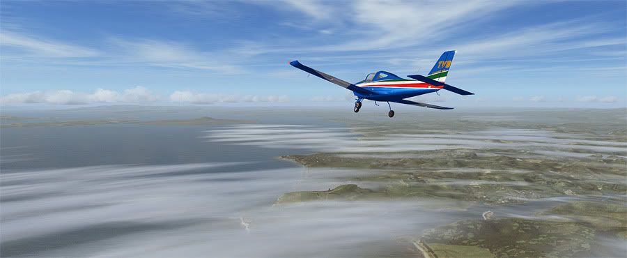
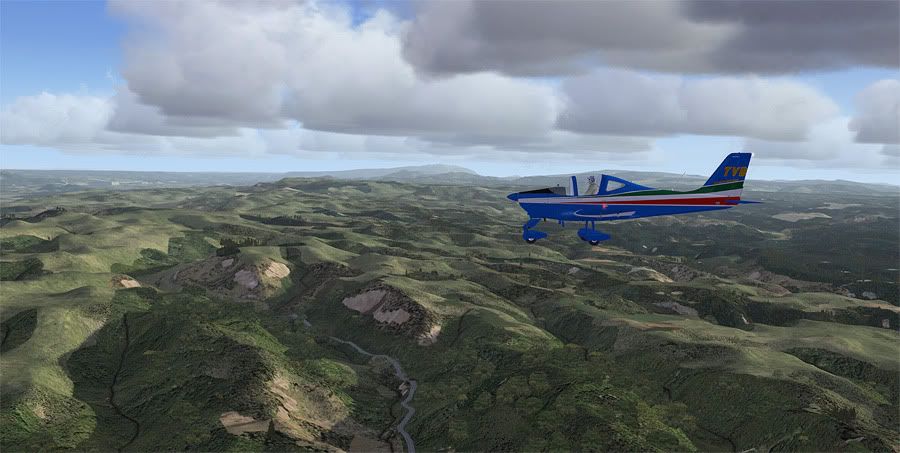
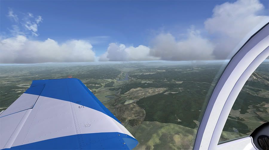
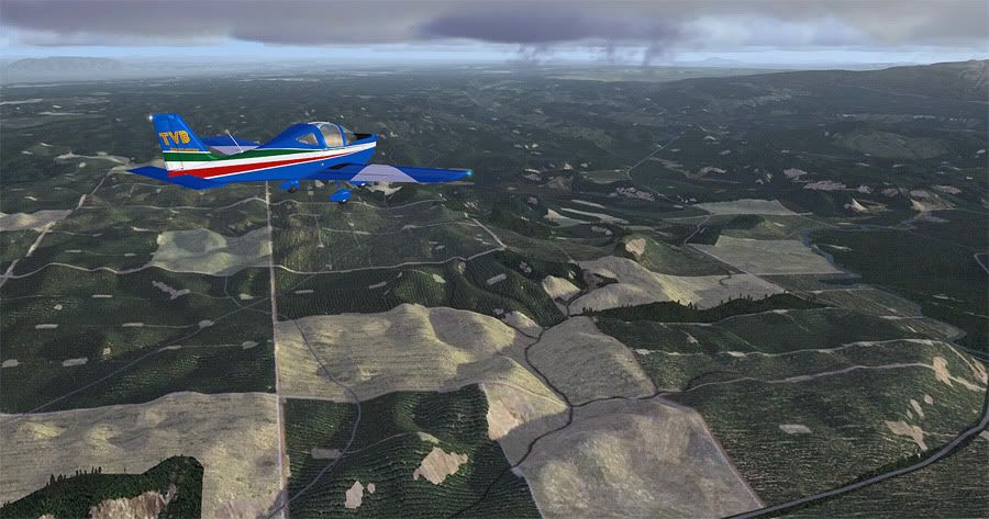
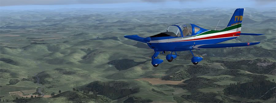
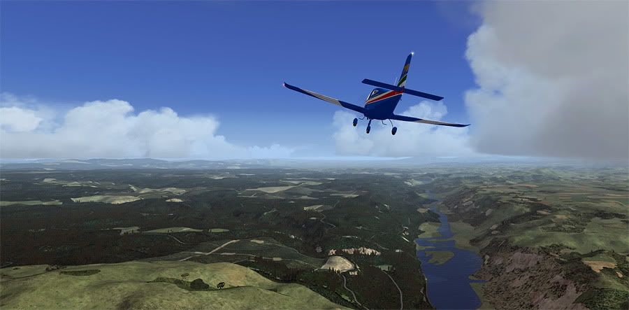
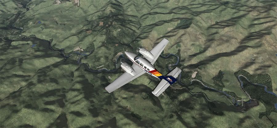
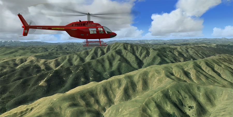
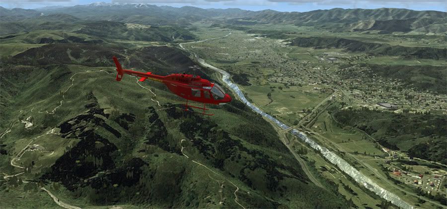
Crossing the Clevedon Valley, with Ardmore to the right


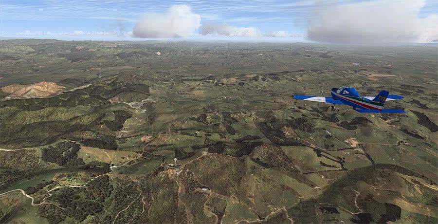
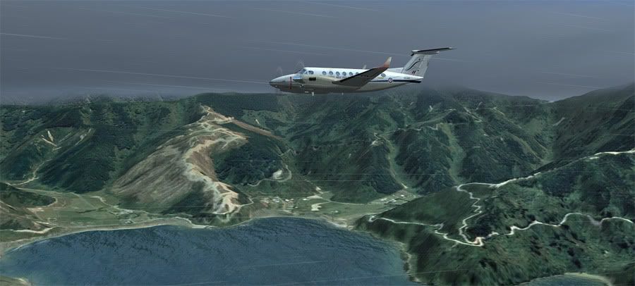
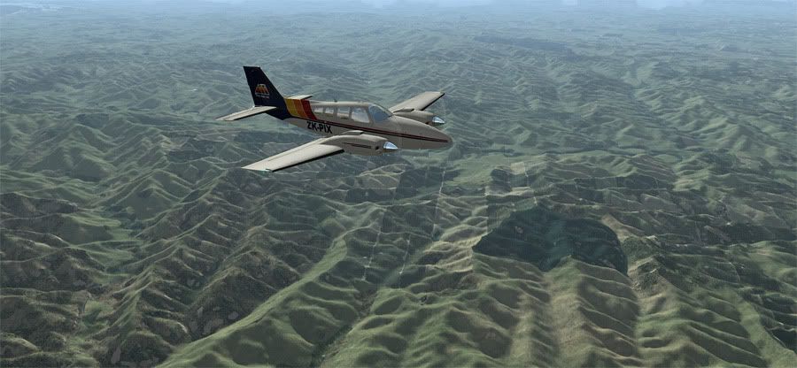
The Hunua Ranges, where I'm currently doing Mountain Flying for my CPL


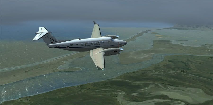
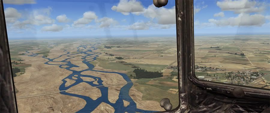
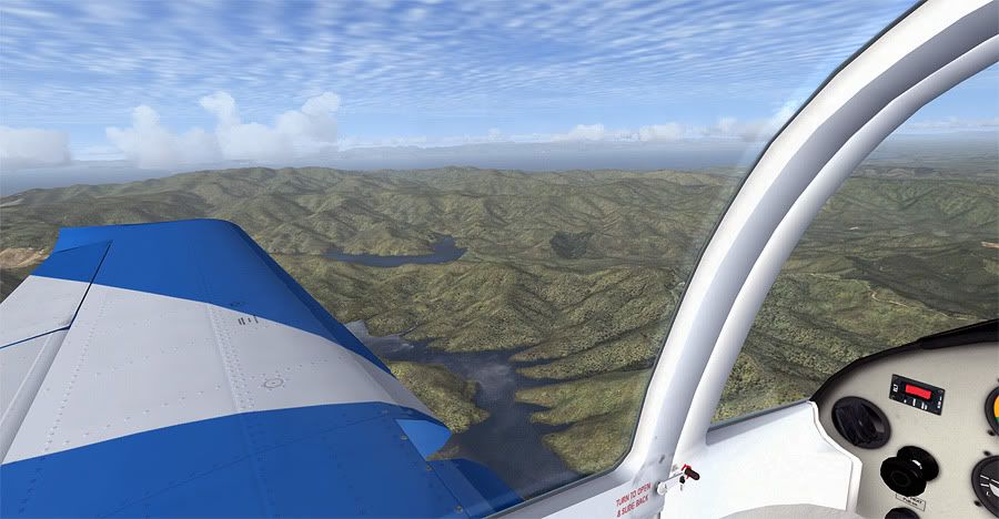
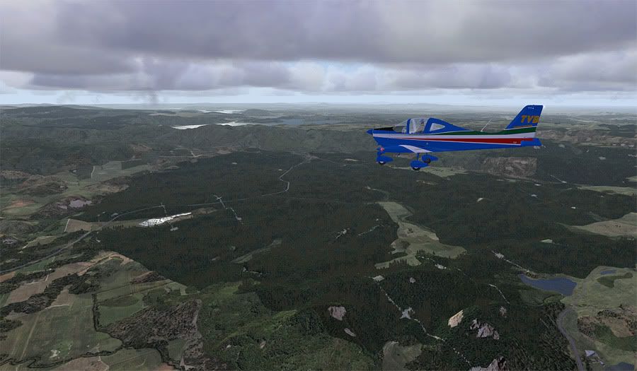
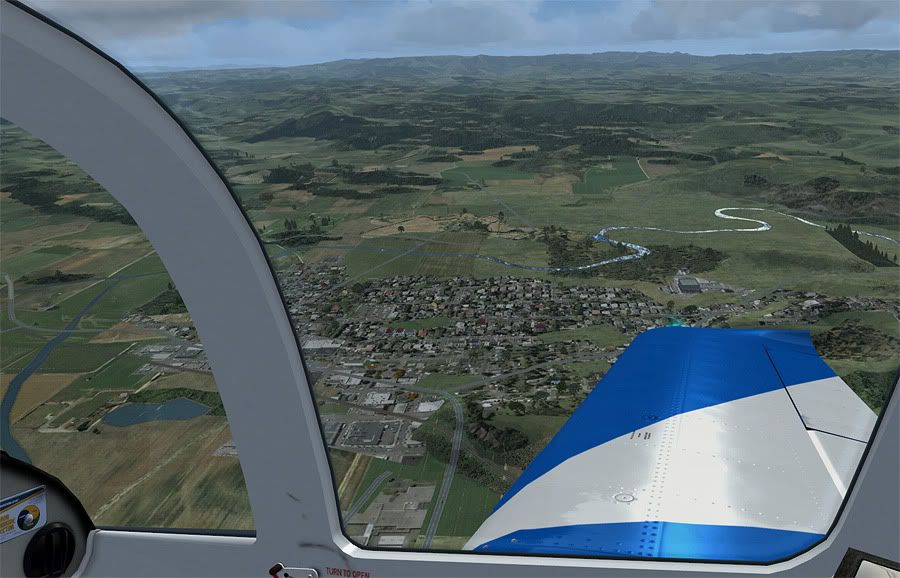
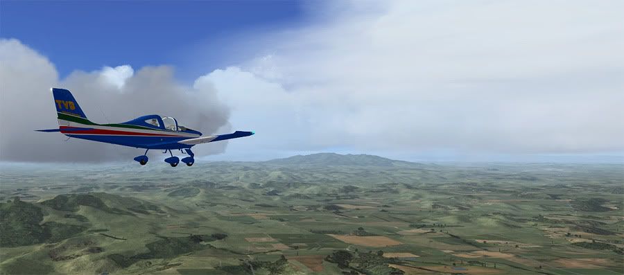
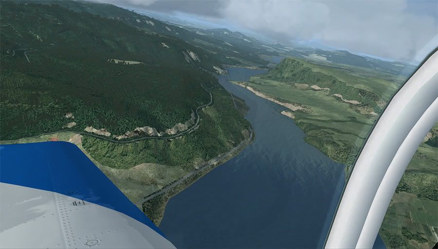
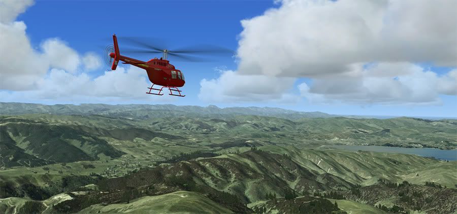
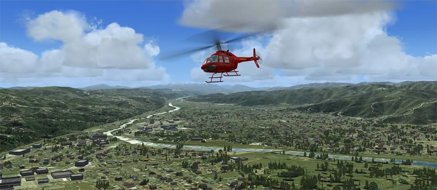
Paeroa, and the Waihi Gap


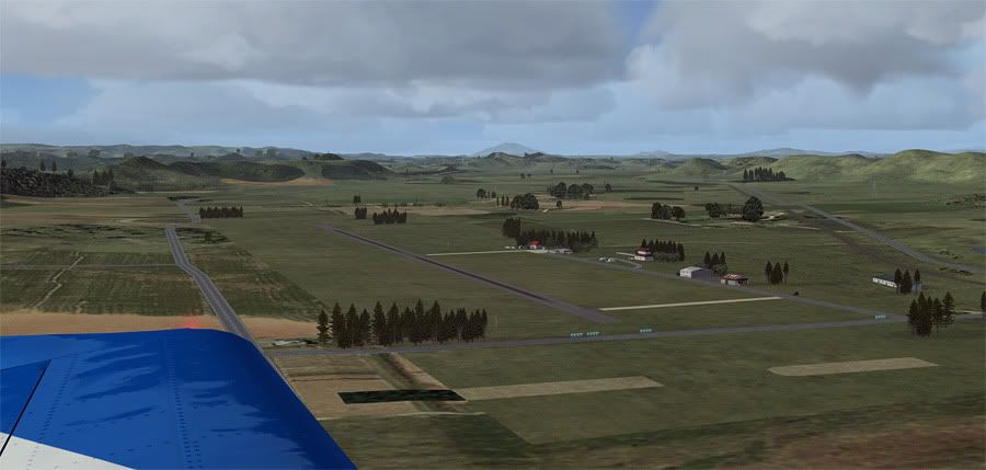
Through the other side, over the goldmine


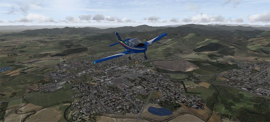
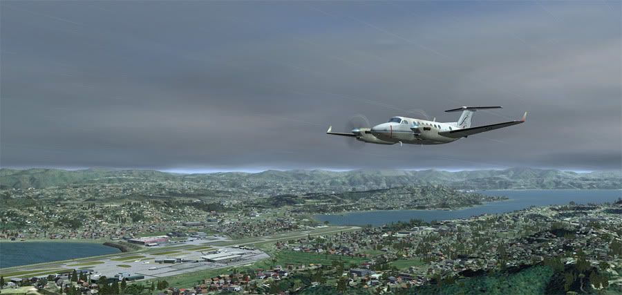
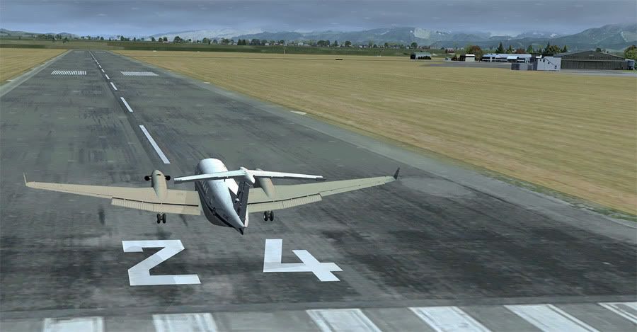
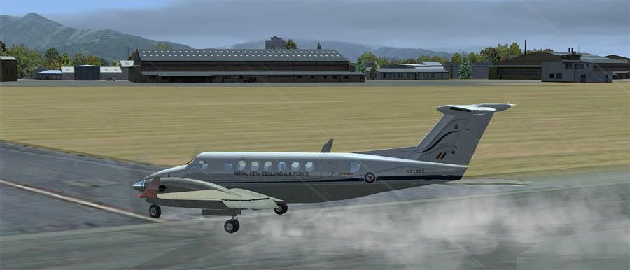
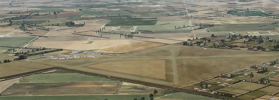
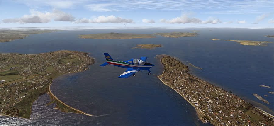
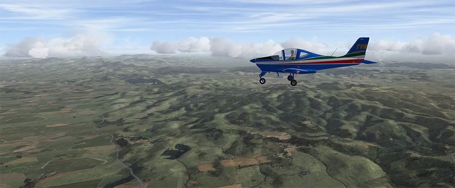
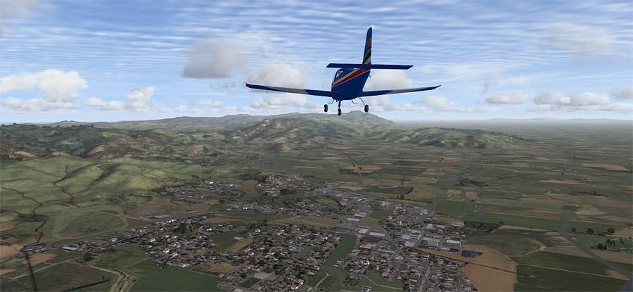
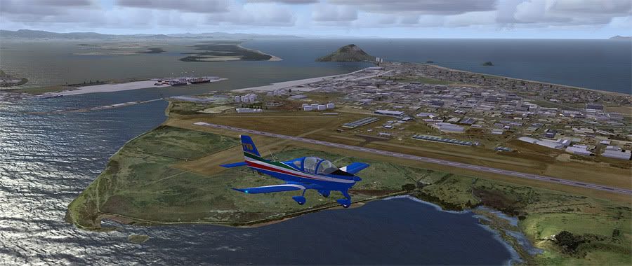
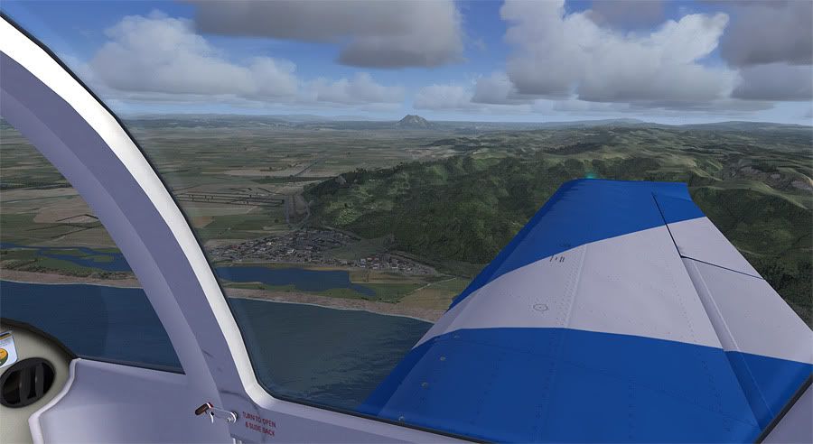
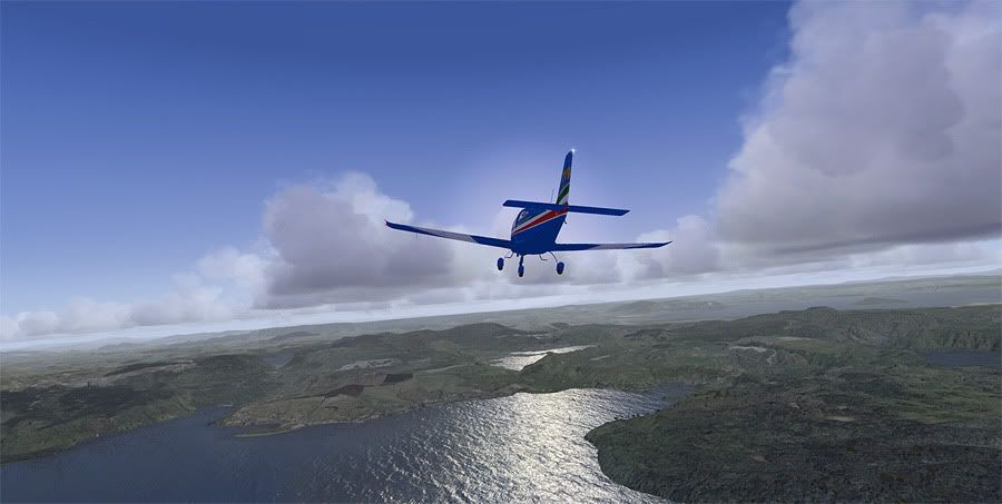
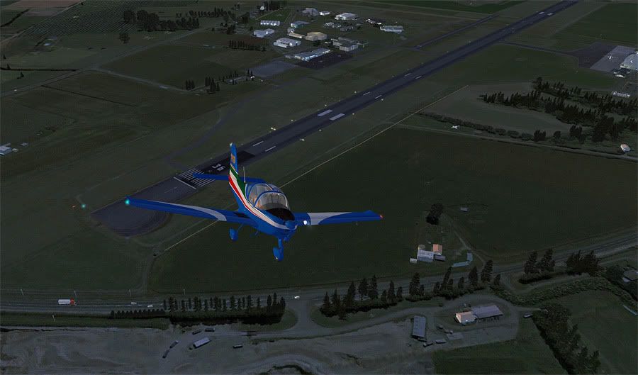
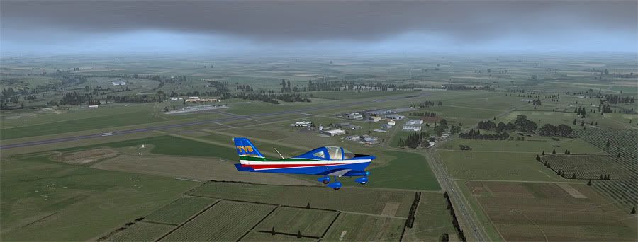
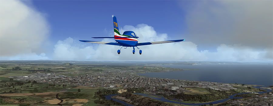
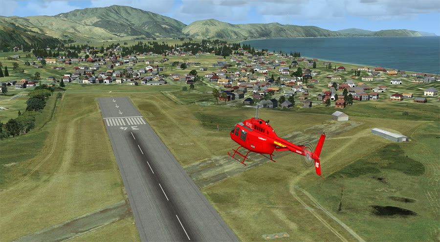
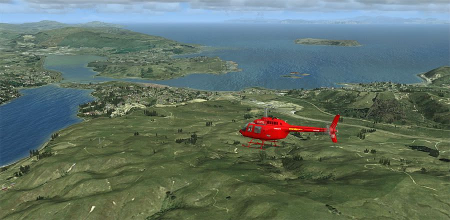
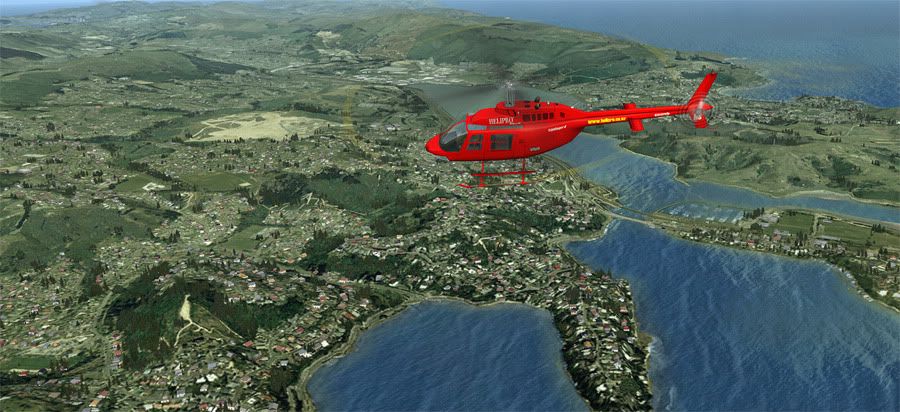
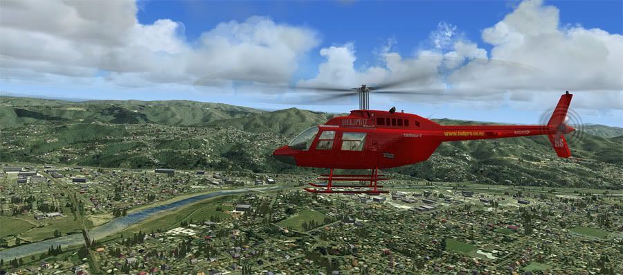
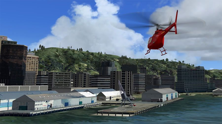
Making a Matakana 1 arrival for TG


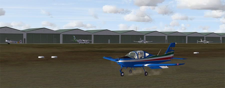
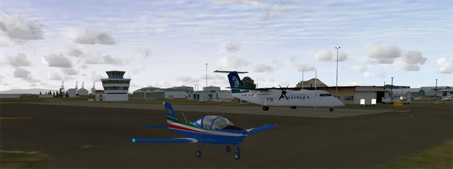
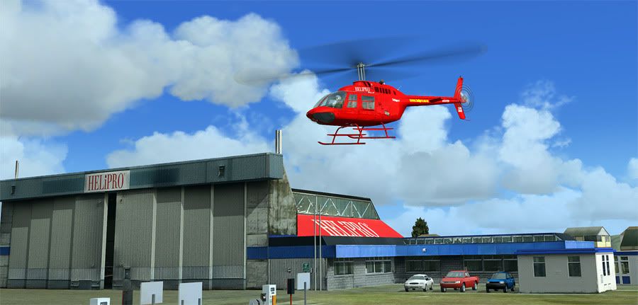
The addons seen in this leg were: Anthony Lynch's P2002 Sierra, VLC, REAL NZ Auckland, REAL NZ Tauranga, DBS Walk and Follow, FTX AI and GNZLAP.

Any feedback, suggestions or tips are welcome. I'm a relative newbie to FSX and it's inner workings. Cheers!
Last edited by ardypilot on Thu Nov 03, 2011 10:28 am, edited 1 time in total.
User avatar
ardypilot
NZFF Pro
 
Topic author
Joined: Wed Apr 26, 2006 10:01 am
Posts: 6802
Location: Auckland

Postby Ian Warren » Sat Sep 17, 2011 6:39 pm

Trolly wrote:
QUOTE (Trolly @ Sep 17 2011,7:26 PM) <{POST_SNAPBACK}>
Any feedback, suggestions or tips are welcome.

I think just simply sit back , compare and enjoy it cool.gif
Image
User avatar
Ian Warren
NZFF Pro
 
Joined: Fri May 05, 2006 5:23 pm
Posts: 41187
Location: AREA 51

Postby cowpatz » Sun Sep 18, 2011 8:03 am

Nice one Andrew and a great start to the adventure. Did you get Walk and Follow to work with Win7 in full screen mode eventually? I am looking for a good program for FSX for viewing in both the VC mode and externally. Something like F1 view for FS9. Any recommendations anyone?
Remember the 50-50-90 rule. Anytime you have a 50-50 chance of getting something right, there's a 90% probability you'll get it wrong!

Image
User avatar
cowpatz
NZFF Pro
 
Joined: Wed Mar 07, 2007 3:28 pm
Posts: 3739

Postby ardypilot » Wed Sep 21, 2011 4:43 pm

Leg 2

Leg Distance: 148nm, Leg Time: 1:45
Total Distance: 294nm, Total Time: 2:50


As luck would have it, I managed to source some wheel fairings for Tango Victor Bravo in Tauranga, which I bolted on for the second leg of the tour. Looking much more streamlined and aerodynamic, I was cleared for to takeoff from runway 25 grass for an east departure to Whakatane.

My time slip last leg had my sim clock set to mid afternoon, with my wheels leaving the deck just after 15:30 local. A few GNZLAP locals added to the ambience, with a Cessna Stationair making a parallel departure with me.


I vacated via the downwind and followed the Bay of Plenty coast towards WK, a very simple straight forward leg. I passed Motiti Island and the township of Matata, both easily recognisable, before entering the WK MBZ. Two of the Bayflight fleet were in the circuit as I opted to join downwind for runway 27 sealed.


Whale Island makes for an easy prominent reference point for a left base turn on approach, and I made a quick touch and go with the intentions of vacating north west to Rotorua.


Mount Edgecumbe stood out clearly on the horizon as I tracked towards RO, with a 33 knot headwind pounding right on the nose (real world weather downloaded from Jeppesen for yesterday afternoon). This kept my groundspeed down to just 80 knots, giving me plenty of time to take in the patchwork of scenic textures VLC has created.


Those of you with a keen eye will notice the route on my Garmin handheld to be coloured white rather than pink when active, with the destination in the 'go to' box reading NZAP. This is because I'd actually flown this leg once before, two evenings ago, but wasn't happy with my systems performance. Turns out that every time you make a chance to any of the FSX settings in the program, it reverts the 'LOD_RADIUS' back to 4.5 resulting in blurry textures. Today with 8.5 set instead, I was much more happy!


Finally I reached the Tarawera MBZ and began a gradual descent over the beautiful lakes. I'll definitely have to revisit the area in the Volcanic Air Safari's Beaver!


After checking the ATIS for Rotorua, I tuned into their tower and was instructed to make a left base approach for runway 18, my final touch and go landing before tracking up to Hamilton.


The sun was getting low in the sky by this time, and the photoreal city looked great as the lights began to switch on in patches as I climbed away towards the Waikato. A very atmospheric feeling when viewed from the VC.


As I crossed the Kaimai's, the texture change from photoreal to VLC was unnoticeable. I'd flown this route on my CPL cross country flight test and can confirm the scenery looks bang on realistic.


Maungatautari volcano was my next reference point on the horizon, which became more of a silhouette the closer I flew. Eventually HN tower cleared me to join via the downwind for Runway 18L, a nice change from the much thinner 18R usually assigned to Ardmore students in the real world.


For some reason in the past, I always seem to arrive at HN in the late afternoon/early evening from the south east, and it's pretty tricky to pick out exactly where the runway is. This was no different in the sim, and I found myself following a track up the Waikato River to Mystery Creek showgrounds, then moving my eyes halfway up the windscreen until I could see the control tower. I'd also installed dimmer textures for the runway lights, as the default ones shine way too much for my liking, and this added to the realism of my arrival.


HN was a buzz with activity, just like the other two airports I'd visited today- I think I need to turn my GA traffic slider down from 70% perhaps. On final approach to 18L, I was told to go around, then given landing clearance, then go around again as a CTC Katana lined up. Doh! I rejoined the downwind as the Katana took off, then bought TVB back to the ground for the final time this leg.


Mount Kakepuku, near Te Awamutu was clearly visible in the distance as I touched down, like it is most days when flying into Hamilton. The combination of the dusk atmospherics, recognising actual landmarks from my regional flying experience and the smoothness of the sim arriving into an amazingly detailed airport with crystal clear textures was the turning point for me. I'm now officially a convert to the dark side (). I really enjoyed this flight.


The addons used in this leg (exluding the same addons from the previous leg above) were: REAL NZ and Rotorua, Timmo's Whakatane, BoP Islands and BoP Volcanos, VLC and Creator2003's Hamilton X.

I have to admit Hamilton X is my favourite airport addon to date, and my FSX home field. I've never been able to run a scenery area this detailed with such smooth FPS before- I really love it. When the sun comes up, I'll begin my next leg early in the morning to give you all a view of the scenery in a different light. Cheers for reading!

QUOTE
Did you get Walk and Follow to work with Win7 in full screen mode eventually? I am looking for a good program for FSX for viewing in both the VC mode and externally. Something like F1 view for FS9. Any recommendations anyone?[/quote]
Eventually, but I ended up disabling it after sort of setting up some alternative camera angles. It wasn't worth the hassle and I found it overly complicated. I'd advise trying something like FS Recorder.
Last edited by ardypilot on Wed Sep 21, 2011 4:54 pm, edited 1 time in total.
User avatar
ardypilot
NZFF Pro
 
Topic author
Joined: Wed Apr 26, 2006 10:01 am
Posts: 6802
Location: Auckland

Postby creator2003 » Thu Sep 22, 2011 7:39 am

Looking good dude winkyy.gif really miss the days when we all did this a lot ,just making another day port which you should be able to use in the next leg maybe ,should be out today only have to upload..

EDIT: is uploaded now" NZTT "
Last edited by creator2003 on Thu Sep 22, 2011 8:43 am, edited 1 time in total.
User avatar
creator2003
NZFF Pro
 
Joined: Fri Jun 16, 2006 12:08 am
Posts: 4633
Location: Cant U C im LOCO

Postby Naki » Thu Sep 22, 2011 9:31 am

Great looking pics and detailed trip report...must get my trip on the road again but Im glued to the RWC at the moment
Last edited by Naki on Thu Sep 22, 2011 9:31 am, edited 1 time in total.
User avatar
Naki
NZFF Pro
 
Joined: Sat Aug 05, 2006 10:03 pm
Posts: 7170
Location: Tauranga

Postby ardypilot » Thu Sep 22, 2011 7:31 pm

Leg 3

Leg Distance: 119nm, Leg Time: 1:10
Total Distance: 413nm, Total Time: 4:00


A moist north easterly airflow today bought low status cloud and heavy drizzle to the Waikato area, blocking my intended route east out of Hamilton International. I had planned to vacate via Mystery Creek, and follow the river visually all the way to Lake Taupo, but instead, I found myself forced to fly IFR. The early morning departure was also canned due to the bad wx, meaning takeoff was proposed till 3 in the afternoon again.

IFR standing for I Follow Roads/Railways that is. The main trunk line shoots straight down past Te Awamutu, through Otorohanga and into Te Kuiti. After departing runway 36L, I decided to track down as far as NZTT to see how clear it was to the south, with forecasts indicating more favourable conditions in that direction than in the 'Tron.


Picking out Te Kuiti aerodrome is easy, even though its fairly basic, with the large oxidation pond immediately to the south of the runway making it stand out from up at 2000 feet. I joined downwind for 34 for a touch and go, having already decided it would be a safer bet to track to the east around the top of the Rangitoto Ranges, then rejoin the river. If the weather was nasty, this section of King Country had ag strips galore sprinkled around my flight path, for a forced landing in the worst case scenario.


Once airborne, I managed to scoot under the cloud back to the Waikato River, using the Maungatautari volcano as a reference point once again. It was obstructed in drizzle when I'd previously tried to find it from the north, but from the southern side, it was clear enough in the haze for me not to have to rely on my GPS for directions.


Lake Arapuni is where the river widens to a what looks like a large artificial rectangle, and is just a trickle upstream from where the world rowing championships were recently held at Lake Karapiro. Once overhead, I banked right to follow the water to it's source at Lake Taupo.


This part of the river is particularly scenic, with its steep cliffed sides, many twists and turns, dammed lakes and in particular, the Whakamaru Gorge- about 25nm north of Taupo airport.


The cloud base began to lower after a period of sort-of-blue skies, and as I ducked under it, Mount Tauhara became visible in the distance. The 3569 ft dormant stratovolcano is a well known landmark, and sits right on the edge of the lakeside tourist town, only a few miles north of the airport.

Knowing this, I peeled away from the river, and cut across flat forest land for 8 or so miles before rejoining it's flow just a few clicks away from the Huka Falls.


I crossed the shoreline of the North Islands largest lake, then lined up for a downwind join for runway 35 on the other side of the bay.


An empty circuit allowed me to make a nice close left base approach, then taxi past the quiet terminal to park up behind the Taupo Tandem Skydiving hanger. Last time I'd flown into AP, the TTS company were the only building open at the airport, and thankfully let me use there toilet facilities whist stopping off on a cross country!


The addons seen in this leg were: Creator2003's newly released NZTT, and his Taupo X airport.
Last edited by ardypilot on Thu Sep 22, 2011 7:35 pm, edited 1 time in total.
User avatar
ardypilot
NZFF Pro
 
Topic author
Joined: Wed Apr 26, 2006 10:01 am
Posts: 6802
Location: Auckland

Postby ardypilot » Wed Sep 28, 2011 2:10 pm

Leg 4

Leg Distance: 184nm, Leg Time: 1:20
Total Distance: 597nm, Total Time: 5:20


It had taken a few days for the weather to clear, but the wait was worth it. Today I swapped aircraft into the larger twin engine Beech Baron 58, painted in the colours of ZK-PIX of Mountain Air.

In the real world, Papa India Xray is a Piper Aztec, and operates on scenic flights and charter work around the central North Island. In the sim however, I'd be ferrying it down country to Kapiti Coast Airport, Paraparaumu. NZPP serves the northern suburbs of Wellington city, and is Air New Zealand's latest domestic destination with 6 weekly flights to and from Auckland due to begin in October using the Dash Q300 aircraft. Mountain Air will station PIX at the airport temporarily to provide connecting flights from the inbound airliners.

0700 was the time on the clock when I fired up engine #1- no need to request clearance out of Taupo as it's uncontrolled. I'd filed a VFR flight plan for the trip South, although surface wind was favouring a northerly takeoff. A few other local twins had the same idea, and I had to hold for a few minutes before backtracking for runway 35 and then revving up the Baron.


NOSE +500 is the rule we use for VFR cruising levels (North Odd, South Even), so with no visible moisture in the air and brilliant views of the Central Plateau volcanoes to be had en route, I selected 10500 as my on track altitude and commenced a climb, vacating Taupo via the downwind.

The atmospheric effects were great, with the early morning sun glinting off the lake and river water below me. This was the first time I'd properly flown in the early morning so far in the tour, and actually in FSX in general.


I was following the shoreline of Lake Taupo south, and it came to an end near the town of Turangi after 10 or so minutes. With 40km visibility, the snowy mountain tops of the three Tongariro National Park active volcanoes came into view.

For the uninformed, these are Mount Ruapehu, Mount Ngauruhoe, and Mount Tongariro. Ruapehu is one of the worlds most active volcanoes, and at 9177 ft, is the highest peak in the North Island. On a clear winters day, I can see it's white framed top on the horizon when flying out of Ardmore, some 280km away. Ngauruhoe at 7516 ft is technically a second cone of Mount Tongariro and most recognisable as the setting of Mount Doom from Peter Jackson's Lord of the Rings trilogy. Tongariro, the northern most cone is 6490 ft and home to the world famous 'Tongariro Alpine Crossing' one day trek, which myself and a group of mates are planning on completing in a few months time.


Instead of setting my autopilot heading bug in a straight line 179 degrees south to Paraparam', I planned to circle the three peaks to the right before continuing on my planned route. With many active military airspace zones in the area, I had to make sure I remained west of the desert road (State Highway 1) as to not infringe on possible live rocket firing.


As it happened, SH1 stood out clearly from the snow on the plateau, and once just past Ruapehu, I made a gentle right hand turn and climbed up to 11,500 for a look at the crater lake, currently sitting at a toasty 39 °C.


Not long after, the famous Whakapapa Chateau came into sight a few thousand feet below, and I continued around the shaded western side of the three mountains back towards Turangi. Once abeam Lake Rotoaira, I descended back down to 10,500 to follow my initial course towards NZPP.


Another 10 minutes passed as I left the snowline behind and entered the rolling hill country of the Manawatu-Wanganui region. The early dawn light made for great shadow effects, which I've often observed in flight and thought of the landscape below looking like it was created about of creased paper or card. Thanks to my fold out VNC map, I was able to pick up the upper reaches of the Whangaehu River below, which would lead me straight to the west coast whilst whizzing along at 165+ knots.


RNZAF base Ohakea controlled the upcoming airspace, which I requested a transition through. The request was granted, and I made a gentle 600 ft/min descent towards the South Taranaki Bight. I believe I was overhead Foxton beach once I reached the coastline and amended my track direct to my destination.


Kapati Island eventually came into view which sits abeam Paraparaumu airport and signalled the end of the leg. I carried out a standard northern arrival, descending to 1000ft and navigating myself 0.5nm seaward of the shoreline to join downwind for 34 sealed. A gentle headwind made touchdown easy, and I rolled full length before vacating to park up next to the air2there commuter airline terminal.


The addons used in this leg (exluding the same addons from the previous legs above) were: Jon Murchison's ZK-PIX skin for the default FSX Baron, Creator2003's Chateau, REAL NZ's freeware Paraparaumu and REAL NZ Wellington, and my latest purchase: Mogwaisoft's 'Shade for FSX'
Last edited by ardypilot on Wed Sep 28, 2011 3:14 pm, edited 1 time in total.
User avatar
ardypilot
NZFF Pro
 
Topic author
Joined: Wed Apr 26, 2006 10:01 am
Posts: 6802
Location: Auckland

Postby scaber » Wed Sep 28, 2011 3:52 pm

Great trip and nice screen shots, it's bringing back memories of my own visits to some of these airports.
Image
|---------- Virtual Tour and Panoramic Photography ---------|
|-------------------- greg mckenzie, Christchurch -------------------|
User avatar
scaber
Senior Member
 
Joined: Mon Feb 08, 2010 9:51 am
Posts: 1417
Location: Christchurch

Postby NZCoffee » Wed Sep 28, 2011 3:55 pm

What preset are you using for Shade? I'm also using shade on my tour so we can compare notes smile.gif. I'm also using ENB, but I'm finding I'm losing a lot of blue from my skies...
NZCoffee
Member
 
Joined: Mon Jul 23, 2007 5:33 pm
Posts: 128

Postby Splitpin » Wed Sep 28, 2011 7:48 pm

thumbup1.gif great trip and screens......keep heading south, its not moving to much at the moment winkyy.gif
User avatar
Splitpin
NZFF Pro
 
Joined: Mon Aug 03, 2009 12:15 pm
Posts: 21330
Location: Christchurch NZ

Postby ardypilot » Thu Sep 29, 2011 8:24 pm

Leg 5

Leg Distance: 47nm, Leg Time: 0.33
Total Distance: 644nm, Total Time: 5:53


For Leg 5, I wanted to try something a little different. I'm a fixed wing pilot through and through, but after flying a few of the FSX Helicopter missions, and thinking 'how hard can it be?', I selected the default Bell 206B JetRanger II as my aircraft to fly.

The distance from Paraparaumu to Wellington central is only 30 odd miles as the crow flies, but to make things interesting, I decided to take a slight detour to explore the regions photoreal scenery and 2m high res terrain mesh.

ZK-HRS, based in the capital in the real world, was the machine for me today. I lifted off from the Helipro hanger on the northern side of the airfield, and followed the Runway 16 centreline on a straight out on departure.


As I climbed, I followed the beachy coastline south, flying overhead the Paekakariki hills before arriving at the head of the Porirua Harbour.


With the top of the South Island now visible out to the west, I swung left inland to track State Highway 58 through the gorge towards the Hutt Valley.


Picking up the Hutt River was easy at 2600' feet, and I mirrored its course from its eastern side towards the city centre.


Once the water of Wellington Harbour was below the skis, I descended down below the glideslope of the inboard aircraft for NZWN, and tracked straight for the CBD.


The Caketin stadium quickly appeared up along my starboard side, and I descended in a right hand pattern over Lamberton Harbour for a touchdown at Queens Wharf. Last time I'd holidayed in Welly, this was where I'd actually spotted this machine parked up in between scenic flights.


I practised a quick touchdown on the wharf helipad, then vacated south around Mount Victoria for Wellington International. Landing clearance was obtained and I touched down on the western apron (the GA side) before shutting down the engines outside the Aero Club building.


Apologies for most these shots looking quite 'same-ish'. There's only so many angles you can use to try and make the eggbeaters look ascetically appealing tongue.gif Next leg I'll be back aboard a proper aircraft with wings for sure!

The addons used in this leg (exluding the same addons from the previous legs above) were: Jon Murchison's ZK-HRS skin for the default FSX Jetranger, REAL NZ Wellington, and the freeware 2m Wellington mesh from vectorlandclass.co.nz

QUOTE
What preset are you using for Shade? I'm also using shade on my tour so we can compare notes smile.gif. I'm also using ENB, but I'm finding I'm losing a lot of blue from my skies...[/quote]
I'm using the Day 1 'Shade default 1.01' preset at the moment- I'm too scared to mess with the settings just yet. What about yourself? And what is ENB??

Thanks for the other replies guys- they'll be more next week!
User avatar
ardypilot
NZFF Pro
 
Topic author
Joined: Wed Apr 26, 2006 10:01 am
Posts: 6802
Location: Auckland

Postby Barrington » Thu Sep 29, 2011 10:04 pm

unsure.gif Trolley. how or where do you get those detailed maps outlining your flight plans? unsure.gif
Last edited by Barrington on Thu Sep 29, 2011 10:11 pm, edited 1 time in total.
Image
Barrington
Forum Addict
 
Joined: Thu Jul 13, 2006 11:42 pm
Posts: 215
Location: Levin New Zealand

Postby ardypilot » Mon Oct 03, 2011 4:53 pm

Leg 6

Leg Distance: 215nm, Leg Time: 0.38
Total Distance: 859nm, Total Time: 6:31


I remember attending a high school careers exbo many moons ago, and asking a RNZAF officer what advantages flying with the military had over private training. His immediate answer was that airforce had way more fun than the civilians, and legally got to do all the things that the CAA wouldn't allow.

Seeing as I ended up becoming a private pilot in the real world, today I'd virtually go and see what that officer was talking about in the sim. For my flight to the South Island across the Cook Straight, I'd be flying the RNZAF Beechcraft B200 King Air, one of 5 in service operated by 42 Squadron. Their primary role is for multi engine crew conversion training, but are occasionally used for VIP transport around the country.

Because the direct flight is such a short one, I'd once again be making a detour to take in the scenery. Firstly, out to South Wairarapa district, due east of Wellington International, for some low level training around the steep coastal terrain. The weather today was poor, with a dark overcast cloudbase sitting just above between 1000 and 1200 feet, accompanied by a gusty northerly breeze.

I started up from the RNZAF crew base on the western apron, just a few hangers along from where I'd parked the Bell 206 last leg, and taxied across the active for a departure to the North. With the wind favouring Runway 34, I made my way past the terminal on the eastern apron on my way, where the 'Wild At Heart' sign can be clearly seen on the above the windows- the local authorities spin at trying to make the capital's notoriously stormy weather into a catchy slogan.


I lined up after a local 185 departed to Taupo, pushed the throttle levers forward and climbed up abeam Mount Victoria.


To remain VFR, I levelled off at 1200 and banked right past the CBD and Westpac Stadium where the All Blacks thrashed the Canadians yesterday. On my left, I passed Somes Island, home of the giant Weta, to continue in an extended right hand circuit pattern for a downwind leg at WN.


With the wind behind me, I shot through the circuit quickly and vacated left to follow the Wainoiomata coastline; low-ish and fast with two PT6A-135 turboprops powering me through the air.


I reached the western head of Palliser Bay, turned to the left and followed its coastline. This was actually quite a challenge, contour flying relatively close to the terrain, but having to deal with the moderate turbulence in the leeside of the hilly range.


Soon Lake Ponui cropped up ahead of the nose, and I pulled a steep low level turn to the left, a practice avoidance maneuver, to backtrack along my path away from the Ferry VOR.


I was now out over the open water of the Cook Straight, with the North Island to my right, and the South Island someone on the left in the distance. With uncertain conditions around the Marlborough region where I intended to land, I made a beeline for Tory VOR, so that once I reached landfall, I could assess my options.


Not long after, the lush green hillsides of Arapawa Island came into view, and I banked left to conform to the branch of the Queen Charlotte Sound that the Interislander ferry also follows.


The cloud base wasn't any higher down here, so it didn't look like the valley behind Picton township was going to be a passable route like I'd planned for. Instead, I'd picked a saddle out (as seen in the screenshot above) which I'd cross over to follow the outer coastline of the Marlborough Sounds towards Blenhiem instead. This required a gentle right hand orbit over the Sound once I reached the south western end of Arapawa Island so I could position myself on the left hand side of the ridge ready to cross it with my wings level.


Once I'd popped over the other side, Port Underwood came in to view- not a particularly interesting place other than the settlement shares my families last name. Seeing as it's a good few hours drive down a gravel road from the nearest big town, this is probably the closest I'll ever come to taking a clique touristy photo posing next to towns sign name!


The little port flashed by in a blur as I continued to track the shoreline now to the south. The steep seaside hills soon opened out into flat plains of the Wairau Valley at Cloudy Bay, an area is famous for its vineyards, and Sauvignon Blanc. The valley also contains the towns of Blenhiem and Renwick, with Woodbourne airport, my final destination today, sitting right in the middle of the two.

I was cleared for a straight in visual approach for runway 24, banking inland once I reached the Wairau Bar at Big Lagoon to line myself up for finals. Airspeed was reduced, flaps and gear were lowered, and I touched down just past the numbers at NZ's only half military, half regional domestic airport.


The morning's rain had kept all the other Marlborough aircraft tucked away in their hangers, so with no room left for the King Air, I taxied it down to the far end of the military apron and parked up next to where the RNZAF's A4 Skyhawk fleet has been kept wrapped in latex since 2007.

Welcome to the South Island followers of this tour!


The addons used in this leg (excluding the same addons from the previous legs above) were: Timothy Clark's RNZAF skin for the default FSX King Air 350, and REAL NZ Marlborough.

QUOTE
Trolley. how or where do you get those detailed maps outlining your flight plans?[/quote]
It's just some custom lines and way points drawn in google maps. You can see an interactive version of the whole tour map here: http://g.co/maps/uvxq5 (Zoom in and out, pan around, change between terrain and satellite views etc).
Last edited by ardypilot on Wed Oct 05, 2011 2:29 pm, edited 1 time in total.
User avatar
ardypilot
NZFF Pro
 
Topic author
Joined: Wed Apr 26, 2006 10:01 am
Posts: 6802
Location: Auckland

Postby Ian Warren » Mon Oct 03, 2011 6:59 pm

Not sure .... but they are familiar looking places ... just cant put me finger on it ! unsure.gif
Image
User avatar
Ian Warren
NZFF Pro
 
Joined: Fri May 05, 2006 5:23 pm
Posts: 41187
Location: AREA 51

Postby ardypilot » Wed Oct 05, 2011 4:02 pm

Leg 7

Leg Distance: 252nm, Leg Time: 1:30
Total Distance: 1111nm, Total Time: 8:01


So far, I've flown a trainer aircraft, a light twin, a helicopter and a turboprop military aircraft, but for this leg, I'd be flying something historic.

The Douglas DC3 is a familiar shape for flight simmers and Kiwis alike, with one airworthy example flying per island. Today I'd be hammering down to Ashburton, where the Southern DC-3, ZK-AMY is based. The machine I'd be flying though is ZK-BYD, a 'Viewmaster' variant with extra large windows from the short lived 1960s 'South Pacific Airlines of New Zealand' company.

Startup at Woodbourne was delayed due to a technical malfunction (Actually I couldn't figure out how to turn Progressive Taxi off and had to reinstall the AFCAD file), but pax were loaded and engines started up just after 10.30am local. The large spread in dew point and temperature equalled just a few 'Toy Story' lookalike cumulus clouds hovering between 3 and 4000 feet, however, visibility was only a hazy 30km- not ideal for snapping screenshots.


I backtracked for runway 24, was given takeoff clearance, accelerated into the sky, and turned right hand downwind back towards the Cook Straight. From circuit altitude, it was clear that the NZWB airport area had received considerably less rainfall than the surrounding fields!


After passing the 24 threshold, I pulled the throttle back and immediately lowered the nose, banking 90 degrees to the right to make a low pass over nearby Omaka airfield. NZOM is the home to the biannual Classic Fighters Airshow, so I carried out a mock beatup along the crowdline at 100 ft AGL before applying full power and climbing back up overhead Blenhiem town.


Once up at 3 grand, I began tracking for Camp Campbell, the north eastern tip of the South Island, right next to the huge salt works at Lake Grassmere.


From here, I crossed the coastline to the Pacific Ocean side, and banked left for a 201 degrees heading. The terrain en route was amazing, with the Seaward Kaikoura Ranges rising straight up from the coast to above the snowline- the highest peak being 9448 feet! State Highway 1 runs along the foot of these mountains, which I followed south heading towards Canterbury.


I looked out for the famous resident whales, but couldn't spot any today. 55 miles later, a small cultivated plain opened up from the foothills, and I descended down over the tourist town of Kaikoura for a touch and go on runway 23.


At just 33 feet wide, it was a bit of a squeeze, especially with the predominant sea/land breeze crosswind being situated parallel with the beach.


I was soon climbing again, this time above the cloud up to 6500 feet enroute to my next stop, Forest Field... ICAO code 'NZFF'. I'd famously made the mistake in writing "No, not an ICAO code, NZFF is in fact an acronym for the New Zealand Flightsim Forums." when opening this website, however, since the discovery of this little back country airstrip not included in FS by default, a number of members have made a pilgrimage there to recreate it virtually. This will be my first visit!


During the 90 mile cruise, there wasn't much scenery to capture- my own fault for setting up the hazy conditions today. The only familiar landmark came towards the end of the cruise, being Pegasus Bay down on my left. NIWA scientists recently identified 10 large active faults underwater here since the major Christchurch earthquake in February. This was my signal to begin a descent.


Rangiora township was the next prominent reference point I could identify, and now all I knew was that NZFF lay somewhere between my current location and the Waimakariri River. I levelled off at 1000 feet, followed my bearing and kept my eyes peeled. It wasn't until the grass runways were almost right below me that I picked it out, dumped the flaps and made a hasty touch and go on runway 18.


Being camouflaged in a plain of very similar sized and shaped paddocks made me a little confused as to why the aerodrome was named 'Forest Field'. This confusion only lasted until climb out, where I swapped my eyes from the sky ahead to the outside view and realised I was slap bang overhead the biggest cluster of autogen trees I'd witnessed thus far in the sim! This area is actually known as Eyrewell Forest to the locals, and apparently acts as a wind break from the strong Nor' Westerly gales for the city of Christchurch.


I decided to stay low for the last stint today, 2000 feet AMSL over the flat expanse of the Canterbury Plains direct to Ashvegas. Christchurch and Banks Peninsular lay just to the east of my final GPS track, lost in the haze. I'll hopefully be visiting Quake City in a future tour when a new scenery addon has been released for the area winkyy.gif


The Rakia braided river was the last I crossed before arriving into town, with the local grass surfaced aerodrome proving just as difficult to pick out amongst the sunburnt countryside as NZFF was.


Before making my approach, I orbited over the centre of town, giving the Viewmaster passengers a final bang for their buck, then joined lefthand downwind for 24- the longest of the three strips, favoured by the wind this morning.


After rolling to a stop, I vacated off the runway and trundled over to park on the apron outside the Ashburton Aviation Museum. During the 1940's, this aerodrome was the sight of a large airforce training facility, home to 50+ Tiger Moths! Today, apart from the resident DC3, NZAS is also home to a Harrier GR3 amongst many other historic aircraft.


The addons used in this leg (excluding the same addons from the previous legs above) were: James Eden's Awesome4some DC3 (as4sumje.zip from flightsim.com), VLC-Godzone Ashburton Airfield, VLC-Godzone Kaikoura Airfield, VLC SI Airfields Pack (from vectorlandclass.co.nz) and Ian Warren's Ashburton photoreal/autogen just released a few hours ago on flightsim.com!

I'm currently on doctor ordered stay at home rest (literally been instructed to put my feet up) after a minor operation earlier in the week, so if nothing crops up, I might just manage one more leg tomorrow too!
Last edited by ardypilot on Wed Oct 05, 2011 4:26 pm, edited 1 time in total.
User avatar
ardypilot
NZFF Pro
 
Topic author
Joined: Wed Apr 26, 2006 10:01 am
Posts: 6802
Location: Auckland

Postby Ian Warren » Wed Oct 05, 2011 4:23 pm

Beauty crisp screens as to the norm Andy , Rakia is in the works , nice little addon to hi-lite NZ longest river bridge , be many to come . Great series cool.gif
Image
User avatar
Ian Warren
NZFF Pro
 
Joined: Fri May 05, 2006 5:23 pm
Posts: 41187
Location: AREA 51

Postby ardypilot » Wed Oct 12, 2011 4:24 pm

Leg 8

Leg Distance: 134nm, Leg Time: 1:10
Total Distance: 1245nm, Total Time: 9:11


It turns out something did come up, and I was grounded at Ashburton for a week. However, during my stay, I was approached by Mount Cook Airline who had a C185 Skywagon they needed flying over to the West Coast when the weather permitted- I was their man.

There was finally a break in the weather today, beautiful blue skies and non of that hazy nonsense. The Canterbury Nor Wester would throw a crosswind into the mix on my first leg over to Lake Tekapo, where I'd be dropping off some cargo before continuing up over the Southern Alps to the little airstrip at the foot of the Franz Joseph glacier.

The wind favoured runway 34 at NZAS, so after topping up the tanks in front of the DC3 I'd arrived in from Woodbourne, I taxied over for a straight out departure.


The circuit was empty, and the C185 lifted off quickly with the headwind.


After clearing the township, I banked left to 240 degrees and locked on track for Tekapo. Even though the plains below were flat as a pancake, I continued my climb up to 6000 feet, as the Southern Alp foothills would gradually begin to sneak in below towards the end of the leg.


The Alps grew ever closer until after 50 or so miles, the farmland below had changed to bare rugged slopes. Out to my right I could see the snowy caps at the fringe of the Two Thumbs Range, whilst out to my left I could still just about make out the Pacific in the distance.


All of a sudden, I was crossing a ridge line which in turn revealed the sparkling azure waters of Lake Tekapo. The bright blue colour isn't an waterclass error, it comes from the purity of the glacier ice fed in from the mountains to the North. To the South and East lies the Makenzie Basin, a sparsely populated (apart from sheep) natural plateau some 62 miles long and 25 miles wide.


I made my joining call to Tekapo traffic and lined up for long final approach on runway 29- another thin strip just 11 metres wide sitting up at 2494 AMSL.


Mixtures and throttles were closed, doors opened, cargo offloaded, doors closed again, and the Skywagon was fired up. It was good to be back to the familiar simplicity of a 6 cylinder piston prop!


I backtracked along the tarmac, made my rolling call, and climbed away swiftly. A gentle bank to the right took me past the Mt John Observatory and small tourist town, where I stayed overnight back in 2002.


Once lined up with the eastern shoreline of the lake, I followed it northbound and climbed up to 9000 feet keeping an ear out for any 'Air Safari' scenic flights common around these parts. Out my right hand window was the Tekapo Skifield and Mount Misery, and to my left, the smaller Lake Alexandria with Lake Pukaki behind it in the distance.


I was soon at the mouth of the Godley River, a braided stream system responsible for keeping Lake Tekapo icy cool. From here I continued to fly my heading, sticking to the right hand side of the valley that the rivers path had carved.


The majestic peak of Mount Cook soon came into view out my cockpit window, the namesake for the airline who owned ZK-MDC that I was flying. Using the highest mountain in the country as a reference point, I picked out Armadillo Saddle at 7155 feet on my VNC map that would allow me to cross west to the upper Tasman Glacier. Once over this crest, I'd then turned right around the top of the ice shelf, and then quickly left again to cross Tasman Saddle at 7990 feet, and then immediately continue over Climbers Col at 8075 feet to arrive at the head of the Franz Joseph glacier.


The snowy terrain looked incredible below, and reminded me of similar real life flying I'd done with the Wakatipu Aero Club in the adjacent mountains I'd be visiting on my next leg. Finding and crossing the saddles were a doddle.


All of a sudden I was actually overhead Franz Joseph as it quickly dropped some 8000 feet in just 7.5 miles. I had to idle the throttle and trim down lots as I attempted to follow its steep gradient down to sea level.


The West Coast is what I like to think of as 'VLC Heartland'. The predominantly westerly weather patterns dump a hell of a lot more rain on the this side of the mountains than the east, resulting in steep sided lush rainforests. Within seconds of crossing the final saddle, the contrast in colour compared to the dry and flat east coast of the South Island was instantly noticeable.


I followed the glaciers gorge out to the flatter coastal plains until the little aerodrome came into sight. NZFJ is another well travelled tourist destination, popular for eco tours and skydiving. A steep approach is required when landing on runway 28, as I was today, due to high terrain and trees very close to the touchdown threshold.


Once down on terra firma, I backtracked along the grass and parked up next to a resident GAF Nomad at the tiny terminal. This is where the real fun begins- no more flat boring scenery for the rest of the tour!


The addons used in this leg (excluding the same addons from the previous legs above) were: Carenado C185F Skywagon (Ski), Wildbillkelso's ZK-MDB repaint, REAL NZ 'Southern Lakes Adventure' (Tekapo), and FS Recorder.
Last edited by ardypilot on Thu Oct 13, 2011 3:07 pm, edited 1 time in total.
User avatar
ardypilot
NZFF Pro
 
Topic author
Joined: Wed Apr 26, 2006 10:01 am
Posts: 6802
Location: Auckland

Postby Ian Warren » Wed Oct 12, 2011 4:43 pm

Sweet scrrens cool.gif , another nice little airfield and town through the very vast Mckenzie Basin being Twizel , just simply no photos , ideal for the region smile.gif pity
Image
User avatar
Ian Warren
NZFF Pro
 
Joined: Fri May 05, 2006 5:23 pm
Posts: 41187
Location: AREA 51

Postby victor_alpha_charlie » Wed Oct 12, 2011 5:48 pm

Loving this thread. Flew through to Pukaki from Christchurch today in a Piper Arrow and it looked very similar. VLC have got that part of NZ pretty spot on thumbup1.gif
User avatar
victor_alpha_charlie
NZFF Pro
 
Joined: Wed Jan 10, 2007 11:09 am
Posts: 2372

Next

Return to Flights

Who is online

Users browsing this forum: No registered users and 7 guests