My girlfriend woke up with a really bad migraine so I took the opportunity to go for a stroll and look at what used to be 'Meigs Field'- A downtown airport in Chicago that was the default starting position for MS Flightsim from around FS4 to FS2002 (?). I remember my brother and I playing FS4 and FS5 with him teaching me circuits etc in the C182 RG and Sopwith Camel
 Unfortunately the airfield no longer exists as it was ripped up in a fairly sneaky 'raid' in the name of 'national security' a few years after the 9/11 attacks and is now a park. Apparently because the bulldozers moved in during the night and without warning, a few aircraft were still left parked on the apron!
When we arrived in Chicago a few days ago, it was -18C but has warmed up heaps in the last few days and things are now thawing out...including previously frozen dog cr*p....lots and lots of thawing dog cr*p!
The parks around here are fantastic and it's amazing to look up into the sky and be able to count at least 5 or so commercial aircraft in the sky at different levels- Either on approach to O'hare or transiting above.
Anyway- Enjoy the pics! They are clickable thumbnails
I always wondered what this building was in FS....I assumed it was a radar station....the modelling wasn't so good in FS4! It's an Planetarium which we hope to visit properly tomorrow

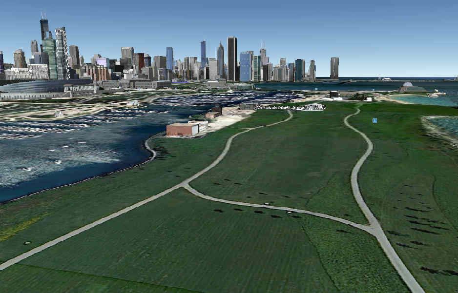
Airfield no more....this is looking NNW towards Chicago and would be between the old runway and apron.

Looking more Nth

Looking South

Looking SSW- The big black building was also modelled in FS4....had no idea what it was then and still have no idea what it is now?
(Google earth tells me it's a convention complex....she's a biggy!)

The old Control tower- Now home to a security company I think?

The old terminal- A lot smaller than I thought....perhaps the scaling was a bit off in FS4. Now home to the parks service.

Entrance to the old terminal from the carpark

Another view of the control tower

Looking south along the field from Solidarity Drive

Looking along Solidarity Drive towards the Planetarium

A looking towards downtown Chicago- It's a nice city. I like it

If you want to see a bit more, then check out the historical imagery option in Google Earth where you can see the airfield as it was, when it was being pulled up and how it is now.


 with em square dang clouds , my regular fights was Champaign to Midway in the DC-3
  Megis was used as the special divert ...