FlightPlan: Mountains of the Mist

Share your simulated flights around NZ here. The place to post your flight reports, flight plan instructions and progress on tours

Postby deeknow » Thu Oct 16, 2008 8:05 pm

Following is a flight plan which begins at Rotorua airport (NZRO) and ends at Wairoa (NZWO) with waypoints at Murupara, Minginui, Waiau river valley, Ruatahuna, Waikaremoana lake front and on to Wairoa. It travels through some awesome Urewera terrain loosely following the main road that cuts throught the forest to Wairoa via the lake.

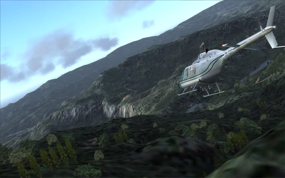
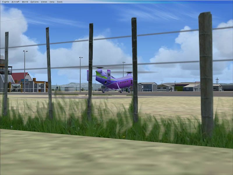
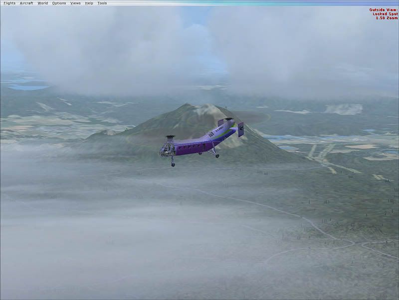
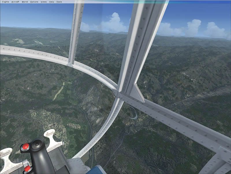
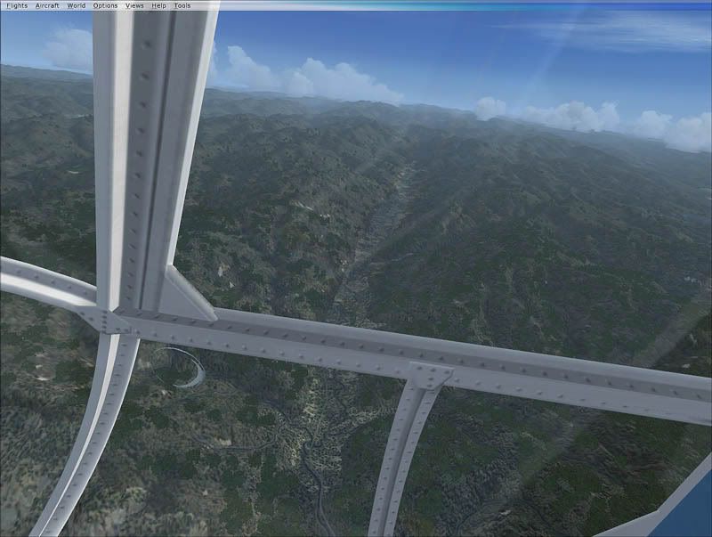
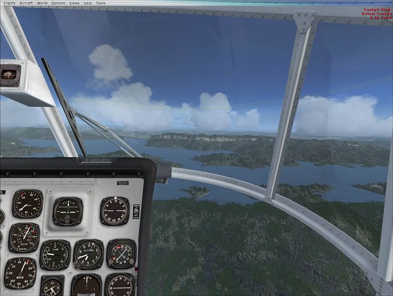
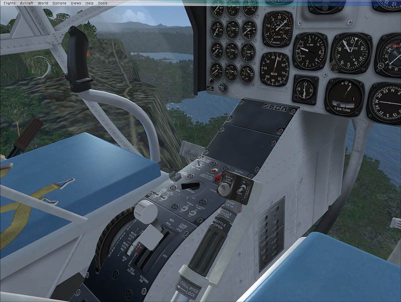
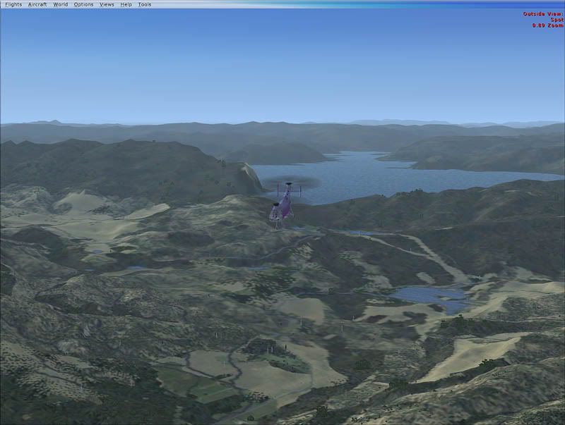
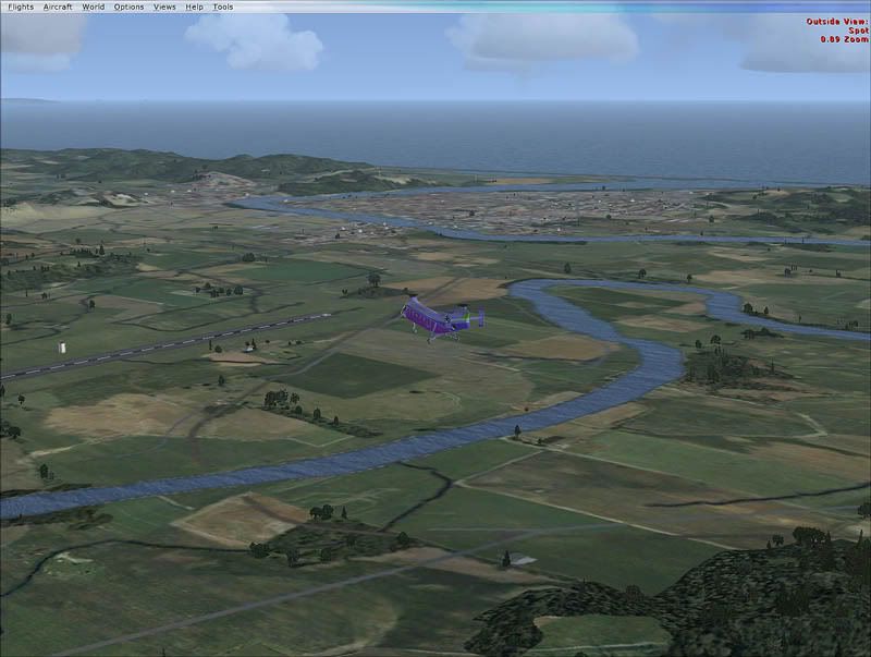
The Miginui to Waiau and back route is one my family and I fly once a year or so on fishing trips into the Waiau river. We fly with Lakeland helicopterswho have a base in Murupara from where they service the region. If your more talented than me you could fly this route in a fixed wing aircraft I guess but it does lend itself more to choppers I think. thumbup1.gif

How to use the flight plan:
  • copy the text from the code area at the bottom of this post into a new *.PLN file in your "My Documents\Flight Simulator Files" folder
  • in the flightsim select "Flights" icon_arrow.gif "Flight planner"
  • click "Load", select your *.PLN file and click "OK"
  • select "VFR" flight plan type
  • select "Direct - GPS" routing
  • click "OK"
A dialogue will pop up asking you if you want to start at the designated airport. Click Yes and you will be taken to Rotorua which is the starting point of the flight plan. Each flight plan needs to start at an official Airport location. The fun part of the flight really starts at Murupara though so once you are on the runway at Rotorua you can skip the first leg by doing this:
  • open the map from the menu ("World icon_arrow.gif Map") - you should now see the legs of the loaded flight plan
  • click the small black Aircraft icon in the centre of the map and drag it to the end of the first purple leg line
  • set the Altitude box to zero
  • click "OK"
You will now be on the ground in Murupara. Display the GPS in your aircraft and you should see the legs you need to follow. You may want to zoom in and out on the GPS for more detail.

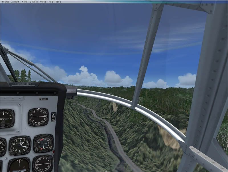
Flying low and close to the terrain is part of the fun of helicopter flying so try and keep below 2000ft. For a challenge and to add to the atmosphere try setting your weather to 'Gray and Rainy', it's not for nothing afterall that the Tuhoe people of Te Urewera are known as 'Children of the Mist'

It's wonderful country, hope you enjoy the flight.

Dean


Code: Select all
   [flightplan]
      AppVersion=9.1.40901
      title=NZRO to NZWO
      description=NZRO, NZWO
      type=VFR
      routetype=1
      cruising_altitude=2000
      departure_id=NZRO, S38* 6.79', E176* 18.77', +000935.00
      departure_position=
      destination_id=NZWO, S39* 0.76', E177* 24.41', +000041.99
      departure_name=Rotorua
      destination_name=Wairoa
      waypoint.0=, NZRO, , NZRO, A, S38* 6.79', E176* 18.77', +000935.00,
      waypoint.1=NZ, MURU, , MURU, I, S38* 27.83', E176* 43.95', +002000.00,
      waypoint.2=NZ, MING, , MING, I, S38* 37.19', E176* 44.48', +002000.00,
      waypoint.3=NZ, WAIHOU1, , WAIHOU1, I, S38* 44.50', E176* 48.84', +002000.00,
      waypoint.4=NZ, WAIHOU2, , WAIHOU2, I, S38* 44.38', E176* 51.33', +002000.00,
      waypoint.5=NZ, BLUESLP, , BLUESLP, I, S38* 47.65', E176* 49.92', +001300.00,
      waypoint.6=NZ, NGAPU, , NGAPU, I, S38* 38.92' , E176* 55.15', +002000,00,
      waypoint.7=NZ, RUATAH, , RUATAH, I, S38* 37.05' , E176* 56.71', +002000,00,
      waypoint.8=NZ, WAIK3, , WAIK3, I, S38* 38.92' , E177* 02.09', +002400.00,
      waypoint.9=NZ, WAIK2, , WAIK2, I, S38* 42.36' , E177* 04.10', +002400.00,
      waypoint.10=NZ, WAIK1, , WAIK1, I, S38* 43.89' , E177* 03.97', +002300.00,
      waypoint.11=NZ, WAIK0, , WAIK0, I, S38* 44.59' , E177* 09.01', +002500.00,
      waypoint.12=NZ, WAIK5, , WAIK5, I, S38* 47.94' , E177* 07.26', +002200.00,
      waypoint.13=, NZWO, , NZWO, A, S39* 0.76', E177* 24.41', +000041.99,
Last edited by deeknow on Thu Oct 16, 2008 9:27 pm, edited 1 time in total.
Deans repaints: http://www.deeknow.com/
X570 Mini-ITX m/b - Ryzen7 5700X3D (8c/16t) - RTX 2060-super - 32GB 3600MHz DDR4 - Win10 - P3Dv5.3
User avatar
deeknow
NZFF Pro
 
Topic author
Joined: Tue Sep 18, 2007 10:15 pm
Posts: 4448
Location: NZHN

Postby Charl » Fri Oct 17, 2008 1:01 pm

I've never been able to save a FP with Waypoints.
You CAN save a flight with an associated waypoint flightplan and so preserve them, but if you reload the saved flightplan the waypoints are gone.
Whatever, I took a look and it is great country.


You need to go to places like this every now and again in RL, just so you can count your blessings!
User avatar
Charl
NZFF Pro
 
Joined: Mon May 01, 2006 8:28 am
Posts: 9691
Location: Auckland

Postby Adamski » Fri Oct 17, 2008 3:52 pm

Is that code complete? Looks like it got truncated sad.gif
Image
User avatar
Adamski
NZFF Pro
 
Joined: Thu Nov 01, 2007 2:22 am
Posts: 5029
Location: Birkenhead, Auckland

Postby deeknow » Fri Oct 17, 2008 4:45 pm

Adamski wrote:
QUOTE (Adamski @ Oct 17 2008, 04:52 PM) <{POST_SNAPBACK}>
Is that code complete? Looks like it got truncated sad.gif

Hey Adamski. It is complete. I just checked by saving the above and loading it and is all good thumbup1.gif
BTW, anyone know what code you should use for arbitrary waypoints like these, I assigned 'I' which I think is for intersections.

Charl wrote:
QUOTE (Charl @ Oct 17 2008, 02:01 PM) <{POST_SNAPBACK}>
Whatever, I took a look and it is great country.

It is awesome aye. I love the section from Ruatahuna up and over to Waikaremoana, crazy country. As I mentioned in my original post we fly the earlier legs from Murupara to Waiau, its so cool climbing up and over from farmland into the wilderness, the guys that take us keep fairly close to the terrain and use the valleys which makes for a great flight biggrin.gif

Dean
Last edited by deeknow on Fri Oct 17, 2008 4:48 pm, edited 1 time in total.
Deans repaints: http://www.deeknow.com/
X570 Mini-ITX m/b - Ryzen7 5700X3D (8c/16t) - RTX 2060-super - 32GB 3600MHz DDR4 - Win10 - P3Dv5.3
User avatar
deeknow
NZFF Pro
 
Topic author
Joined: Tue Sep 18, 2007 10:15 pm
Posts: 4448
Location: NZHN

Postby Bandit » Fri Oct 17, 2008 8:14 pm

That's a great flight in RW. I have been going into the Waiau with Silver and co around November for the last few years.

Got stuck at the old Parahaki hut one time due to the weather. The beach we got dropped off on on the Friday got washed away and wasn't there when they came back for us. The video one of the boys got was interesting though.

Last year we stayed at Central Waiau and can really recommend the fishing. Plenty of deer but the pigs are a bit skinny on it.
Testers are born to fiddle. What does this button do? Oh! Never mind.....
User avatar
Bandit
Forum Addict
 
Joined: Fri Jul 21, 2006 10:08 pm
Posts: 423
Location: Palmerston North

Postby deeknow » Fri Oct 17, 2008 9:06 pm

Bandit wrote:
QUOTE (Bandit @ Oct 17 2008, 09:14 PM) <{POST_SNAPBACK}>
Got stuck at the old Parahaki hut one time due to the weather. The beach we got dropped off on on the Friday got washed away and wasn't there when they came back for us.


Wo... can be real changeable all right. We've been caught out by rain a few times, makes the stream a bit more challenging to cross when you're fishing. Small world huh Bandit? I was thinking of knocking up a flightsim model of DOC hut looking structure in GMAX and dropping it into some of the spots in the Whirinaki area, will keep you posted if it works out, be fun to buzz round them in a chopper. smile.gif
Deans repaints: http://www.deeknow.com/
X570 Mini-ITX m/b - Ryzen7 5700X3D (8c/16t) - RTX 2060-super - 32GB 3600MHz DDR4 - Win10 - P3Dv5.3
User avatar
deeknow
NZFF Pro
 
Topic author
Joined: Tue Sep 18, 2007 10:15 pm
Posts: 4448
Location: NZHN

Postby Timmo » Sat Oct 18, 2008 7:17 am

Well I decided to do some exploring around that area too- A flight from Whakatane via Galatea (which doesnt exist in FSX unfortunately) then following the road to Whirinaki, across to Lake Waikaremoana and then down to Wairoa as I was running low on fuel- Aircraft was the brilliant Piasecki (Vertol) H-12 C for FSX- Not the prettiest of choppers! It does suffer, as I discovered, quite badly from carb icing....and it sucks fuel like there is no tomorrow!

Taking off from Whakatane

Heading past Mount Edgecumbe/Pukaki

Following the road out of Murupara


Pretty rugged out here!


Lake Waikaremoana


Heading in Wairoa
Last edited by Timmo on Sat Oct 18, 2008 7:19 am, edited 1 time in total.
Timmo
NZFF Pro
 
Joined: Wed Oct 25, 2006 6:28 pm
Posts: 2056
Location: Tauranga

Postby Ian Warren » Sat Oct 18, 2008 10:28 am

Nice screens Timmo smile.gif , your choice in helos - SUPERB , the Piasecki (Vertol) H-12 C , one fantastic freeware model , I do prefer the NY airline model smile.gif
Image
User avatar
Ian Warren
NZFF Pro
 
Joined: Fri May 05, 2006 5:23 pm
Posts: 41187
Location: AREA 51

Postby Adamski » Sat Oct 18, 2008 2:13 pm

deeknow wrote:
QUOTE (deeknow @ Oct 17 2008, 04:45 PM) <{POST_SNAPBACK}>
Hey Adamski. It is complete. I just checked by saving the above and loading it and is all good thumbup1.gif
BTW, anyone know what code you should use for arbitrary waypoints like these, I assigned 'I' which I think is for intersections.


I took the liberty of converting it to FSX (code below) ... though I found that to load it into FSX, you have to load it into the flight planner, "Find Route" and then reload it again. You're right - I think "I" is for "[I]ntersections". In FSX, I added the waypoints manually/roughly (by dragging them out), then edited the PLN file with your co-ordinates.

I'll put up some screenies of the resulting flight!

Code: Select all
<?xml version="1.0" encoding="UTF-8"?>

<SimBase.Document Type="AceXML" version="1,0">
    <Descr>AceXML Document</Descr>
    <FlightPlan.FlightPlan>
        <Title>Rotorua (NZRO) to Wairoa (NZWO)</Title>
        <FPType>VFR</FPType>
        <RouteType>VOR</RouteType>
        <CruisingAlt>2000</CruisingAlt>
        <DepartureID>NZRO</DepartureID>
        <DepartureLLA>S38° 6' 47.40",E176° 18' 46.20",+000935.00</DepartureLLA>
        <DestinationID>NZWO</DestinationID>
        <DestinationLLA>S39° 0' 45.60",E177° 24' 24.60",+000041.99</DestinationLLA>
        <Descr>NZRO, NZWO</Descr>
        <DeparturePosition>18</DeparturePosition>
        <DepartureName>Rotorua</DepartureName>
        <DestinationName>Wairoa</DestinationName>
        <AppVersion>
            <AppVersionMajor>10</AppVersionMajor>
            <AppVersionBuild>61637</AppVersionBuild>
        </AppVersion>
        <ATCWaypoint id="NZRO">
            <ATCWaypointType>Airport</ATCWaypointType>
            <WorldPosition>S38° 6' 47.40",E176° 18' 46.20",+000935.00</WorldPosition>
            <ICAO>
                <ICAOIdent>NZRO</ICAOIdent>
            </ICAO>
        </ATCWaypoint>
        <ATCWaypoint id="MURU">
            <ATCWaypointType>User</ATCWaypointType>
            <WorldPosition>S38° 27' 49.80",E176° 43' 57.00",+002000.00</WorldPosition>
        </ATCWaypoint>
        <ATCWaypoint id="MING">
            <ATCWaypointType>User</ATCWaypointType>
            <WorldPosition>S38° 37' 11.40",E176° 44' 28.80",+002000.00</WorldPosition>
            <Descr>MING</Descr>
        </ATCWaypoint>
        <ATCWaypoint id="WAIHOU1">
            <ATCWaypointType>User</ATCWaypointType>
            <WorldPosition>S38° 44' 30.00",E176° 48' 50.40",+002000.00</WorldPosition>
            <Descr>WAIHOU1</Descr>
        </ATCWaypoint>
        <ATCWaypoint id="WAIHOU2">
            <ATCWaypointType>User</ATCWaypointType>
            <WorldPosition>S38° 44' 22.80",E176° 51' 19.80",+002000.00</WorldPosition>
            <Descr>WAIHOU2</Descr>
        </ATCWaypoint>
        <ATCWaypoint id="BLUESLP">
            <ATCWaypointType>User</ATCWaypointType>
            <WorldPosition>S38° 47' 39.00",E176° 49' 55.20",+001300.00</WorldPosition>
            <Descr>BLUESLP</Descr>
        </ATCWaypoint>
        <ATCWaypoint id="NGAPU">
            <ATCWaypointType>User</ATCWaypointType>
            <WorldPosition>S38° 38' 55.20",E176° 55' 9.00",+002000.00</WorldPosition>
            <Descr>NGAPU</Descr>
        </ATCWaypoint>
        <ATCWaypoint id="RUATAH">
            <ATCWaypointType>User</ATCWaypointType>
            <WorldPosition>S38° 37' 3.00",E176° 56' 42.60",+002000.00</WorldPosition>
            <Descr>RUATAH</Descr>
        </ATCWaypoint>
        <ATCWaypoint id="WAIK3">
            <ATCWaypointType>User</ATCWaypointType>
            <WorldPosition>S38° 38' 55.20",E177° 2' 5.40",+002400.00</WorldPosition>
            <Descr>WAIK3</Descr>
        </ATCWaypoint>
        <ATCWaypoint id="WAIK2">
            <ATCWaypointType>User</ATCWaypointType>
            <WorldPosition>S38° 42' 21.60",E177° 4' 6.00",+002400.00</WorldPosition>
            <Descr>WAIK2</Descr>
        </ATCWaypoint>
        <ATCWaypoint id="WAIK1">
            <ATCWaypointType>User</ATCWaypointType>
            <WorldPosition>S38° 43' 53.40",E177° 3' 58.20",+002300.00</WorldPosition>
            <Descr>WAIK1</Descr>
        </ATCWaypoint>
        <ATCWaypoint id="WAIK0">
            <ATCWaypointType>User</ATCWaypointType>
            <WorldPosition>S38° 44' 35.40",E177° 9' 0.60",+002500.00</WorldPosition>
            <Descr>WAIK0</Descr>
        </ATCWaypoint>
        <ATCWaypoint id="WAIK5">
            <ATCWaypointType>User</ATCWaypointType>
            <WorldPosition>S38° 47' 56.40",E177° 7' 15.60",+002200.00</WorldPosition>
            <Descr>WAIK5</Descr>
        </ATCWaypoint>
        <ATCWaypoint id="NZWO">
            <ATCWaypointType>Airport</ATCWaypointType>
            <WorldPosition>S39° 0' 45.60",E177° 24' 24.60",+000041.99</WorldPosition>
            <ICAO>
                <ICAOIdent>NZWO</ICAOIdent>
            </ICAO>
        </ATCWaypoint>
    </FlightPlan.FlightPlan>
</SimBase.Document>
Last edited by Adamski on Sat Oct 18, 2008 2:30 pm, edited 1 time in total.
Image
User avatar
Adamski
NZFF Pro
 
Joined: Thu Nov 01, 2007 2:22 am
Posts: 5029
Location: Birkenhead, Auckland

Postby Adamski » Sat Oct 18, 2008 2:26 pm

And here are the pics!


Thanks for the original flightplan - it was fun to fly - awesome scenery. I wish I could do it in Real Life!
Last edited by Adamski on Sat Oct 18, 2008 2:31 pm, edited 1 time in total.
Image
User avatar
Adamski
NZFF Pro
 
Joined: Thu Nov 01, 2007 2:22 am
Posts: 5029
Location: Birkenhead, Auckland

Postby deeknow » Sat Oct 18, 2008 6:38 pm

Timmo wrote:
QUOTE (Timmo @ Oct 18 2008, 08:17 AM) <{POST_SNAPBACK}>
Well I decided to do some exploring around that area too

Nice pics Timmo, man FSX just makes those high level shots look amazing doesnt it? BTW, I see the Wairoa strip is sealed in your FSX pics but in FS9 it's a dirt track, anyone know if its sealed in real life, I couldnt find any photos on the net
Deans repaints: http://www.deeknow.com/
X570 Mini-ITX m/b - Ryzen7 5700X3D (8c/16t) - RTX 2060-super - 32GB 3600MHz DDR4 - Win10 - P3Dv5.3
User avatar
deeknow
NZFF Pro
 
Topic author
Joined: Tue Sep 18, 2007 10:15 pm
Posts: 4448
Location: NZHN

Postby deeknow » Sat Oct 18, 2008 6:49 pm

Adamski wrote:
QUOTE (Adamski @ Oct 18 2008, 03:13 PM) <{POST_SNAPBACK}>
I took the liberty of converting it to FSX (code below) ... I'll put up some screenies of the resulting flight!

Nice one Adamski, thanx for the conversion. Good to see MS are using XML for this sort of thing instead of the kludgy old INI type thing in FS9. Like the screenshots too, jeeze the bluffs on that far side of Waikeremoana look pretty lifelike, much better than in my FS9 mesh. The more I see stuff like this and those ones from Timmo the more I think it may be time to jump to FSX

I've gotta say I'm really enjoying having the "the roads and rivers" add-on, makes it so much fun following roads you know through country like this on low level VFR flights.
Deans repaints: http://www.deeknow.com/
X570 Mini-ITX m/b - Ryzen7 5700X3D (8c/16t) - RTX 2060-super - 32GB 3600MHz DDR4 - Win10 - P3Dv5.3
User avatar
deeknow
NZFF Pro
 
Topic author
Joined: Tue Sep 18, 2007 10:15 pm
Posts: 4448
Location: NZHN

Postby Adamski » Sat Oct 18, 2008 7:42 pm

deeknow wrote:
QUOTE (deeknow @ Oct 18 2008, 06:49 PM) <{POST_SNAPBACK}>
Nice one Adamski, thanx for the conversion. Good to see MS are using XML for this sort of thing instead of the kludgy old INI type thing in FS9. Like the screenshots too, jeeze the bluffs on that far side of Waikeremoana look pretty lifelike, much better than in my FS9 mesh. The more I see stuff like this and those ones from Timmo the more I think it may be time to jump to FSX

I've gotta say I'm really enjoying having the "the roads and rivers" add-on, makes it so much fun following roads you know through country like this on low level VFR flights.

Yes (XML) .. that's what threw me in my original post ... I was expecting some sort of a "close" tag winkyy.gif

I've only got the freeware RB mesh (and don't have Roads & Rivers) ... just the few TopRob sceneries I've managed to buy ... but the result is still pretty amazing. The only spoiler for FSX is (I think) the lack of decent NZ "green" textures. Too much desert stuff! I think it's a result of MS thinking that only the top half of the world is actually populated, so all the default textures are the wrong way around!

You'll need a pretty hefty system, though, if you're thinking of "upgrading".
Image
User avatar
Adamski
NZFF Pro
 
Joined: Thu Nov 01, 2007 2:22 am
Posts: 5029
Location: Birkenhead, Auckland

Postby Alex » Sat Oct 18, 2008 7:50 pm

deeknow wrote:
QUOTE (deeknow @ Oct 18 2008, 07:38 PM) <{POST_SNAPBACK}>
BTW, I see the Wairoa strip is sealed in your FSX pics but in FS9 it's a dirt track, anyone know if its sealed in real life, I couldnt find any photos on the net

The chart from aip.net.nz shows that part of the runway is sealed. winkyy.gif

Alex
Alex
NZFF Pro
 
Joined: Fri Jul 14, 2006 3:39 pm
Posts: 3620


Return to Flights

Who is online

Users browsing this forum: No registered users and 3 guests