I don't have any plans to include Whenuapai, for a couple of reasons.
First, there is the whole area of cost -- I plan to hold the cost of Auckland close to other products (although it may be a bit dearer), but it has already taken longer than anything else, and in the end may take 4 times as long as Wellington. Adding another airport would add another 3 months, which I need to live through. Previous releases have either been one big airport or 2 smaller airports, although Marlborough was three, I suppose. Auckland is already one huge airport plus Ardmore, which is in reality a major modelling job -- more so than Tauranga or Rotorua, for instance.
Also, so many people have said that they are working on Whenuapai in the past, I have always assumed that we'd see something by now. This would be the ideal airport for someone to produce a freeware version to match Auckland City.
-Robin
FSX RealNZAuckland
39 posts
• Page 2 of 2 • 1, 2
![]() by mfraser » Tue Sep 16, 2008 7:40 am
by mfraser » Tue Sep 16, 2008 7:40 am
Well, that is assuming these people have access to a military airbase and can get permission to wander around the tarmac!
Great screens and work Robin. I'm looking forward to the upcoming releases. I'm just wondering, if its not commercially sensitive, where do you source your aerial imagery? Are you chartering flights or purchasing the images from an aerial mapping company? Just curious as I wanted to do a freeware photoreal Northland (Whangarei and Kerikeri), however the LINZ orthophotos do not extend that far north and I suspect to purchase aerial images will be too expensive for a freeware offering!
Any advice would be appreciated.
Regards,
Mat
- mfraser
- Sim-holic
- Joined: Sun May 04, 2008 4:23 pm
- Posts: 537
- Location: Auckland, New Zealand
![]() by toprob » Tue Sep 16, 2008 9:23 am
by toprob » Tue Sep 16, 2008 9:23 am
mfraser wrote:QUOTE (mfraser @ Sep 16 2008, 07:40 AM) <{POST_SNAPBACK}>Well, that is assuming these people have access to a military airbase and can get permission to wander around the tarmac!
Great screens and work Robin. I'm looking forward to the upcoming releases. I'm just wondering, if its not commercially sensitive, where do you source your aerial imagery? Are you chartering flights or purchasing the images from an aerial mapping company? Just curious as I wanted to do a freeware photoreal Northland (Whangarei and Kerikeri), however the LINZ orthophotos do not extend that far north and I suspect to purchase aerial images will be too expensive for a freeware offering!
Any advice would be appreciated.
Regards,
Mat
This is a real ongoing issue, as there is really no way that NZ developers -- payware or freeware -- could justify the price of commercial imagery. For instance, the best price I've had for an aerial image of NZAA -- and I mean just the airport bounds -- is $9,000 plus GST, and I just won't pay this. In my experience NZ mapping companies have no flexibility when it comes to costs:) I would much rather hire a helicopter and shoot my own, but I wouldn't want to do this for a large area... To shoot NZAA this way would cost just under $1,000, which works better when spread over a customer base of 500.
The LINZ project is no more -- it has been replaced by Kiwimage, which is a military/local govt collaboration, and has not yet released any imagery.
However freeware folk have one other avenue which isn't available to me. Many local councils can supply imagery, provided you don't charge for it. You really need to ask, and if you are lucky you'll get hold of someone who understands what you are trying to do, and is willing to help. This is why Paraparaumu is freeware -- the airport image was supplied by the Kapiti council, and like most councils they have a rule which starts something to the effect that since the imagery is paid for by their ratepayers, nobody can charge them for it again.
But you'd really need to push hard to get hold of something useful. This takes some planning, and you need to talk to a lot of people, but it would be worth it in the end.
Regarding access to Whenuapai, I would suspect that it would be next to impossible for anyone to get access for this sort of project, unless you already have access. But it would be very possible to shoot it from the air -- that's how I did Woodbourne, shooting through the open window of a Cessna. Not ideal, but very useful.
-

toprob - NZFF Pro
- Joined: Sat Apr 29, 2006 4:56 pm
- Posts: 6741
- Location: Upper Hutt
![]() by Goose » Sat Sep 27, 2008 10:49 am
by Goose » Sat Sep 27, 2008 10:49 am
these previews look awesome! any idea when it will be finished? im considering buying to auckland 2004 scenery to tide me over until then, but will it work on fsx? i have all the other fsx scenery and i love it!! havent got wanaka yet but ill be ordering it soon as i can steal the credit card back off the missus, haha
- Goose
![]() by Kelvinr » Sun Oct 05, 2008 1:29 pm
by Kelvinr » Sun Oct 05, 2008 1:29 pm
creator2003 wrote:QUOTE (creator2003 @ Sep 15 2008, 10:02 AM) <{POST_SNAPBACK}>I would doubt that it will have that airport in it but you just never know what will be in the addon till its out ,i like the wait and not knowing anyway ,builds up the excitement for when the addon comes out ,we just dont know whats going to be in it
I'm just too impatient! Any follow up on RealAucklandX? I'm wondering more about how far the scenery spans, more specifically what suburbs, district?
Thanks.

-

Kelvinr - Sim-holic
- Joined: Sat May 03, 2008 1:06 pm
- Posts: 904
![]() by toprob » Sun Oct 05, 2008 4:38 pm
by toprob » Sun Oct 05, 2008 4:38 pm
Kelvinr wrote:QUOTE (Kelvinr @ Oct 5 2008, 02:29 PM) <{POST_SNAPBACK}>I'm just too impatient! Any follow up on RealAucklandX? I'm wondering more about how far the scenery spans, more specifically what suburbs, district?
Thanks.
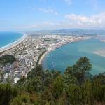
You will need to be a bit patient, this is still some time away:)
Here's the photo coverage:

-
toprob - NZFF Pro
- Joined: Sat Apr 29, 2006 4:56 pm
- Posts: 6741
- Location: Upper Hutt
![]() by Kelvinr » Mon Oct 06, 2008 3:48 pm
by Kelvinr » Mon Oct 06, 2008 3:48 pm
toprob wrote:QUOTE (toprob @ Oct 5 2008, 05:38 PM) <{POST_SNAPBACK}>You will need to be a bit patient, this is still some time away:)
Here's the photo coverage:
Awesome, that's all I asked for. I understand the tedious hours involved in this sort of work... certainly a huge area. Mind blowing stuff. Thanks for your reply.
Kelvin--------------------------------------
-
Kelvinr - Sim-holic
- Joined: Sat May 03, 2008 1:06 pm
- Posts: 904

![]() by toprob » Mon Oct 06, 2008 4:22 pm
by toprob » Mon Oct 06, 2008 4:22 pm
Naki wrote:QUOTE (Naki @ Oct 6 2008, 05:06 PM) <{POST_SNAPBACK}>There will still be a FS9 version.........?
There will be a FS2004 airport -- the rest already exists for FS2004.
-
toprob - NZFF Pro
- Joined: Sat Apr 29, 2006 4:56 pm
- Posts: 6741
- Location: Upper Hutt

![]() by slopit12 » Tue Oct 07, 2008 10:25 am
by slopit12 » Tue Oct 07, 2008 10:25 am
Regarding the area for the Auckland scenery.
I'm just interested how you actually pick the area that your going to cover. It seems to me that with such an incredibly large area covered, you would extend it just a bit further to the East, so that more of the scenery goes right to the edge of the water? There seems to be a coastal section that would look a bit messy because of the scenery ending just before the coast.
Don't get me wrong here, I'm not claiming to have any better judgment on these issues (because I know nothing!) but I was just wondering if there was a reason you select the area you do?
I'm so looking forward this scenery!
- slopit12
- Member
- Joined: Fri Jan 25, 2008 9:38 am
- Posts: 86
![]() by Ian Warren » Tue Oct 07, 2008 11:03 am
by Ian Warren » Tue Oct 07, 2008 11:03 am
slopit12 wrote:QUOTE (slopit12 @ Oct 7 2008, 10:25 AM) <{POST_SNAPBACK}>I'm just interested how you actually pick the area that your going to cover. It seems to me that with such an incredibly large area covered, you would extend it just a bit further to the East, so that more of the scenery goes right to the edge of the water? There seems to be a coastal section that would look a bit messy because of the scenery ending just before the coast.
The area is limited to the size of the actual photo Robin has to work with ,we all be happy if the people(the aerial photo/image company) would extend the limit matching the coast , this would also help with further and future addon scenery but at a huge cost .
-

Ian Warren - NZFF Pro
- Topic author
- Joined: Fri May 05, 2006 5:23 pm
- Posts: 41187
- Location: AREA 51
![]() by toprob » Tue Oct 07, 2008 1:13 pm
by toprob » Tue Oct 07, 2008 1:13 pm
slopit12 wrote:QUOTE (slopit12 @ Oct 7 2008, 11:25 AM) <{POST_SNAPBACK}>Regarding the area for the Auckland scenery.
I'm just interested how you actually pick the area that your going to cover. It seems to me that with such an incredibly large area covered, you would extend it just a bit further to the East, so that more of the scenery goes right to the edge of the water? There seems to be a coastal section that would look a bit messy because of the scenery ending just before the coast.
Don't get me wrong here, I'm not claiming to have any better judgment on these issues (because I know nothing!) but I was just wondering if there was a reason you select the area you do?
I'm so looking forward this scenery!
Yes, as Ian said, this is limited by the available aerial imagery. If I could get hold of that little strip, it would be included.
Provided you use a good landclass scenery, you won't notice this anyway, as the photo scenery is blended to the default. Well, if you lived there then you won't be able to find your house...
-
toprob - NZFF Pro
- Joined: Sat Apr 29, 2006 4:56 pm
- Posts: 6741
- Location: Upper Hutt
![]() by slopit12 » Wed Oct 08, 2008 12:13 pm
by slopit12 » Wed Oct 08, 2008 12:13 pm
toprob wrote:QUOTE (toprob @ Oct 7 2008, 02:13 PM) <{POST_SNAPBACK}>Yes, as Ian said, this is limited by the available aerial imagery. If I could get hold of that little strip, it would be included.
Provided you use a good landclass scenery, you won't notice this anyway, as the photo scenery is blended to the default. Well, if you lived there then you won't be able to find your house...
Ah ok, so it's not your decision at all.
No I don't live there...but it would be annoying if I did!
- slopit12
- Member
- Joined: Fri Jan 25, 2008 9:38 am
- Posts: 86
![]() by Ian Warren » Wed Oct 08, 2008 1:28 pm
by Ian Warren » Wed Oct 08, 2008 1:28 pm
Hecks another way of looking at it .... GOGGLE EARTH ... really disappointed my bro .. what no West Melton 

-
Ian Warren - NZFF Pro
- Topic author
- Joined: Fri May 05, 2006 5:23 pm
- Posts: 41187
- Location: AREA 51
![]() by Timmo » Thu Oct 09, 2008 9:54 am
by Timmo » Thu Oct 09, 2008 9:54 am
QUOTE
Regarding access to Whenuapai, I would suspect that it would be next to impossible for anyone to get access for this sort of project, unless you already have access.[/quote]
It is on my 'to do list' but, of course, limited time etc means that it will be sometime away. I have taken some photos air side (complete with interception by base ops....almost got pinged) but need to do the rest. I have access to the base since I am part of the flying club.
The good thing about Whenuapai is that it appears to be almost identical in construction to Ohakea so once one is done, so too is the other. The hangers are the same, the housing is the same, the buildings are the same!.....gotta love standardised government construction!
I think the next step, in terms of reference photos is to ask for permission rather than trying to take them on my various trips through the base to the aeroclub.....There is always the chance they will say 'no' but hopefully with the recent releases of Nigel's aircraft, they will have a positive view on it.
- Timmo
- NZFF Pro
- Joined: Wed Oct 25, 2006 6:28 pm
- Posts: 2056
- Location: Tauranga
![]() by ZK-MADMAX » Sat Oct 11, 2008 8:22 pm
by ZK-MADMAX » Sat Oct 11, 2008 8:22 pm
I must be a real bum, but if I am correct that area includes North Shore Airfield?  (fingers crossed)
Looking great so far Robin. This could be the bump im looking for to upgrade my computer to cater for all this awesome scenery! Looking forward to release.
(fingers crossed)Looking great so far Robin. This could be the bump im looking for to upgrade my computer to cater for all this awesome scenery!
Looking forward to release.Last edited by ZK-MADMAX on Sat Oct 11, 2008 9:14 pm, edited 1 time in total.
- ZK-MADMAX
39 posts
• Page 2 of 2 • 1, 2
Return to Godzone 'Real New Zealand' Scenery Support
Who is online
Users browsing this forum: No registered users and 16 guests