Mount Tarawera and the Rotorua Lakes

Read and report on flightsim developers progress of upcoming or completed products

Postby Timmo » Fri Sep 14, 2007 9:52 am

Hi Guys
This was uploaded to Avsim yesterday and can be downloaded now. The main feature of this freeware release is a 5m Lidar derived terrain mesh....it looks fantastic in FSX and is great for low flying, especially chopper and agricultural work. It has been designed to compliment another photoreal scenery release by Robin Corn- see below.

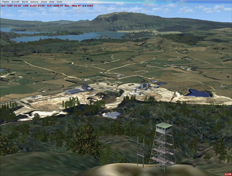
How good does it look?
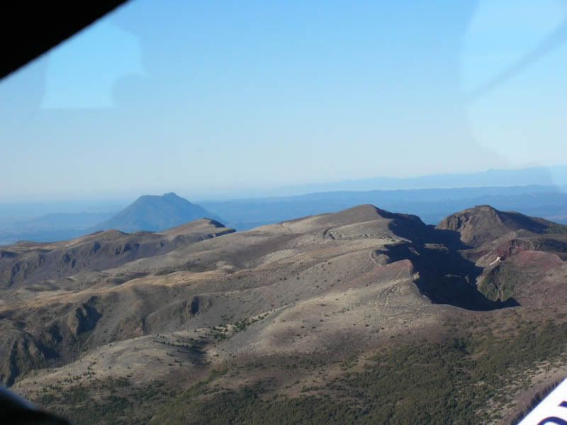
Here is a real photo taken when flying around Mount Tarawera:


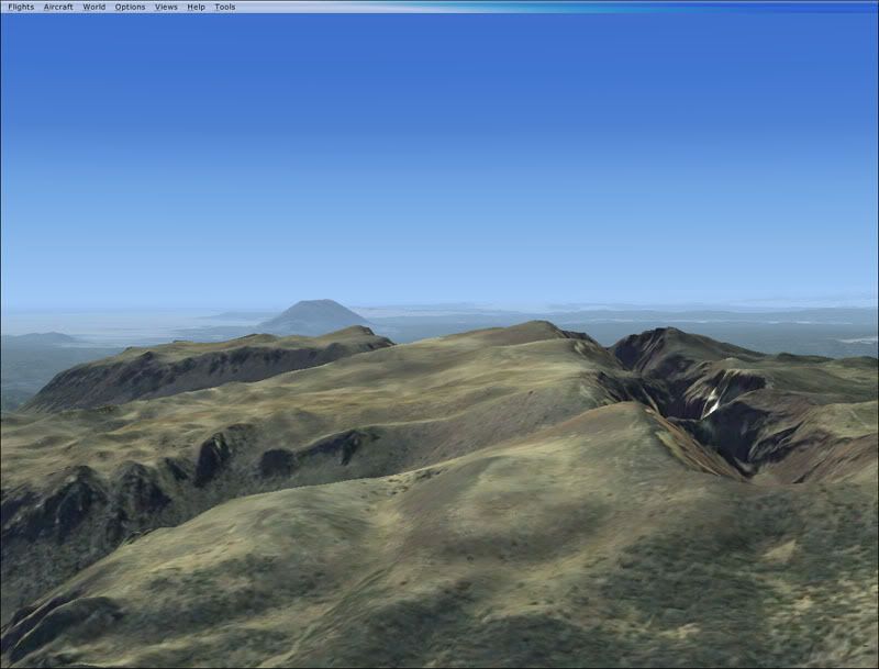
Here is the same position as viewed in FSX:


The file name is: BOPVolcanoes_Tarawera

From the readme:
Mount Tarawera is a volcanic mountain 24 kilometres southeast of Rotorua in the North Island of New Zealand. It consists of a series of rhyolitic lava domes that were fissured down the middle by a basaltic eruption in 1886. The peaks are Ruawahia Peak, Tarawera Peak and Wahanga Peak. The summit is at 1111 metres. The crater of the volcano is a series of chasms, running for 6 kilometres northeast-southwest.
The volcano is surrounded by a series of lakes, many of which were created or drastically altered in the 1886 eruption. These lakes include Lakes Tarawera, Rotomahana, Rerewhakaaitu, Okataina, Okareka, Tikitapu (Blue Lake) and Rotokakahi (Green Lake). The Tarawera River runs northeastwards across the northern flank of the mountain from Lake Tarawera.
Source: Wikipedia


• This scenery was created from a 0.8m pixel resolution Ortho-rectified Aerial mosaic owned by Environment Bay of Plenty (The Bay of Plenty Regional Council) and flown over the summers of 2003/2004. The imagery has been de-sampled for use in Flight Simulator X and utilizes custom terrain mesh. The textures are intended for summer daylight flying only, although due to the evergreen nature of New Zealand's native bush, the areas appearance remains relatively constant throughout the year.
• The mesh was created from 2m pixel resolution LiDaR derived terrain model owned by Environment Bay of Plenty. This has been de-sampled to 5m for use in FSX.
• This scenery is complimentary to another release by Robin Corn which covers Lake Rotorua. It is a freeware component of the Payware "RealNZ Rotorua' scenery available from www.windowlight.co.nz. Both the payware and freeware components are fantastic and I would highly recommend getting them.
• The area features many small airstrips including a small dirt airstrip on the eastern edge of the main crater- These have had "flattens' to make them landable but have not had airstrips definitions/textures applied. The smaller airstrips are used for agricultural applications on the farmland in this area.
• To find this scenery fly east from Rotorua airport (NZRO) or South-South West from Whakatane Airport (NZWK)

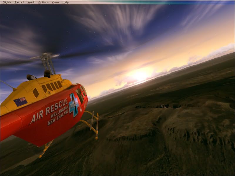
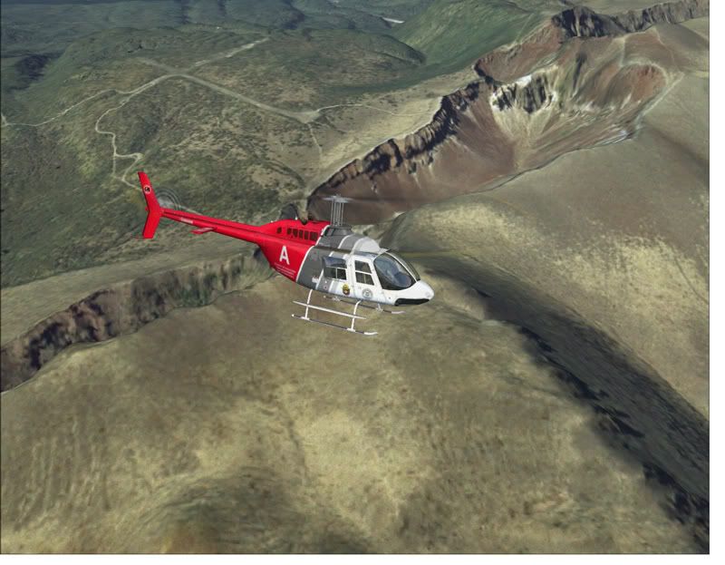
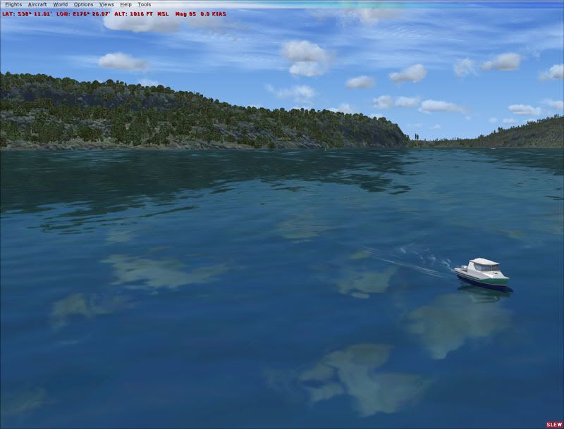
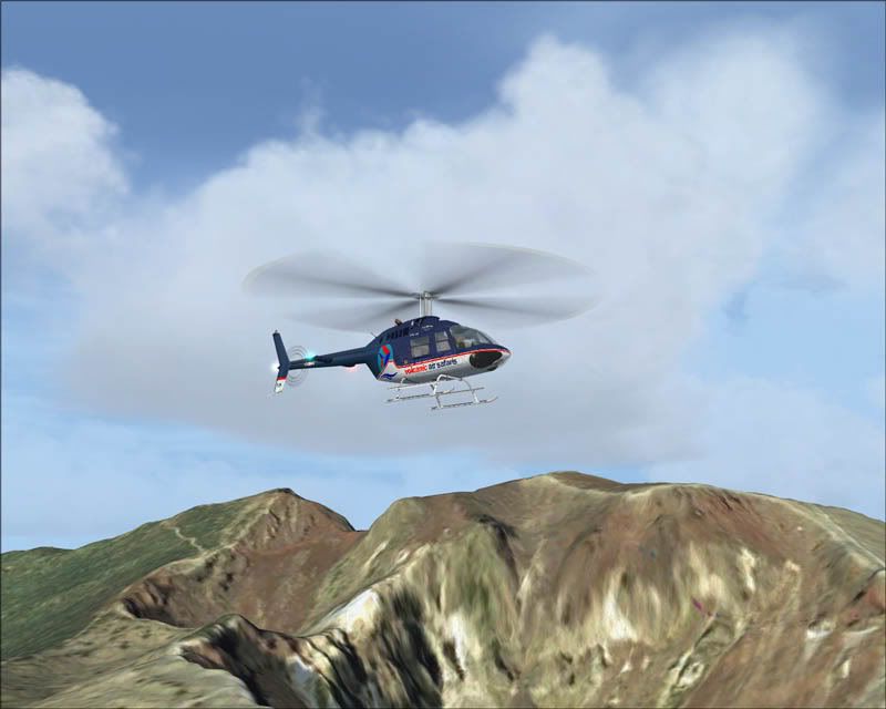
Have some more pics :super:


There is a small error with the .txt readme file giving details of a previous release- Ignore this and simply read the word document readme....its far prettier anyway smile.gif

Enjoy-
Timmo
NZFF Pro
 
Topic author
Joined: Wed Oct 25, 2006 6:28 pm
Posts: 2056
Location: Tauranga

Postby Christian » Fri Sep 14, 2007 12:10 pm

been hanging out for that one - downloading now!
Last edited by Christian on Fri Sep 14, 2007 12:10 pm, edited 1 time in total.
Breathtakingly gorgeous FS landscapes for New Zealand.
Visit Sim Pilot Experience now:
http://www.simpilotexperience.com
Follow me on twitter:
http://www.twitter.com/ChristianStock
User avatar
Christian
Forum Addict
 
Joined: Sun Apr 30, 2006 12:03 pm
Posts: 426
Location: melbourne

Postby Alex » Fri Sep 14, 2007 9:01 pm

Cool, awesome work Timmo, am downloading now. biggrin.gif

Alex
Alex
NZFF Pro
 
Joined: Fri Jul 14, 2006 3:39 pm
Posts: 3620

Postby Timmo » Mon Sep 17, 2007 8:40 am

Over 1000 downloads so far smile.gif
Timmo
NZFF Pro
 
Topic author
Joined: Wed Oct 25, 2006 6:28 pm
Posts: 2056
Location: Tauranga

Postby Christian » Mon Sep 17, 2007 12:00 pm

Timmo wrote:
QUOTE(Timmo @ Sep 21 2007, 08:40 PM) <{POST_SNAPBACK}>
Over 1000 downloads so far smile.gif


I also reserved you a special place in this months Sim Pilot newsletter as scenery of the month winkyy.gif

Christian
Breathtakingly gorgeous FS landscapes for New Zealand.
Visit Sim Pilot Experience now:
http://www.simpilotexperience.com
Follow me on twitter:
http://www.twitter.com/ChristianStock
User avatar
Christian
Forum Addict
 
Joined: Sun Apr 30, 2006 12:03 pm
Posts: 426
Location: melbourne

Postby Charl » Wed Sep 19, 2007 10:57 pm

Timmo wrote:
QUOTE(Timmo @ Sep 17 2007, 08:40 AM) <{POST_SNAPBACK}>
Over 1000 downloads so far smile.gif

Add one more!
Did anyone mention that the Fletcher you left us in the supplied flight is a little overweight?
First try I ran through that big puddle, crash.
As a matter of pride I didn't change the fuel or payload and spent many happy moments falling over the edge of the precipice with full flaps hurridly deployed and meeting the trees below.
Got to know the high-res terrain first-hand before I gave up and shed some load.
And what a pleasure!
It's great to see work produced by someone who's clearly enjoying doing so.
Great stuff, and a great complimentary scenery to RealNZ Rotorua.
I hope the BOP Council guys are just as pleased
User avatar
Charl
NZFF Pro
 
Joined: Mon May 01, 2006 8:28 am
Posts: 9691
Location: Auckland

Postby G-HEVN » Thu Sep 20, 2007 12:05 am

Christian wrote:
QUOTE(Christian @ Sep 17 2007, 01:00 AM) <{POST_SNAPBACK}>
I also reserved you a special place in this months Sim Pilot newsletter as scenery of the month winkyy.gif


So it's not based on merit then? (not suggesting the scenery doesn't deserve it, but it seems rather underhand to have the award reserved.)
G-HEVN
 

Postby gokanru » Thu Sep 20, 2007 1:23 am

Damn good scenery Timmo,it sure is a pleasure too see something great being put out for FSX.Your scenery and Toprobs compliment each other very nicely,thanks a lot to both you and Toprob. thumbup1.gif clapping.gif clapping.gif clapping.gif
gokanru
 

Postby Timmo » Thu Sep 20, 2007 7:07 am

Charl wrote:
QUOTE(Charl @ Sep 24 2007, 10:57 AM) <{POST_SNAPBACK}>
Add one more!
Did anyone mention that the Fletcher you left us in the supplied flight is a little overweight?
First try I ran through that big puddle, crash.
As a matter of pride I didn't change the fuel or payload and spent many happy moments falling over the edge of the precipice with full flaps hurridly deployed and meeting the trees below.
Got to know the high-res terrain first-hand before I gave up and shed some load.
And what a pleasure!
It's great to see work produced by someone who's clearly enjoying doing so.
Great stuff, and a great complimentary scenery to RealNZ Rotorua.
I hope the BOP Council guys are just as pleased


haha yeah, that was a last minute addition but i put my failed takeoff run down to a dodgy joystick i have at work.....

speaking of which, a fletcher is just going overhead as i type!
Timmo
NZFF Pro
 
Topic author
Joined: Wed Oct 25, 2006 6:28 pm
Posts: 2056
Location: Tauranga

Postby Christian » Thu Sep 20, 2007 2:01 pm

G-HEVN wrote:
QUOTE(G-HEVN @ Sep 24 2007, 12:05 PM) <{POST_SNAPBACK}>
So it's not based on merit then? (not suggesting the scenery doesn't deserve it, but it seems rather underhand to have the award reserved.)


Very much based on merit. Timmo's scenery is groundbreaking, no one else has released scenery based on LIDAR data and it's unlikely many will as access to such data is very restricted (unless you have a disposable $100,000 in your bank - most people I know would rather spend that sort of money on a fast car than 40x40km elevation data!).

Christian
Breathtakingly gorgeous FS landscapes for New Zealand.
Visit Sim Pilot Experience now:
http://www.simpilotexperience.com
Follow me on twitter:
http://www.twitter.com/ChristianStock
User avatar
Christian
Forum Addict
 
Joined: Sun Apr 30, 2006 12:03 pm
Posts: 426
Location: melbourne

Postby emmarcel » Sun Sep 23, 2007 9:23 am

Thanks for this great addon

It's a great place to be and to fly and this addon for FSX is just amazing, great work.

The view on Mount Tarawera is just the same as in real life from the bach of my mother-in-law. A shame because I live in Holland and with two kids (and a Kiwi wife) it's getting a little expensive to fly over in real life. But with this addon you are just there.

Just off topic the dates of the messages seems to be wrong, Christian wrote a reply on the 25th and I'm still on the 22th?? I know that you guys living in the future, but this seems a bit to much.

Christian Posted Sep 25 2007, 02:01 AM
QUOTE(G-HEVN @ Sep 24 2007, 12:05 PM)


On topic

Thanks again and I'm looking forward to your next masterpiece.

Marcel
Last edited by emmarcel on Sun Sep 23, 2007 2:19 pm, edited 1 time in total.
emmarcel
Newbie
 
Joined: Mon Aug 07, 2006 5:12 am
Posts: 4
Location: Voorburg Netherlands

Postby cowpatz » Sun Sep 23, 2007 1:20 pm

Excuse my ignorance Timmo but is this just for FSX or will it work in FS9 as well?
FSX is sitting here unopened waiting for a computer upgrade. I just dont think my AMD 2700 processor will handle it well enough. dry.gif
Cheers
Steve
Last edited by cowpatz on Sun Sep 23, 2007 1:20 pm, edited 1 time in total.
Remember the 50-50-90 rule. Anytime you have a 50-50 chance of getting something right, there's a 90% probability you'll get it wrong!

Image
User avatar
cowpatz
NZFF Pro
 
Joined: Wed Mar 07, 2007 3:28 pm
Posts: 3739

Postby Timmo » Sun Sep 23, 2007 2:13 pm

Cowpatz- Just for FSX sorry mate......it just wouldnt have the same effect in FS9....the terrain is 5 times better than what Fs9 can handle and the imagery is probably around twice as good.

Marcel: You can change the settings for time on the control panel i think
Timmo
NZFF Pro
 
Topic author
Joined: Wed Oct 25, 2006 6:28 pm
Posts: 2056
Location: Tauranga


Return to Announcements

Who is online

Users browsing this forum: No registered users and 11 guests