Oxford2Oxford
![]() by G-HEVN » Fri Feb 16, 2007 10:29 am
by G-HEVN » Fri Feb 16, 2007 10:29 am
Leg 35: Forrest YFRT to Minnipa YMPA
 Route: YFRT CDU MPA YMPA.389 nm, 2.6 hours (total: 16,426 nm, 101.8 hours)
As we continue through the desert towards Adelaide, we pass the 100 hours milestone. Not entirely sure whether to cheer or cry, but either way it deserves a beer!

We had an excellent time staying here, listening to tales of the airfield in years gone by, while supping on our tinnies. But now it's time to take our leave of Wal and Dog, and get on our way.

The worst part of the trip is the bit between closing the canopy and getting enough airspeed and height for the air vents to become effective!

We have a nice fast steed, but I can't help thinking of those poor unfortunates of years gone by that actually had to walk across this vast hostile plain.

The Great Australian Bight. Nothing between us and Antarctica...

Nothing between us and Darwin, some 800 miles away...
Okay, there's Ayers Rock, but that's all!

Somewhere in this scrub is Minnipa. It's little more than a grass strip, and quite hard to spot, but fortunately it has an NDB. And according to the map, it's right by the railway...

Here we are!

The afternoon storms are brewing again!

Bumpity bumpity, even with full back stick, this is a rough old bit of grass. Better check the prop once we've stopped, just to be safe.

Fortunately there's no damage. Now I need a drink, where's the fridge?....
 Route: YFRT CDU MPA YMPA.389 nm, 2.6 hours (total: 16,426 nm, 101.8 hours)
As we continue through the desert towards Adelaide, we pass the 100 hours milestone. Not entirely sure whether to cheer or cry, but either way it deserves a beer!
We had an excellent time staying here, listening to tales of the airfield in years gone by, while supping on our tinnies. But now it's time to take our leave of Wal and Dog, and get on our way.
The worst part of the trip is the bit between closing the canopy and getting enough airspeed and height for the air vents to become effective!
We have a nice fast steed, but I can't help thinking of those poor unfortunates of years gone by that actually had to walk across this vast hostile plain.
The Great Australian Bight. Nothing between us and Antarctica...
Nothing between us and Darwin, some 800 miles away...
Okay, there's Ayers Rock, but that's all!
Somewhere in this scrub is Minnipa. It's little more than a grass strip, and quite hard to spot, but fortunately it has an NDB. And according to the map, it's right by the railway...
Here we are!
The afternoon storms are brewing again!
Bumpity bumpity, even with full back stick, this is a rough old bit of grass. Better check the prop once we've stopped, just to be safe.
Fortunately there's no damage. Now I need a drink, where's the fridge?....
- G-HEVN
![]() by G-HEVN » Sun Feb 18, 2007 10:41 am
by G-HEVN » Sun Feb 18, 2007 10:41 am
Leg 36: Minnipa YMPA to Adelaide Parafield YPPF
Route: YMPA PAG PF YPPF. 274nm, 2.0 hours (total: 16,700nm, 103.8 hours)


Backtracking down the grass track that serves as a runway. Let's hope we can take off without doing any prop damage.

Oh yes! And as we climb out we can look back and clearly see the railway track (oh for some AI trains!!!) and highway.

As we approach Port Augusta, we must make sure we stay outside the Monument Hill restricted airspace,

Good navigation again - overhead and dead on time!

Heading down the edge of the Flinders Ranges towards Adelaide.

As we descend towards the city, we're cleared to transit through the overhead of the Edinburgh Military air base, and to join right base for Parafield runway 26,

Ewww! There's something wrong here!

We're down on the ground -- if it is ground, that is. A later discussion on the VOZ support forum and some experimentation, determines this is a problem using the VOZ landclass in FSX. Apparently it uses a value that's no longer supported. That's easy enough: We'll just disable the landclass for the start of the next leg.
Route: YMPA PAG PF YPPF. 274nm, 2.0 hours (total: 16,700nm, 103.8 hours)
Backtracking down the grass track that serves as a runway. Let's hope we can take off without doing any prop damage.
Oh yes! And as we climb out we can look back and clearly see the railway track (oh for some AI trains!!!) and highway.
As we approach Port Augusta, we must make sure we stay outside the Monument Hill restricted airspace,
Good navigation again - overhead and dead on time!
Heading down the edge of the Flinders Ranges towards Adelaide.
As we descend towards the city, we're cleared to transit through the overhead of the Edinburgh Military air base, and to join right base for Parafield runway 26,
Ewww! There's something wrong here!
We're down on the ground -- if it is ground, that is. A later discussion on the VOZ support forum and some experimentation, determines this is a problem using the VOZ landclass in FSX. Apparently it uses a value that's no longer supported. That's easy enough: We'll just disable the landclass for the start of the next leg.
- G-HEVN
![]() by ardypilot » Sun Feb 18, 2007 11:41 am
by ardypilot » Sun Feb 18, 2007 11:41 am
That is unfortunate about the Parafield landclass, it looks so good in FS9 (as does the rest of Adelaide):
Looking forward to the next leg!
Looking forward to the next leg!
Last edited by ardypilot on Sun Feb 18, 2007 11:46 am, edited 1 time in total.
-

ardypilot - NZFF Pro
- Joined: Wed Apr 26, 2006 10:01 am
- Posts: 6802
- Location: Auckland
![]() by G-HEVN » Sun Feb 18, 2007 12:04 pm
by G-HEVN » Sun Feb 18, 2007 12:04 pm
Trolly: You don't have long to wait...! 
Leg 37: Adelaide Parafield YPPF to Mt Gambier YMTG
Route: YPPF AD MIA MTG YMTG 413nm 2.8 hours (total: 17,113nm. 106.6 hours)
We're not heading directly to Mt Gambier, but rather making a detour via Mildura. Partly because that's the way the original tour went, but also we've been asked if we wouldn't mind dropping off some spares to an RFDS plane that should meet us there.

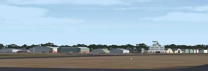
Turning off the VOZ landclass did the trick regarding ground textures. I thought it might be fun to see what would happen if I enabled the VOZ airport scenery. Well it's actually not bad! In the Rossair hangar, they've obviously been doing some maintainance...

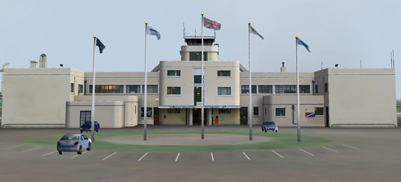
Another hangar and the tower.

I don't kno how old it is, but the tower really does have a deco look to it.

Nothing like a bit of gratuitous advertising!

So you can see, the ground textures are now looking perfectly normal. We can soon switch the landclass back on again (FSX supports changing scenery addons mid flight!)

We're following the Murray River.

Turning final for runway 36. The wind is 040/14G21, making it a little sporty!

We deliver the spares to the air ambulance chaps, and grab a quick coke before heading off again.

Downwind for Mt Gambier. I presume that's the mount ahead of us. We get bounced around rather from the turbulence over the trees.

And once again, we're on final. Next repoting point is the bar in approximately 2 minutes...
Leg 37: Adelaide Parafield YPPF to Mt Gambier YMTG
Route: YPPF AD MIA MTG YMTG 413nm 2.8 hours (total: 17,113nm. 106.6 hours)
We're not heading directly to Mt Gambier, but rather making a detour via Mildura. Partly because that's the way the original tour went, but also we've been asked if we wouldn't mind dropping off some spares to an RFDS plane that should meet us there.
Turning off the VOZ landclass did the trick regarding ground textures. I thought it might be fun to see what would happen if I enabled the VOZ airport scenery. Well it's actually not bad! In the Rossair hangar, they've obviously been doing some maintainance...
Another hangar and the tower.
I don't kno how old it is, but the tower really does have a deco look to it.
Nothing like a bit of gratuitous advertising!
So you can see, the ground textures are now looking perfectly normal. We can soon switch the landclass back on again (FSX supports changing scenery addons mid flight!)
We're following the Murray River.
Turning final for runway 36. The wind is 040/14G21, making it a little sporty!
We deliver the spares to the air ambulance chaps, and grab a quick coke before heading off again.
Downwind for Mt Gambier. I presume that's the mount ahead of us. We get bounced around rather from the turbulence over the trees.
And once again, we're on final. Next repoting point is the bar in approximately 2 minutes...
- G-HEVN

![]() by ardypilot » Sun Feb 18, 2007 5:40 pm
by ardypilot » Sun Feb 18, 2007 5:40 pm
I thought it might be fun to see what would happen if I enabled the VOZ airport scenery.
Amazing isn't it? Parafield was the first addon for FS9 (that I knew of) that included moving cars- gives off a real busy atmosphere with the VOZ AI installed too- is that what that Air Ambo is from?
but the tower really does have a deco look to it
What about EGKA?
Great leg once again- I was studying Mt Gamber in tourisum last week. Where next?
-
ardypilot - NZFF Pro
- Joined: Wed Apr 26, 2006 10:01 am
- Posts: 6802
- Location: Auckland
![]() by G-HEVN » Sun Feb 18, 2007 8:36 pm
by G-HEVN » Sun Feb 18, 2007 8:36 pm
For 'most amazing airport buildings' I think it's hard to beat Berlin Templehof. And the tragedy is, they've been trying to close it down for years.
Next up: Melbourne, Albury/Wodonga (where my rellies live), Sydney, then Lord Howe and Norfolk Islands (whatever order they come in) to Auckland...
Next up: Melbourne, Albury/Wodonga (where my rellies live), Sydney, then Lord Howe and Norfolk Islands (whatever order they come in) to Auckland...
- G-HEVN
![]() by G-HEVN » Mon Feb 19, 2007 11:15 am
by G-HEVN » Mon Feb 19, 2007 11:15 am
Leg 38: Mount Gambier YMTG to Melbourne Essendon YMEN
Route: YMTG MTG YWE YMEN. 196nm, 1.5 hours (Total: 17,309 nm, 108.1 hours)
Although almost 200 nautical miles, for Australia, this is just a short hop.

It's been a while since we had weather, but the signs are, today we might have some. With no reason today to deviate, we're just gonna head East.

Climbing out and turning overhead the airport. There's the extinct volcano of Mount Gambier to our left; it won't hurt just to take a quick look...

The crater and its aptly named Blue Lake.

A last glance over our shoulder at the crater and the airport beyond.

One of the many small lakes on the route.

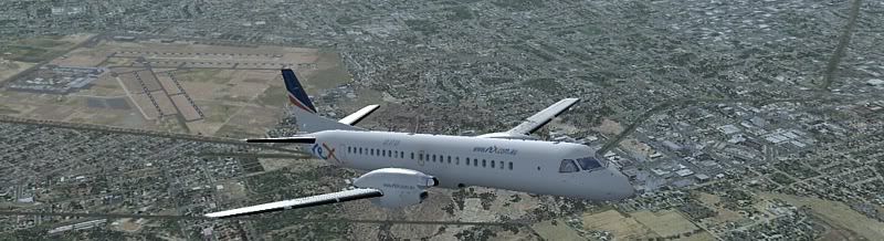
Approach into Melbourne. The International airport is on our left, and the strange hole ahead of us is presumably punishment for any pilot who overruns the runway!

Turning final for runway 17. Melbourne's CBD is visible, but that's an adventure for later!

I don't think we're likely to be short on fuel; I just hope it's the right sort!

No, that's not my brakes locking up; it's just spray from a brief passing shower. It's a shame FS only has two states: dry and soaked!
Route: YMTG MTG YWE YMEN. 196nm, 1.5 hours (Total: 17,309 nm, 108.1 hours)
Although almost 200 nautical miles, for Australia, this is just a short hop.
It's been a while since we had weather, but the signs are, today we might have some. With no reason today to deviate, we're just gonna head East.
Climbing out and turning overhead the airport. There's the extinct volcano of Mount Gambier to our left; it won't hurt just to take a quick look...
The crater and its aptly named Blue Lake.
A last glance over our shoulder at the crater and the airport beyond.
One of the many small lakes on the route.
Approach into Melbourne. The International airport is on our left, and the strange hole ahead of us is presumably punishment for any pilot who overruns the runway!
Turning final for runway 17. Melbourne's CBD is visible, but that's an adventure for later!
I don't think we're likely to be short on fuel; I just hope it's the right sort!
No, that's not my brakes locking up; it's just spray from a brief passing shower. It's a shame FS only has two states: dry and soaked!
- G-HEVN

![]() by G-HEVN » Tue Feb 20, 2007 9:36 am
by G-HEVN » Tue Feb 20, 2007 9:36 am
Leg 39 Melbourne Essendon YMEN to Sydney Bankstown YSBK
Route: YMEN AY (full stop at YMAY) BIK YSBK, 378nm, 3.0 hours. (Total: 17,687nm, 111.1 hours)
Today's trip takes us to the end of the Australian mainland. We do make a stop for lunch at Albury (I have relatives in neighbouring Wodonga), but unfortunately there's not space for the family snaps. Maybe later there'll be a director's cut...

Holding ready for departure. But before we head onto track, we really must take a look around the town...

There are bridges. There's only one thing to do with a bridge!

And boats. I think this one is a tanker.

A few gulls. Unfortunately I missed the picture of the near birdstrike.

This one comes with its own cranes!

The CBD

and stadium. Nobody's playing.

Okay, enough sightseeing! let's get going!

<insert your own travel montage here!> We're now on right base for Bankstown runway 11 Right.

And so to land. There are three parallel runways here, and it's quite fun in the real world to see them all working at once!
Route: YMEN AY (full stop at YMAY) BIK YSBK, 378nm, 3.0 hours. (Total: 17,687nm, 111.1 hours)
Today's trip takes us to the end of the Australian mainland. We do make a stop for lunch at Albury (I have relatives in neighbouring Wodonga), but unfortunately there's not space for the family snaps. Maybe later there'll be a director's cut...
Holding ready for departure. But before we head onto track, we really must take a look around the town...
There are bridges. There's only one thing to do with a bridge!
And boats. I think this one is a tanker.
A few gulls. Unfortunately I missed the picture of the near birdstrike.
This one comes with its own cranes!
The CBD
and stadium. Nobody's playing.
Okay, enough sightseeing! let's get going!
<insert your own travel montage here!> We're now on right base for Bankstown runway 11 Right.
And so to land. There are three parallel runways here, and it's quite fun in the real world to see them all working at once!
- G-HEVN
![]() by ZK-Brock » Tue Feb 20, 2007 6:02 pm
by ZK-Brock » Tue Feb 20, 2007 6:02 pm
Yeah G-HEVN, Bankstown's awesome! I flew there in a 152 last time I went to Australia with some company called McIvers air services. There was a cool Pitts special flying around that day too, as well as a Tecnam, various twins, and even a B1900  Also saw some DC-3s parked. It's a really great airfield IMO, lots of traffic to look at (and try not to crash into
  )
)
Also saw some DC-3s parked. It's a really great airfield IMO, lots of traffic to look at (and try not to crash into )- ZK-Brock
- NZFF Pro
- Joined: Sun Jul 23, 2006 3:35 pm
- Posts: 2035
![]() by G-HEVN » Tue Feb 20, 2007 8:25 pm
by G-HEVN » Tue Feb 20, 2007 8:25 pm
I flew there last October, in an Arrow III from Schofield's flying club (got the T-shirt!  ), which is on the right hand side of runway 11, ie far side to the main buildings. I distinctly remember us landing on 11 centre, with traffic both to the left and right of us. In fact, I wrote it up here.
), which is on the right hand side of runway 11, ie far side to the main buildings. I distinctly remember us landing on 11 centre, with traffic both to the left and right of us. In fact, I wrote it up here.- G-HEVN
![]() by G-HEVN » Wed Feb 21, 2007 11:41 am
by G-HEVN » Wed Feb 21, 2007 11:41 am
Leg 40: Sydney BAnkstown YSBK to Lord Howe Island YLHI
Route: YSBK SY LHI YLHI, 435nm, 3.0 hours (Total 18,122nm, 114.1 hours)
A lot of preparation went into this leg (yeah, right!). We've got 435 nautical miles, of which 420 is over open water. For the first 210 miles, the nearest land in case of trouble or engine problems, is directly behind us. For the other 210 miles, it's a small speck of land directly ahead. There is literally nowhere else to go. Thus fuel management and weight/balance management are critical. If anything goes wrong there's literally nowhere to go.

Of course, we need really good weather and favourable winds. Thus we find ourselves starting out takeoff run in the rain!

And of course, Sydney is not going to escape the tour treatment just because we have a big journey ahead, although the fuel load means we're more restricted in the manoeuvres available to us.

And so we come to the Tyne, er, Sydney HArbour bridge. Looks kinda like a lightweight wire frame model here, but I do hear they light it up quite nicely at New Years!

The Opera House. Circular Quay, behind it, looks rather less impressive than I last remember!

Caught by Canyon Cam!

Two and a half hours over the ocean at 9500ft. We considered supplemental oxygen, but the extra weight and complexity involved outweighed any percieved benefit from the additional altitude.

We were out of range of the Sydney VOR after about 150 miles, so had to trust to dead reckoning until within range of the Lord Howe NDB. Fortunately the wind remained pretty well constant, so the island appeared almost on the nose!

I'll admit to a small amount of cheating here. The first time in, I discovered that the default FS has no terrain mesh here at all; the island was totally flat. What you now see here is a mixture of VOZ (scenery) and Darren Jackson's FS9 addon (mesh and landclass).

Short final. If you install Darren Jackson's scenery, disable the 'coastline' part, otherwise much of the airport becomes flooded.

Now that would have been a much easier way to get here!
Route: YSBK SY LHI YLHI, 435nm, 3.0 hours (Total 18,122nm, 114.1 hours)
A lot of preparation went into this leg (yeah, right!). We've got 435 nautical miles, of which 420 is over open water. For the first 210 miles, the nearest land in case of trouble or engine problems, is directly behind us. For the other 210 miles, it's a small speck of land directly ahead. There is literally nowhere else to go. Thus fuel management and weight/balance management are critical. If anything goes wrong there's literally nowhere to go.
Of course, we need really good weather and favourable winds. Thus we find ourselves starting out takeoff run in the rain!
And of course, Sydney is not going to escape the tour treatment just because we have a big journey ahead, although the fuel load means we're more restricted in the manoeuvres available to us.
And so we come to the Tyne, er, Sydney HArbour bridge. Looks kinda like a lightweight wire frame model here, but I do hear they light it up quite nicely at New Years!
The Opera House. Circular Quay, behind it, looks rather less impressive than I last remember!
Caught by Canyon Cam!
Two and a half hours over the ocean at 9500ft. We considered supplemental oxygen, but the extra weight and complexity involved outweighed any percieved benefit from the additional altitude.
We were out of range of the Sydney VOR after about 150 miles, so had to trust to dead reckoning until within range of the Lord Howe NDB. Fortunately the wind remained pretty well constant, so the island appeared almost on the nose!
I'll admit to a small amount of cheating here. The first time in, I discovered that the default FS has no terrain mesh here at all; the island was totally flat. What you now see here is a mixture of VOZ (scenery) and Darren Jackson's FS9 addon (mesh and landclass).
Short final. If you install Darren Jackson's scenery, disable the 'coastline' part, otherwise much of the airport becomes flooded.
Now that would have been a much easier way to get here!
- G-HEVN

Who is online
Users browsing this forum: No registered users and 30 guests