Oxford2Oxford

Share your simulated flights around NZ here. The place to post your flight reports, flight plan instructions and progress on tours

Postby Alex » Fri Jan 19, 2007 2:55 pm

Looking good. :D

Alex
Alex
NZFF Pro
 
Joined: Fri Jul 14, 2006 3:39 pm
Posts: 3620

Postby G-HEVN » Sun Jan 21, 2007 10:17 pm

Leg 12: Luxor Intl HELX to Port Sudan HSPN

Continuing up the Nile to Aswan and Lake Nasser, then cutting across the Nubian desert to the coastal town of Port Sudan.

user posted image
Every now and then I notice something odd - like the landing light in this shot is just a pinpoint. Strange!
Anyhow, we're about to be cleared for take off and hed South on the first stage of the flight.

user posted image
Climbing out over the desert. This is the desert: Get used to it!

user posted image
More desert. The fertile Nile valley (but less so after the building of the dam) shows as a thin green ribbon.

user posted image
Approaching Aswan and Lake Nasser. The Low Dam is at the first widening of the river, and the High Dam at the second.

user posted image
Taking a closer look at how Microsoft modelled the Aswan High Dam.. Oh, they didn't! Ho hum!

user posted image
As the sun creeps higher into the sky, we cross the lake and head into even more desert

user posted image
Yup, desert. Not sure how the clouds got there though. Guess it must me something to do with the nearest weater station some 100 miles away on the coast...

user posted image
And so to land. The town is just a few miles to the North, so we're not as isilated as it might appear.

user posted image
Finally another map update of our progress. As you can see, the original team turned back shortly after Cairo hand headed for Port Said, from where they go a boat into Bombay. We of course don't have such luxuries!
G-HEVN
 

Postby G-HEVN » Tue Jan 23, 2007 11:01 pm

Leg 13: Port Sudan HSPN to Aden Intl OYAA

Route: ASM SB KRA, 735nm, 4.0 hours (total: 6005nm, 42.4 hours)

Put on your Lawrence of Arabia soundtrack for another trip through the desert. We're taking the default Cessna Caravan from Port Sudan, down through Eritrea, crossing the Red Sea at its narrowest point and on to the port of Aden on the South coast of Yemen.

user posted image
Global Freightways flight 1 to Aden holding ready for departure

user posted image
Climbing out to our cruise altitude of FL95. Already Port Sudan recedes into the distance, and we settle down to a monotonous landscape of sand to the right, sea to the left. Still, it makes navigation easy!

user posted image
I can't imagine why there are not more passengers. It can't be a reflection on my flying, surely?

user posted image
Crossing the Red Sea: Out of Africa!

user posted image
Only to be greeted by more sand!

user posted image
Making our descent into Aden. We've been cleared straight in for 08, but we'll shoot the ILS just for the practice!

user posted image
Short final. It's nice to see something that isn't sand for a change!

user posted image
"Global, go around!" Bu66er! What was that about, there's nobody on the runway...

user posted image
Turning final for the second attempt. Let's hope they don't send us round - I've go a low fuel lamp!

user posted image
Um.... DId the tide suddenly come in?
G-HEVN
 

Postby ZK-Brock » Wed Jan 24, 2007 7:57 am

Haha G-HEVN, what happened there my old son
ZK-Brock
NZFF Pro
 
Joined: Sun Jul 23, 2006 3:35 pm
Posts: 2035

Postby Zöltuger » Wed Jan 24, 2007 9:10 am

maybe the tires needed a clean?
Zöltuger
 

Postby JonARNZ » Wed Jan 24, 2007 11:42 am

:P 
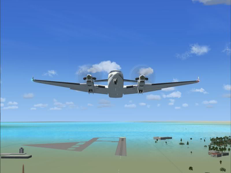
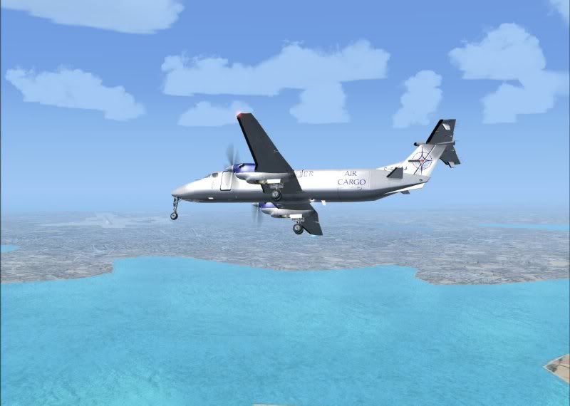
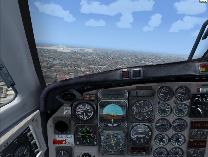
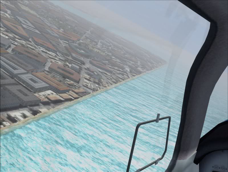
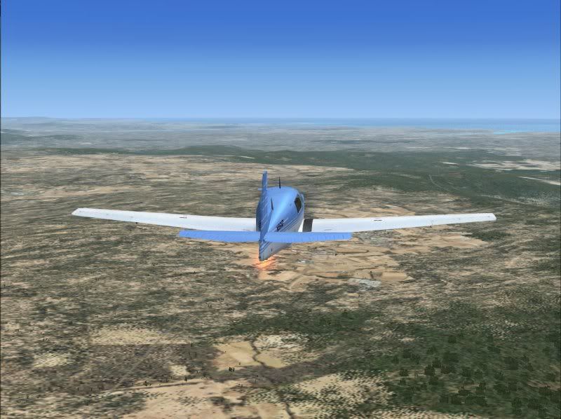
Maybe thats why the go around, the tide was on short finals before you? :blink: Or perhaps FSX is modelling the effects of global warming :wacko:
ARNZX flightsim.co.nz
Asus Sabretooth X79 MB | i73930K CPU | 8GB DDR3 1600 C7 Ram | GTX 560Ti DCII OC | Corsair H80 Water Cooling
User avatar
JonARNZ
Senior Member
 
Joined: Sat Oct 21, 2006 12:49 pm
Posts: 1523
Location: Auckland

Postby G-HEVN » Wed Jan 24, 2007 11:53 am

I think that runway can definitely be classified 'wet wet wet'!!! :lol:
G-HEVN
 

Postby G-HEVN » Wed Jan 24, 2007 11:56 am

Leg 14: Aden Intl OYAA to Muscat Seeb Intl OOMS

Route KRA - MCT. Default King Air 350. 1108nm, 3.3 hours (total 7113 nm 45.7 hours)


user posted image
Loading up the plane. You've probably noticed the plane getting just a little bigger with each leg. It's the souvenirs I'm afraid! We keep running out of space to stash them; by the end of this tour we'll probably need our own 747!

user posted image
We've filed IFR, and we're cleared straight up to 13000 on our runway heading of 080

user posted image
Our wheels are barely up when the airport once again sinks under the sea. Most wierd! I'm starting to wonder if we should be in a Shorts Sandringham rather than a King Air! Bob in the back starts singing Michael, Row the Boat Ashore...

user posted image
Despite the protestations of our controller, we circle the isthmus to take a closer look. All seems fine again!

user posted image
The Beech 350 VC

user posted image
The copilot has just nipped out for some, er, refreshment! (and to check the liferaft!)

user posted image
Sand. Lots of sand. Dee dah... da da da da deee dahh.. Da de de da dahhh... Ahem!

user posted image
ATC calls for us to descend for the ILS, at whick point these huuuge piles of rocky sand appear!

user posted image
"Kilo Alpha expedite your descent" Yeah right. Did I mention huge?

user posted image
Short final to another deserted airport. Strange though just how many trucks are driving past on the road!
G-HEVN
 

Postby ZK-Brock » Wed Jan 24, 2007 12:00 pm

Really Cool pics again G-HEVN, looks like FSX models desert pretty well ('cept when you're flying over the southern alps, a little much desert there)
ZK-Brock
NZFF Pro
 
Joined: Sun Jul 23, 2006 3:35 pm
Posts: 2035

Postby G-HEVN » Fri Jan 26, 2007 1:40 am

Leg 15: Muscat Seeb Intl OOMS to Karachi Jinnah Intl OPKC

Route: MCT - KC 546nm, 2.3 hours (total 7659nm 48.0 hours)
Despite assurances to the contrary, Seeb only had Jet-A1 available, and no 100LL. So all the AVGAS burners in our little fleet are stranded awaiting fuel supplies (ironic, being in the oil-rich Middle East!). Meanwhile, we're going to strike out on our own, and have arranged to meet up with the team in Mumbai. For part of the way, we've managed to hitch a ride on a Buddha Air Beech 1900 that's heading back to Kathmandu after a charter op.

user posted image
Taxying for take off

user posted image
Heading out. This is the PMDG Beech 1900D.

user posted image
It integrates into FSX almost perfectly, with no odd glitches switching between screens and panels.

user posted image
Hopefully this is our last view of sand for quite some time!

user posted image
Straight out over the sea.

user posted image
Keep going until the sun goes down

user posted image
We need to change tanks, and now we discover the one problem: In 2D, the fuel sub panel won't display, and in the VC, the tank delector switch is missing...

user posted image
I know it's cheating, but we have to resort to the fuel/load dialog to balance the tanks.

user posted image
Descending into Karachi. There's a solid undercast below us, so we have little idea of where we are.

user posted image
On the ground, and heading into the terminal for a cuppa, and a search for a seat to Mumbai...
G-HEVN
 

Postby JonARNZ » Fri Jan 26, 2007 2:28 pm

Great shots, again :thumbup: 
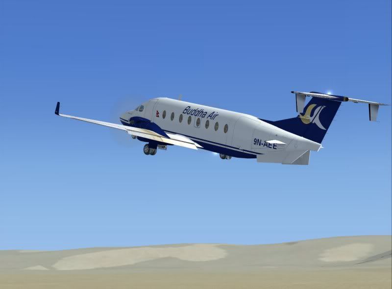
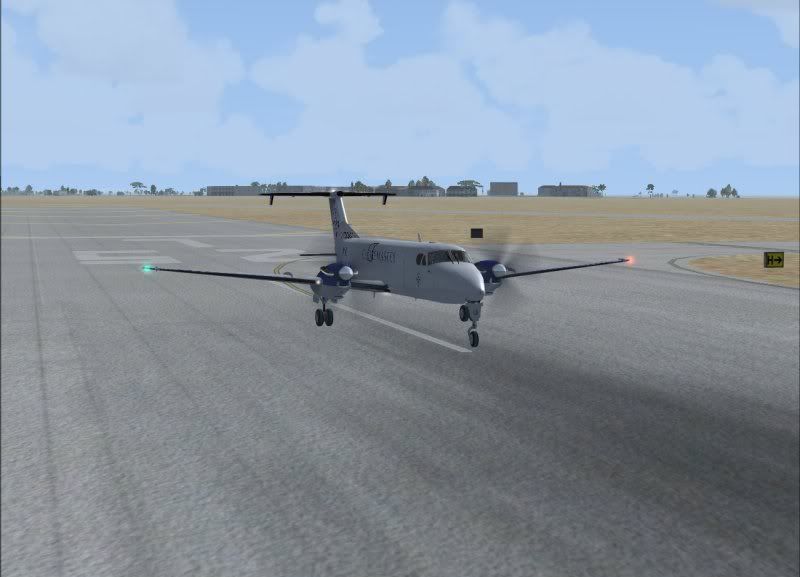
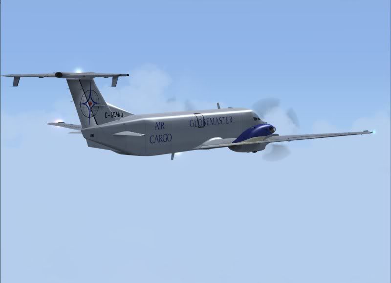
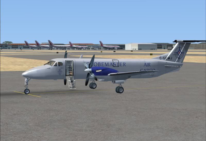
The PMDG 1900 looks good in FSX, I shall copy it over right now I think.
ARNZX flightsim.co.nz
Asus Sabretooth X79 MB | i73930K CPU | 8GB DDR3 1600 C7 Ram | GTX 560Ti DCII OC | Corsair H80 Water Cooling
User avatar
JonARNZ
Senior Member
 
Joined: Sat Oct 21, 2006 12:49 pm
Posts: 1523
Location: Auckland

Postby G-HEVN » Fri Jan 26, 2007 9:33 pm

Just beware of the missing fuel panel in the 'D' model (the 'C' is okay though)

I have also made thumbnails for all the official paint schemes if you'd like them...
G-HEVN
 

Postby ardypilot » Fri Jan 26, 2007 10:37 pm

Great to read your progress HEVN, keep up the good reports :thumbup:

BTW Brock, I also have to say the C206 is my favourite Carenado bird. You might want to get the full pack which includes float and cargo variations to spice things up :P
User avatar
ardypilot
NZFF Pro
 
Joined: Wed Apr 26, 2006 10:01 am
Posts: 6802
Location: Auckland

Postby G-HEVN » Sat Jan 27, 2007 12:00 pm

Leg 16: Karachi Jinnah Intl OPKC to Mumbai Chhatrapati Shivaji Intl VABB

Route: KC JAM DMN BBB 552nm 2.4 hours (total: 8211nm 50.4 hours)

To hitch a ride down to Mumbai, we had to walk across to the cargo terminal, where a Globemaster 1900C had some available space.

Settling in to the office. Just time to read the email before putting on the coffee... You'll see that the tank selector switch is present and fully functional in the C model.
user posted image

Lining up on runway 25. Hope the in flight movie is something good! AAArrrrghhh! Snakes on a Plane!!!
user posted image

Climbing out
user posted image

Turning onto track. You can see there are two Karachi airports to choose from. Good job we found the right one in the dark last night!
user posted image

user posted image

Descending over Mumbai
user posted image

Downwind for runway 27, visual approach
user posted image

Danglies down, three greens, turning final...
user posted image

Cleared to land runway 27. Let's hope we don't have a problem, 'cos there's nowhere to go!
user posted image

It might be quiet on our side of the airport, but just across the runway, it's a different story...
user posted image
G-HEVN
 

Postby G-HEVN » Sun Jan 28, 2007 11:31 am

Leg 17: Mumbai Chhatrapati Shivaji Intl VABB to Goa Dabolim Navy VAGO

Route: VABB PUN KP GOA VAGO 295nm 1.6 hours (total:8506nm 52 hours)

Braving the infamous Mumbai smog, that puts even Los Angeles into the shade, we head from our hotel to the airport, meeting up with the rest of the team in the process. The airport was IFR and so we sat around drinking coffee until eventually, we could at least see the end of the runway...

user posted image
Today we're flying the FSX default Mooney. Cleared for engine start and taxi.

user posted image
As we taxi out to runway 27, we listen to the ATIS: wind 241/9, Visability 5km, QNH 1016, Temp 24, dewpoint 16. This is about as good as we're going to get!

user posted image
Up, up and away...

user posted image
Climbing out over the coast, we're cleared for a left turn. Most of the city disappears under the smog.

user posted image
Our first waypoint looms out of the murk. This is one of the downsides of FS weather - the city smog is extended many tens of miles into the countryside.

user posted image
Finally the weather clears, and we can seen the countryside below.

user posted image
Heading back towards the coast, and Goa.

user posted image
Descending across the coastal plain.

user posted image
Turning final

user posted image
Final, runway 26. Have to say it, this was one of the few planes so far in FSX where I've preferred the 2D cockpit!
G-HEVN
 

Postby G-HEVN » Mon Jan 29, 2007 10:15 am

Leg 18: Goa Dabolim Navy VAGO to Bangalore VOBG

Route: VAGO BBI BBG VOBG. 358 nm, 2.8 hours (total 8864 nm, 54.8 hours)

The strangest things happen in airport bars! We met up with abunch of Aussies that were on a "world tour" in their C206. I suspect they were basically just going from bar to bar and basically wouldn't fly to anywhere that was more than 2 hours from a pub! Anyhow, turns out they were also going to Bangalore, so we decided to swap ride for ride...

user posted image
Here's a map of the Indian Sector of the tour. The original route is shown in cyan, and our progress in red. The inset shows more detail for this leg.

user posted image
Once again, a hazy, smoggy start to the day. The glow from the beacon piercing the gloom.

user posted image
Climbing out. The Navy were perfect hosts, keeping out of our way such that you wouldn't even know they were there!

user posted image
A watery sun forces its way through the haze.

user posted image
As we head inland, brown turns to green...

user posted image
Our route takes us over the Tungabhadra Reservoir

user posted image

user posted image
'Hide and Seek'. A game of limited possibilities in the back of an aeroplane. But we're having a go!

user posted image
As we get close to Bangalore, the weather starts to close in.

user posted image
Very Very Very short final!
G-HEVN
 

Postby ZK-Brock » Mon Jan 29, 2007 11:25 am

Many awesome shots there G-HEVN.
ZK-Brock
NZFF Pro
 
Joined: Sun Jul 23, 2006 3:35 pm
Posts: 2035

Postby G-HEVN » Tue Jan 30, 2007 8:28 am

Leg 19: Bangalore VOBG to Thiruvananthapuram (Trivandrum) VOTV

Route: CCB CIA TVM 352nm 2.2 hours (total:9216nm 57 hours). This leg takes us as far South as we can get on mainland India.

user posted image
Tower clears us to line up.

user posted image
Bangalore's elevation of 2900ft means we need to pay attention to leaning the mixture. Fortunately the temperature of 21 degrees is at the cold end of the scale, but we're still going to need more runway than usual to get off the ground.

user posted image
As we turn on track, the Mysore Plateau stretches off into the distance

user posted image

user posted image
In the distance we can see the peaks of the Western Ghats

user posted image
We've crossed the mountains and returned to the coast at Cochin.This 'outtake' just goes to show that our camera ship doesn't get it right every time!

user posted image
A vast network of estuaries drain the rivers of the Western Ghats into the Arabian Sea.

user posted image
The moon rises over the Western Ghats

user posted image
Turning final at Trivandrum

user posted image
Cleared to land. Trivandrum gets 1.7 metres of rain per year, thanks to the rain-catching infuence of the mountains to the West. Okay, we are in the dry season, but, well, Microsoft strikes again!
G-HEVN
 

Postby G-HEVN » Wed Jan 31, 2007 12:14 pm

Leg 20: Thiruvananthapuram (Trivandrum) VOTV to Colombo Bandarnaike Intl VCBI

Route: TVM KAT 214nm 1.6 hours (total 9430nm 58.6 hours)

Leg 20 represents the approximate half way mark, YAY!!!! :lol: 
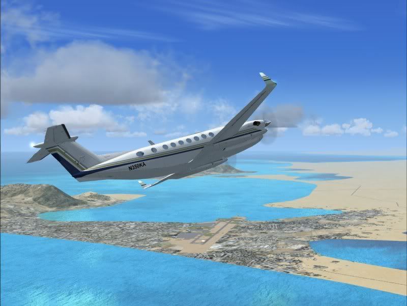
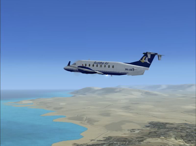
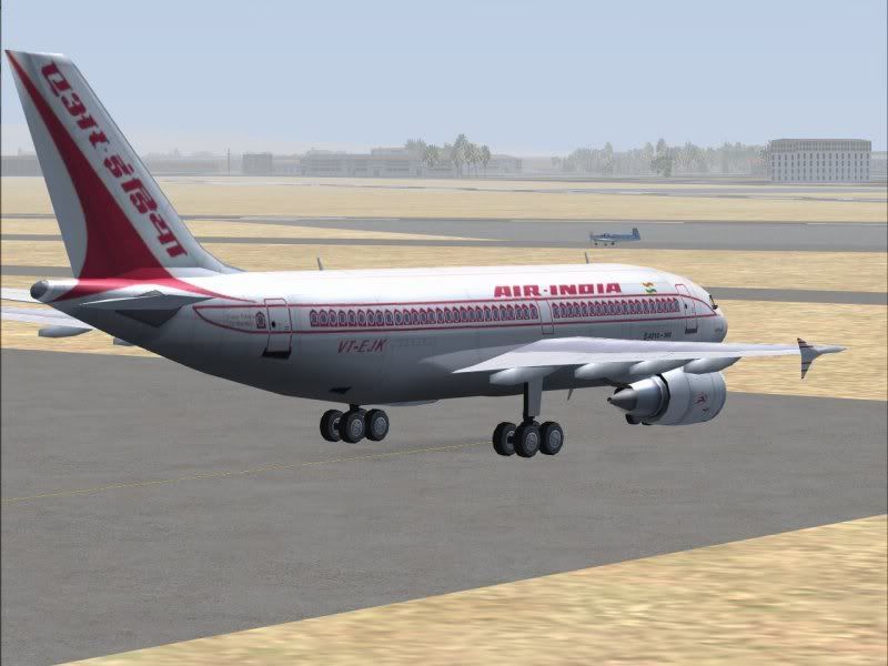
The original tour route (see map with leg 18 ) basically follows the coast around and up to Madras, but with Sri Lanka so close, it's a destination hard to resist...

user posted image
We're given clearance to depart from the intersection, saving us some time backtracking.

user posted image
Ahead we can see the city of Nagercoil, on the Southern tip of India

user posted image
This is it: Kanyakumari. As far South as we can get in India!

user posted image
The confluence of three seas: The Arabian Sea, the Bay of Bengal and the Indian Ocean.

user posted image
That's a lot of sea!

user posted image
Fortunately we're not troubled with the view for long, as a storm brews up and we have to concentrate on keeping down breakfast!

user posted image
Calm air again, and now there's just the Negombo lagoon between us an the airport.

user posted image
Short final. Notice the railway line just this side of the 04 threshold.
"Kilo Papa Go around". Blast!!!

user posted image
This is take two. We are going to land! It's not a matter of fuel - we have plenty - it's just that after the rough crossing, we could sure use some fresh air...

user posted image
The ground contoller must have a sense of humour. Supposedly this is "GA Parking". Yeah, right!
G-HEVN
 

Postby Alex » Wed Jan 31, 2007 12:50 pm

Hahaha, great shots there, is that an Emirates A310 at the end there? :D

Alex
Alex
NZFF Pro
 
Joined: Fri Jul 14, 2006 3:39 pm
Posts: 3620

PreviousNext

Return to Flights

Who is online

Users browsing this forum: No registered users and 0 guests