victor_alpha_charlie wrote:QUOTE (victor_alpha_charlie @ Oct 12 2011,6:48 PM) <{POST_SNAPBACK}>Loving this thread. Flew through to Pukaki from Christchurch today in a Piper Arrow and it looked very similar. VLC have got that part of NZ pretty spot on
Working on making even better , the little towns to help in NAV and VFR , just simply need time to paint and , Tim have given us the VLCcanvas .
Trolly's VLC Tour
39 posts
• Page 2 of 2 • 1, 2
![]() by Ian Warren » Wed Oct 12, 2011 6:18 pm
by Ian Warren » Wed Oct 12, 2011 6:18 pm

-

Ian Warren - NZFF Pro
- Joined: Fri May 05, 2006 5:23 pm
- Posts: 41187
- Location: AREA 51
![]() by ardypilot » Thu Oct 13, 2011 3:01 pm
by ardypilot » Thu Oct 13, 2011 3:01 pm
Leg 9
Leg Distance: 218nm, Leg Time: 1:20
Total Distance: 1463nm, Total Time: 10:31
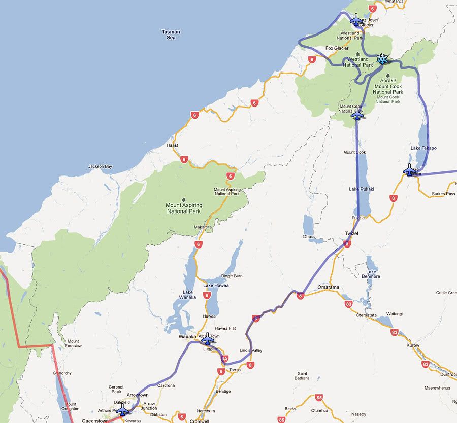
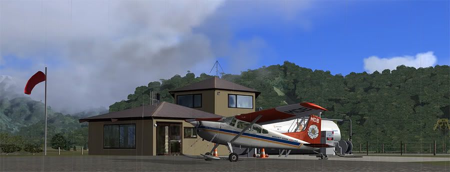
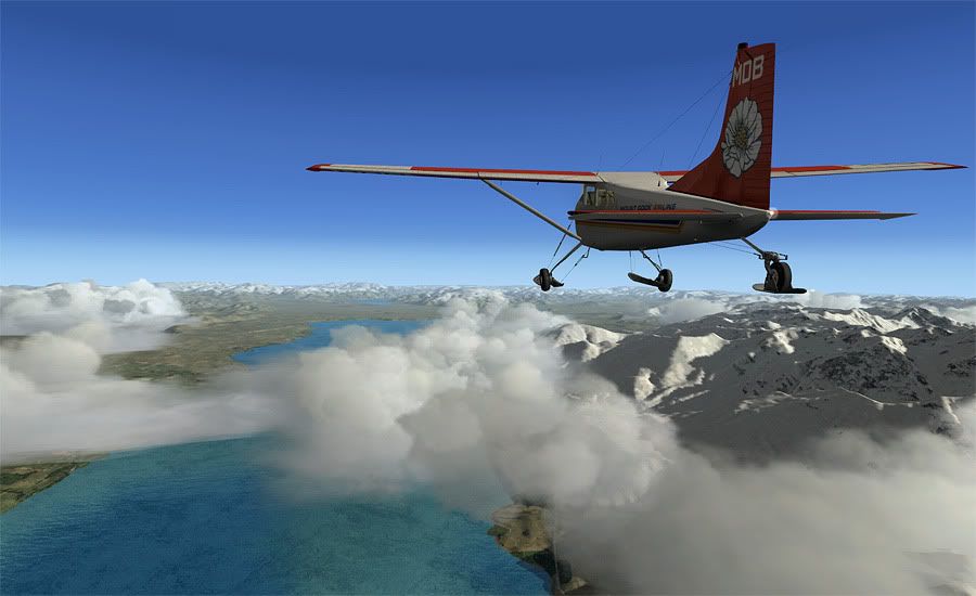
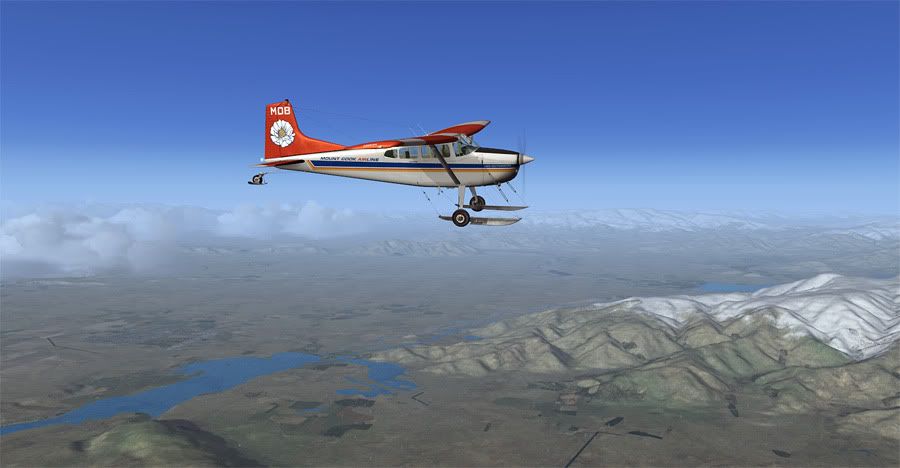
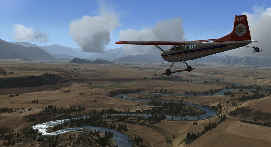
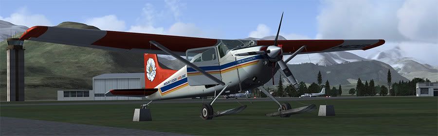
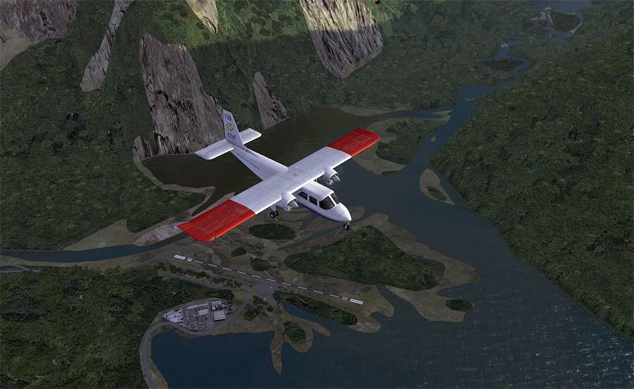
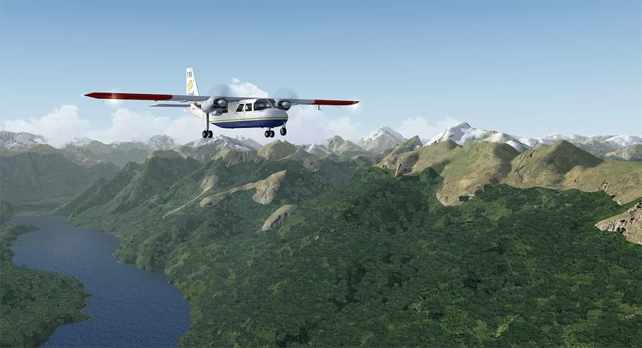
Whilst overnighting at Franz Joseph, I'd managed to convince my contact at Mount Cook Airline to let my fly ole Mike Delta Bravo down as far as Queenstown, as long as someone could ferry her back up to NZMC afterwards. A few phone calls had everything confirmed, and the next afternoon, I was back at the aerodrome filling the tanks.
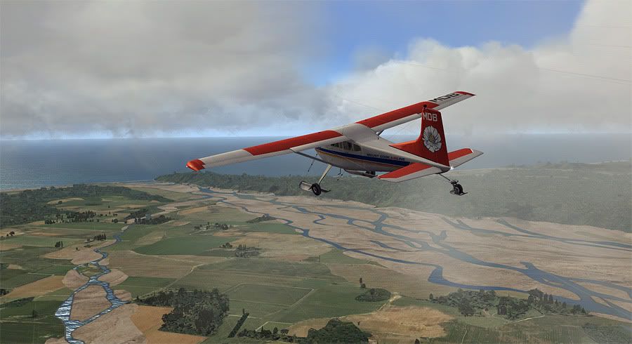
Typical drizzly West Coast weather had made an appearance today, although forecasts on the other side of the mountains sounded more favourable. I gassed up the Skywagon, and departed the small seal strip straight out towards the Tasman Sea from runway 28.
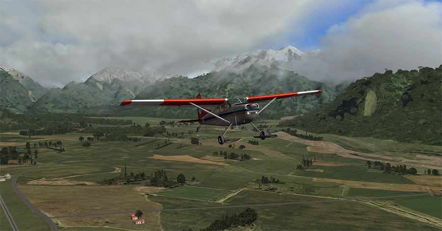
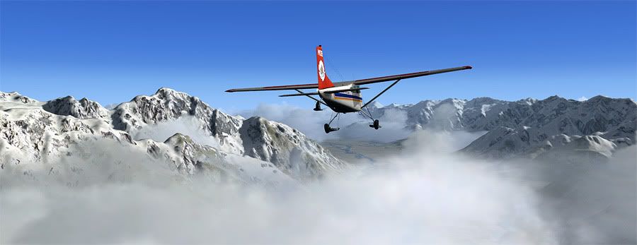
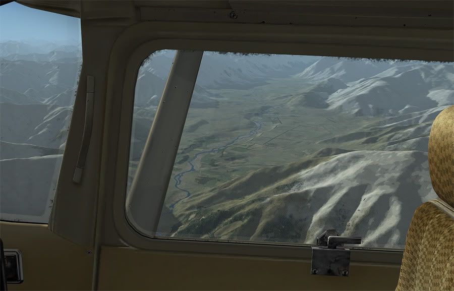
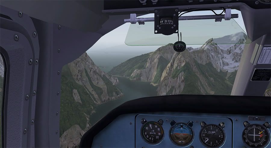
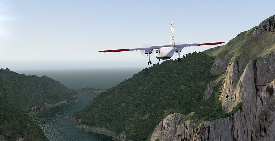
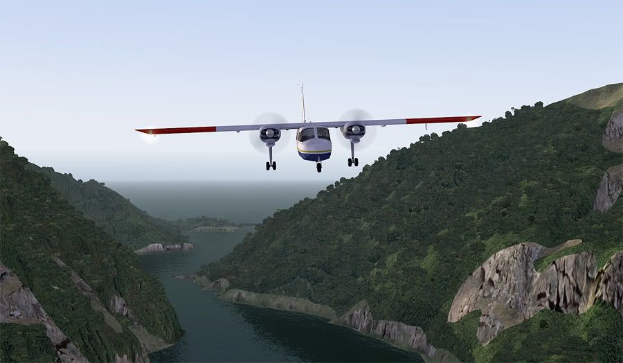
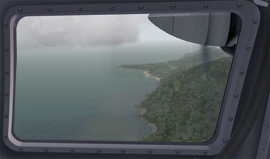
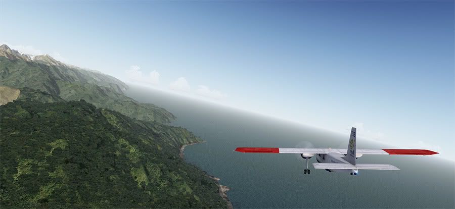
The scattered cloud base kept me below 1800 feet as I tracked south, following the coast, looking for the mouth of the Cook River that I'd follow inland to the foot of the Fox Glacier, just 20 miles away from NZFJ.
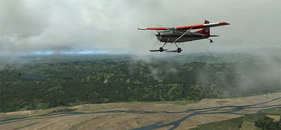
I shortly found the river, and banked to the left, following it into a gorge which I believed would soon give way to the icy foot of the glacier. However, when it didn't appear as I'd expected, I realised I must have mistakenly been following a tangent tributary- which I confirmed with my VNC map and made a hasty decision to fly up an unfamiliar bush clad valley which I hoped would pop me out right above the snowline to Fox.
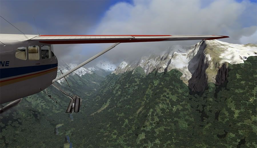
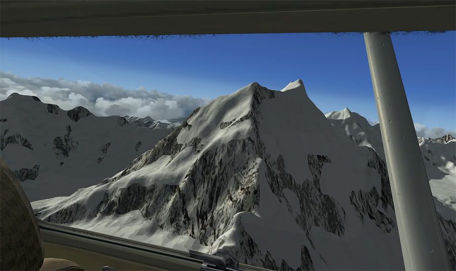
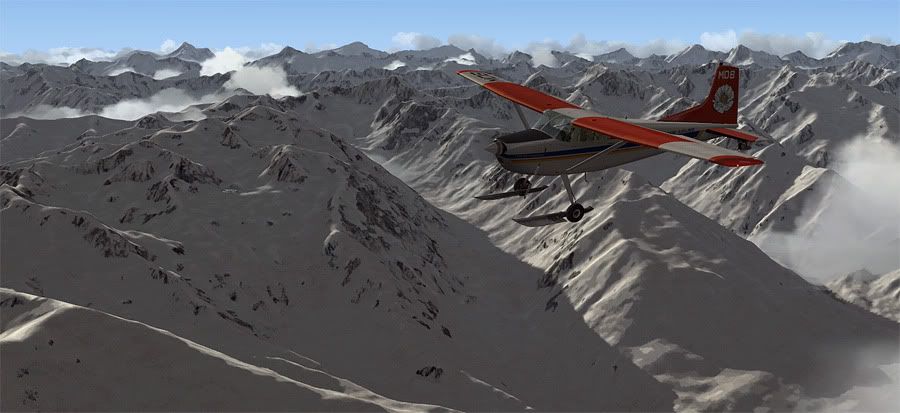
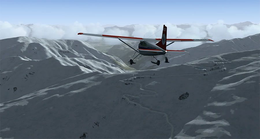
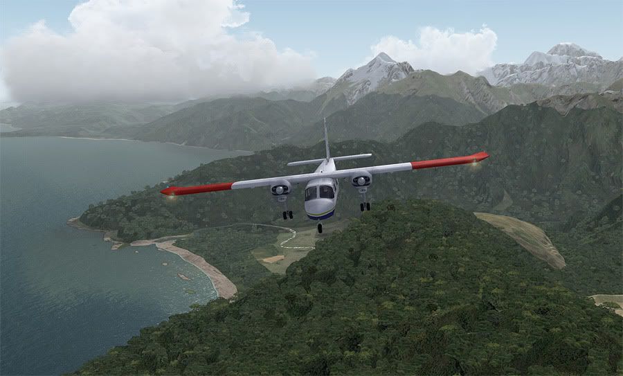
This meant having to power through the cloud as I followed the uphill gradient, a big no-no in real life, but an interesting test of my navigating skills in the sim. It turns out I was right about my error, and the valley detour positioned me out midway up the glacier. At this stage I was only at 6500 feet, so I continued climbing up to 11,000 feet, which I'd need to be at to cross the peaks of the Southern Alps.
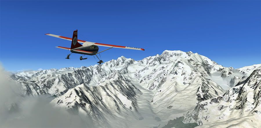
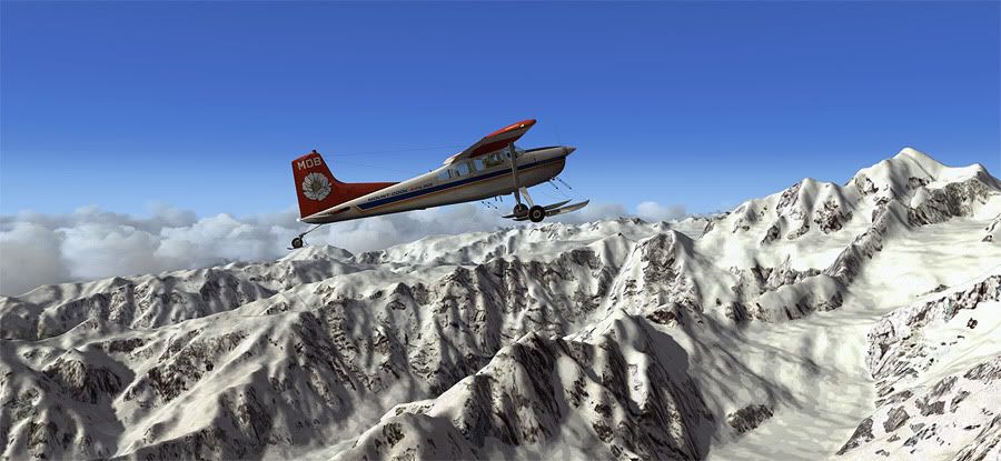
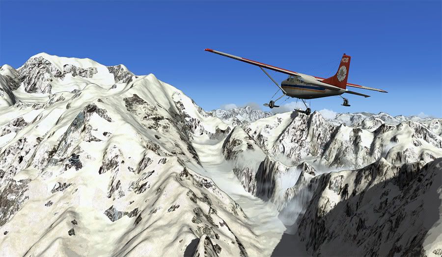
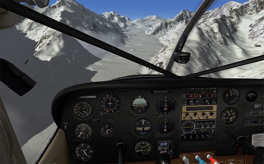
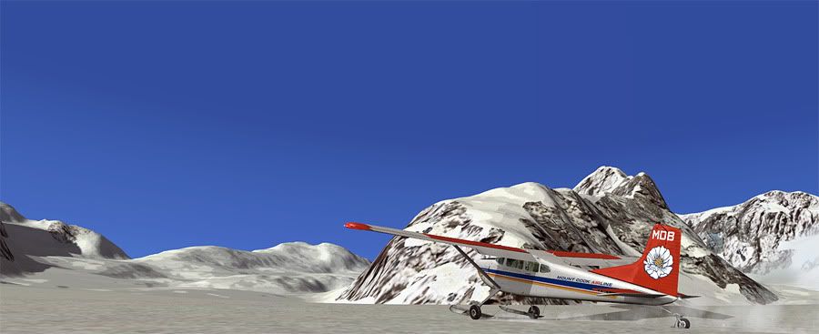
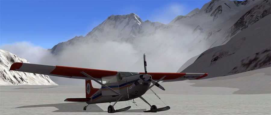
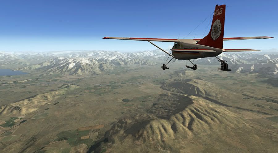
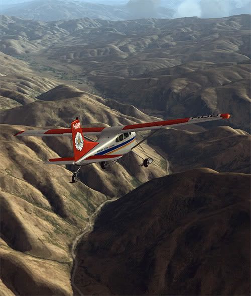
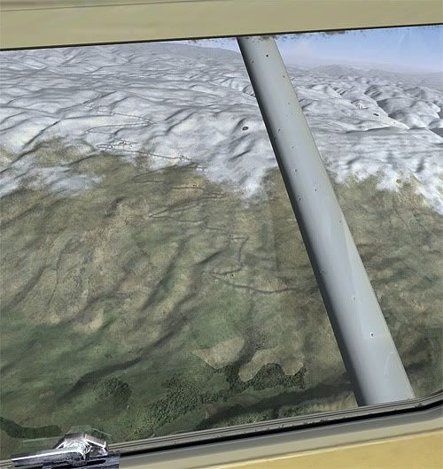
I passed Mount Cook on my port side, and began a power off descent along its eastern face, facing north towards Tasman Glacier. MBD is fitted with skis and usually earns its keep running tourists up from nearby Mount Cook Village for snow landings up on the glaciers. Today it was my turn to experience this.
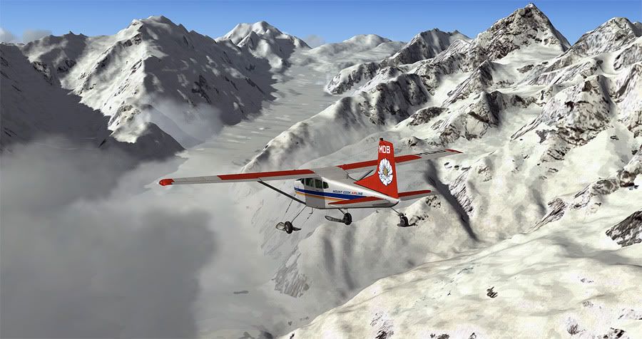
Flaring was a odd experience coming into land on a large white sloping up hill surface, but I made it down in once piece. After shutting the engine down and exploring the powder quickly, I jumped back aboard and swung the 185 180 degrees to face down the valley for a gravity assisted takeoff.
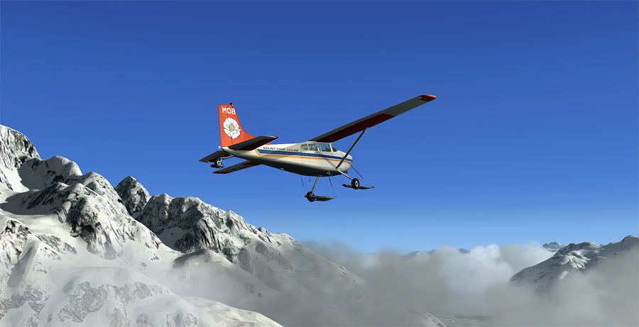
Cloud was still relatively thick in the upper reaches of the valley, so whilst sticking close to the recognisable mountain edges, I opted to fly overhead the Mount Cook home base airfield rather than making a touch and go landing.
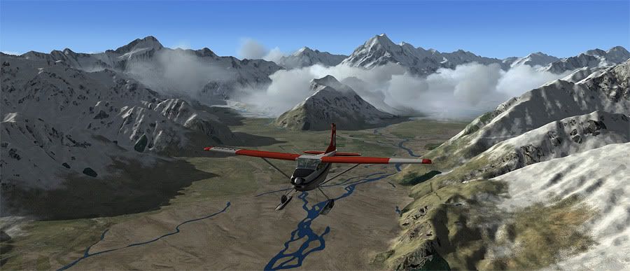
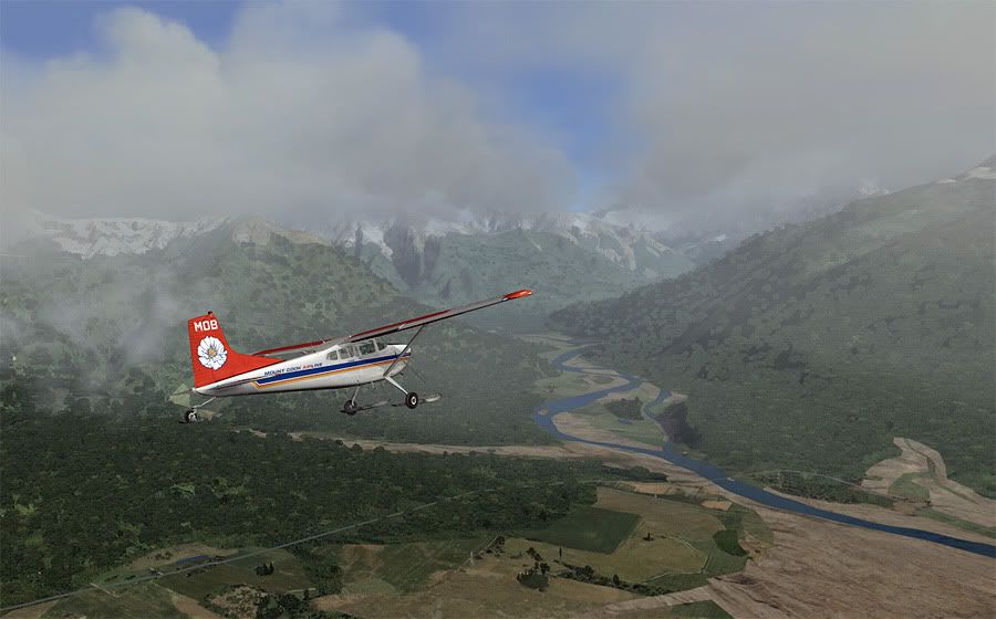
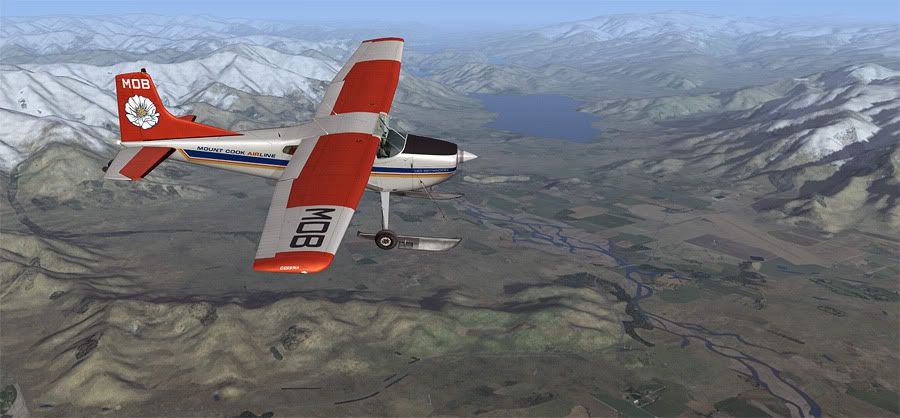
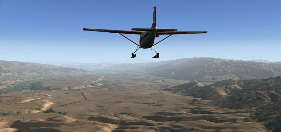
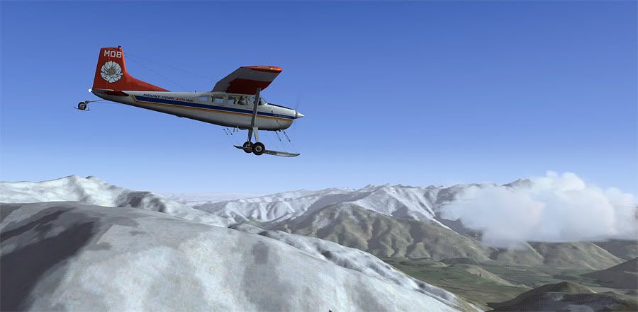
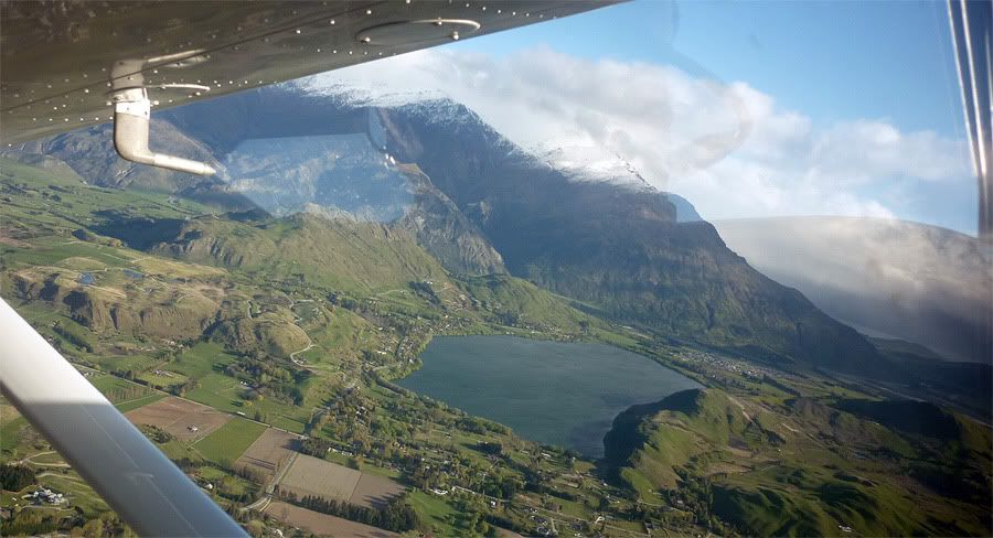
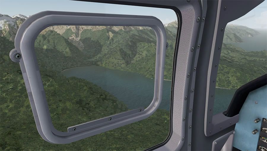
I was now pointing due South, tracking along Lake Pukaki that runs parallel to Lake Tekapo, heading into the Makenzie Basin where the CUs were thankfully dissipating.
The broad expanse of the plateau was looking picturesque in the mid afternoon light as I reached the bottom of the lake, and turned south west to follow the State Highway 8 from Twizel township to Wanaka.
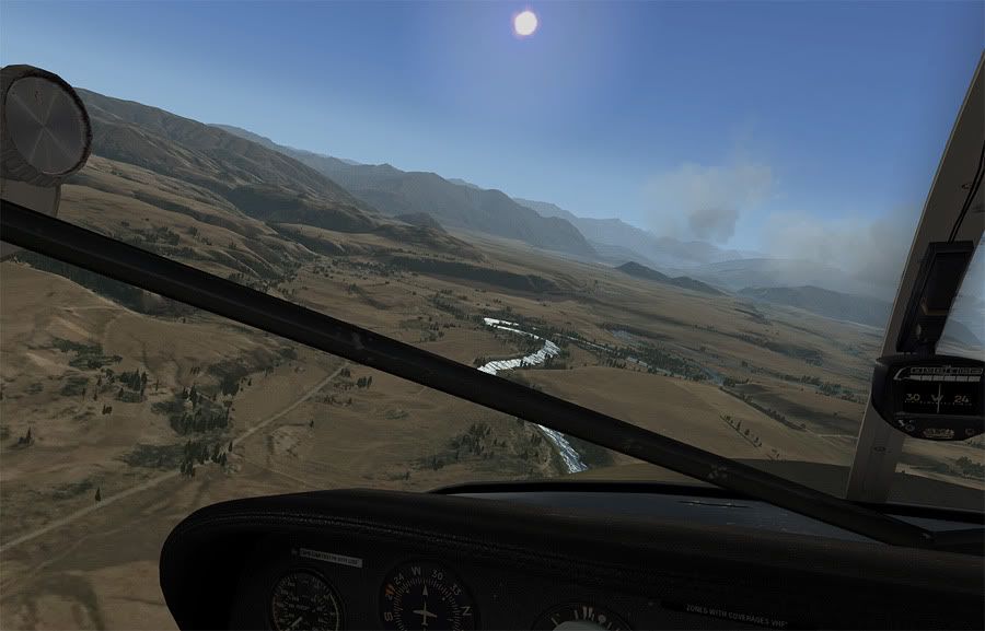
Purring along at 140 knots, I passed Omarama on my right, once home of the World Gliding Championships whilst following the road below me. As the Ahuriri River branched off to my right hand side, I descended a little to be able to clearly pick out the Lindis Pass that would lead me through to my next destination.
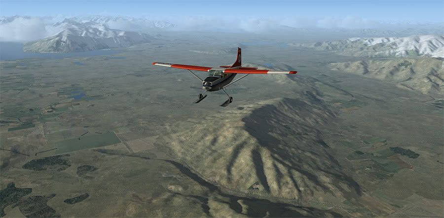
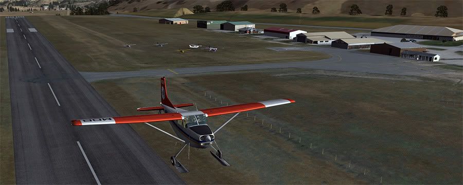
Once through the gorge, the large dry brown valleys of Central Otago opened up below. From here it was an easy interception of the Clutha River that would lead me all the way west to the base leg of Wanaka aerodromes circuit.
Wanaka is famous for its large bi-annual Easter airshow, and in the spirit of this, I made a low highspeed flapless approach for runway 29, buzzing the resident aircraft who'd all parked up for the day.
The NZWF runway elevation was 1142 feet, yet I needed to be at least at 5500 feet to cross the Cardrona Saddle into Queenstown- the final stop for today. This required a gentle bank left, full power as I followed the Cardrona River around the hillscape next to the aerodrome.
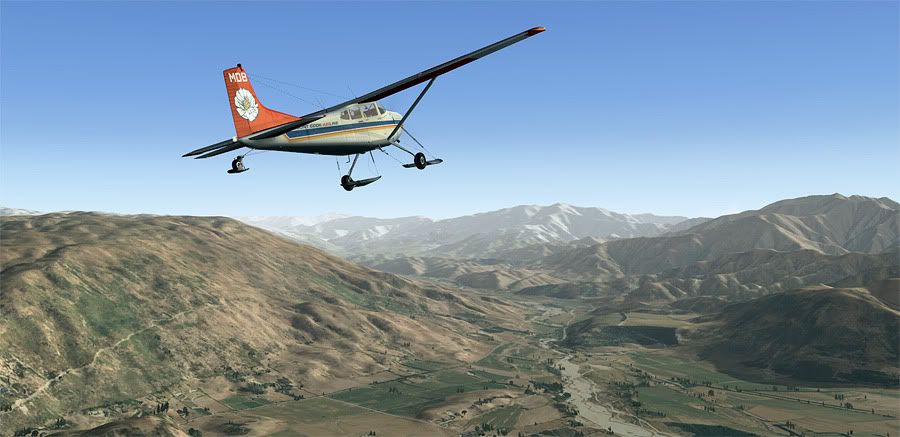
The mountain and lake views out the window were as stunning as I remembered them from flying along the same route last October in a C172. (Slideshow of photos here). Crossing over the Cadrona Saddle is the standard VFR arrival from the North, using the Race to the Sky hillclimb road to the Snow Farm Skifield on the eastern side of the valley as a visual cue for when to bank right for the ridge itself.
Over across the saddle, it was time for an immediate descent as per instruction from NZQN tower. I crossed Arrowtown and Lake Hayes VRPs for a straight in final approach for runway 23 at Queenstown, properly one of the most stunning airports in the world.
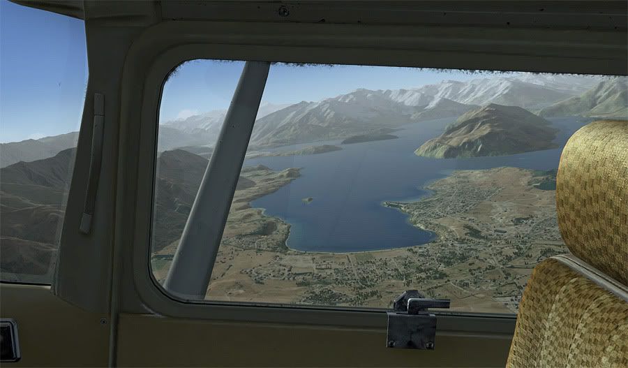
However, with no good scenery addons for Queenstown airport itself yet released, I didn't feel my sim setup did the area justice. Instead, here's a photo caught at a similar time of day from my back seat passenger of Lake Hayes, whilst turning onto final approach in the real world.
I see if I can tweak my environmental settings to get the area looking a little better for my next leg- not far to go now!
No new addons used in this leg- The Wanaka area photoreal is part of the REAL NZ 'Southern Lakes Adventure' download.
Leg Distance: 218nm, Leg Time: 1:20
Total Distance: 1463nm, Total Time: 10:31
Whilst overnighting at Franz Joseph, I'd managed to convince my contact at Mount Cook Airline to let my fly ole Mike Delta Bravo down as far as Queenstown, as long as someone could ferry her back up to NZMC afterwards. A few phone calls had everything confirmed, and the next afternoon, I was back at the aerodrome filling the tanks.
Typical drizzly West Coast weather had made an appearance today, although forecasts on the other side of the mountains sounded more favourable. I gassed up the Skywagon, and departed the small seal strip straight out towards the Tasman Sea from runway 28.
The scattered cloud base kept me below 1800 feet as I tracked south, following the coast, looking for the mouth of the Cook River that I'd follow inland to the foot of the Fox Glacier, just 20 miles away from NZFJ.
I shortly found the river, and banked to the left, following it into a gorge which I believed would soon give way to the icy foot of the glacier. However, when it didn't appear as I'd expected, I realised I must have mistakenly been following a tangent tributary- which I confirmed with my VNC map and made a hasty decision to fly up an unfamiliar bush clad valley which I hoped would pop me out right above the snowline to Fox.
This meant having to power through the cloud as I followed the uphill gradient, a big no-no in real life, but an interesting test of my navigating skills in the sim. It turns out I was right about my error, and the valley detour positioned me out midway up the glacier. At this stage I was only at 6500 feet, so I continued climbing up to 11,000 feet, which I'd need to be at to cross the peaks of the Southern Alps.
I passed Mount Cook on my port side, and began a power off descent along its eastern face, facing north towards Tasman Glacier. MBD is fitted with skis and usually earns its keep running tourists up from nearby Mount Cook Village for snow landings up on the glaciers. Today it was my turn to experience this.
Flaring was a odd experience coming into land on a large white sloping up hill surface, but I made it down in once piece. After shutting the engine down and exploring the powder quickly, I jumped back aboard and swung the 185 180 degrees to face down the valley for a gravity assisted takeoff.
Cloud was still relatively thick in the upper reaches of the valley, so whilst sticking close to the recognisable mountain edges, I opted to fly overhead the Mount Cook home base airfield rather than making a touch and go landing.
I was now pointing due South, tracking along Lake Pukaki that runs parallel to Lake Tekapo, heading into the Makenzie Basin where the CUs were thankfully dissipating.
The broad expanse of the plateau was looking picturesque in the mid afternoon light as I reached the bottom of the lake, and turned south west to follow the State Highway 8 from Twizel township to Wanaka.
Purring along at 140 knots, I passed Omarama on my right, once home of the World Gliding Championships whilst following the road below me. As the Ahuriri River branched off to my right hand side, I descended a little to be able to clearly pick out the Lindis Pass that would lead me through to my next destination.
Once through the gorge, the large dry brown valleys of Central Otago opened up below. From here it was an easy interception of the Clutha River that would lead me all the way west to the base leg of Wanaka aerodromes circuit.
Wanaka is famous for its large bi-annual Easter airshow, and in the spirit of this, I made a low highspeed flapless approach for runway 29, buzzing the resident aircraft who'd all parked up for the day.
The NZWF runway elevation was 1142 feet, yet I needed to be at least at 5500 feet to cross the Cardrona Saddle into Queenstown- the final stop for today. This required a gentle bank left, full power as I followed the Cardrona River around the hillscape next to the aerodrome.
The mountain and lake views out the window were as stunning as I remembered them from flying along the same route last October in a C172. (Slideshow of photos here). Crossing over the Cadrona Saddle is the standard VFR arrival from the North, using the Race to the Sky hillclimb road to the Snow Farm Skifield on the eastern side of the valley as a visual cue for when to bank right for the ridge itself.
Over across the saddle, it was time for an immediate descent as per instruction from NZQN tower. I crossed Arrowtown and Lake Hayes VRPs for a straight in final approach for runway 23 at Queenstown, properly one of the most stunning airports in the world.
However, with no good scenery addons for Queenstown airport itself yet released, I didn't feel my sim setup did the area justice. Instead, here's a photo caught at a similar time of day from my back seat passenger of Lake Hayes, whilst turning onto final approach in the real world.
I see if I can tweak my environmental settings to get the area looking a little better for my next leg- not far to go now!
No new addons used in this leg- The Wanaka area photoreal is part of the REAL NZ 'Southern Lakes Adventure' download.
QUOTE
Loving this thread. Flew through to Pukaki from Christchurch today in a Piper Arrow and it looked very similar. VLC have got that part of NZ pretty spot on  [/quote]
Maybe in the future you could go a VLC vs South Island flying photos comparison thread and I could do one for the North Island?
[/quote]Maybe in the future you could go a VLC vs South Island flying photos comparison thread and I could do one for the North Island?
Last edited by ardypilot on Thu Oct 13, 2011 3:08 pm, edited 1 time in total.
-

ardypilot - NZFF Pro
- Topic author
- Joined: Wed Apr 26, 2006 10:01 am
- Posts: 6802
- Location: Auckland
![]() by Ian Warren » Thu Oct 13, 2011 3:55 pm
by Ian Warren » Thu Oct 13, 2011 3:55 pm
Trolly wrote:QUOTE (Trolly @ Oct 13 2011,4:01 PM) <{POST_SNAPBACK}>Maybe in the future you could go a VLC vs South Island flying photos comparison thread and I could do one for the North Island?
Be most highly recommend by all
-
Ian Warren - NZFF Pro
- Joined: Fri May 05, 2006 5:23 pm
- Posts: 41187
- Location: AREA 51
![]() by deeknow » Thu Oct 13, 2011 5:15 pm
by deeknow » Thu Oct 13, 2011 5:15 pm
Fan-tastico Trolly, awesome pics, and yarn
Deans repaints: http://www.deeknow.com/
X570 Mini-ITX m/b - Ryzen7 5700X3D (8c/16t) - RTX 2060-super - 32GB 3600MHz DDR4 - Win10 - P3Dv5.3
X570 Mini-ITX m/b - Ryzen7 5700X3D (8c/16t) - RTX 2060-super - 32GB 3600MHz DDR4 - Win10 - P3Dv5.3
-

deeknow - NZFF Pro
- Joined: Tue Sep 18, 2007 10:15 pm
- Posts: 4484
- Location: NZHN
![]() by victor_alpha_charlie » Thu Oct 13, 2011 6:20 pm
by victor_alpha_charlie » Thu Oct 13, 2011 6:20 pm
Trolly wrote:QUOTE (Trolly @ Oct 13 2011,4:01 PM) <{POST_SNAPBACK}>Maybe in the future you could go a VLC vs South Island flying photos comparison thread and I could do one for the North Island?
Gotta buy it first, looks awesome but being a poor student things are tight at the mo
-

victor_alpha_charlie - NZFF Pro
- Joined: Wed Jan 10, 2007 11:09 am
- Posts: 2372
![]() by ardypilot » Wed Oct 26, 2011 7:38 pm
by ardypilot » Wed Oct 26, 2011 7:38 pm
Leg 10
Leg Distance: 75nm, Leg Time: 0.38
Total Distance: 1538nm, Total Time: 11:09
Sorry for the delay between legs readers- some decent wx in the real world has seen me spending less time at the computer over the last two weeks! When I left off, you may remember me moaning about how I wasn't satisfied with the level of detail around NZQN in the sim- since then, I have attempted to build my own AFCAD for FSX, then in turn, found a better version from another member, and also purchased and installed REX 2. The textures that come with this are amazing. In fact I feel as though I should really start my whole tour again now my sim is running with the hi-def weather as it really does breathe a whole new lease of life into the visuals! Anyhow, on with the flight...
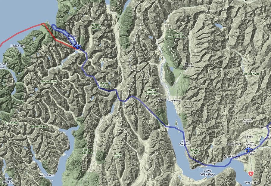
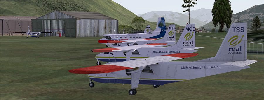
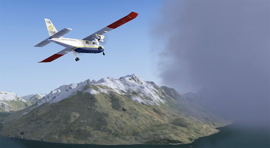
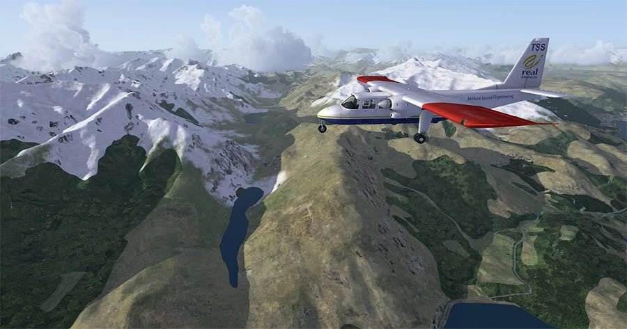
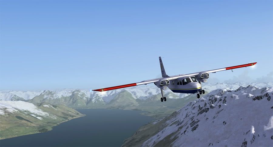
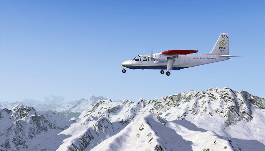
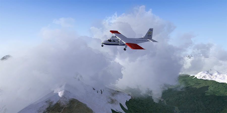
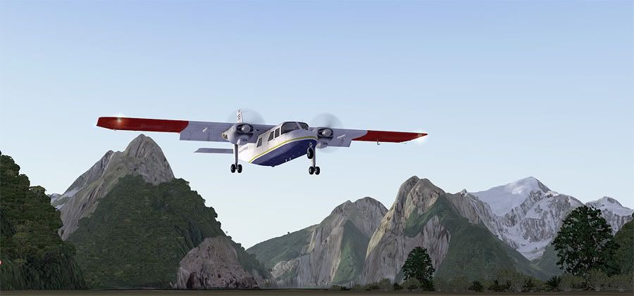
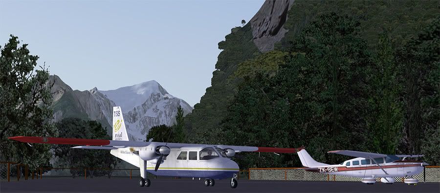
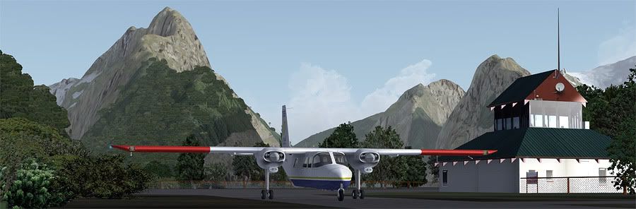
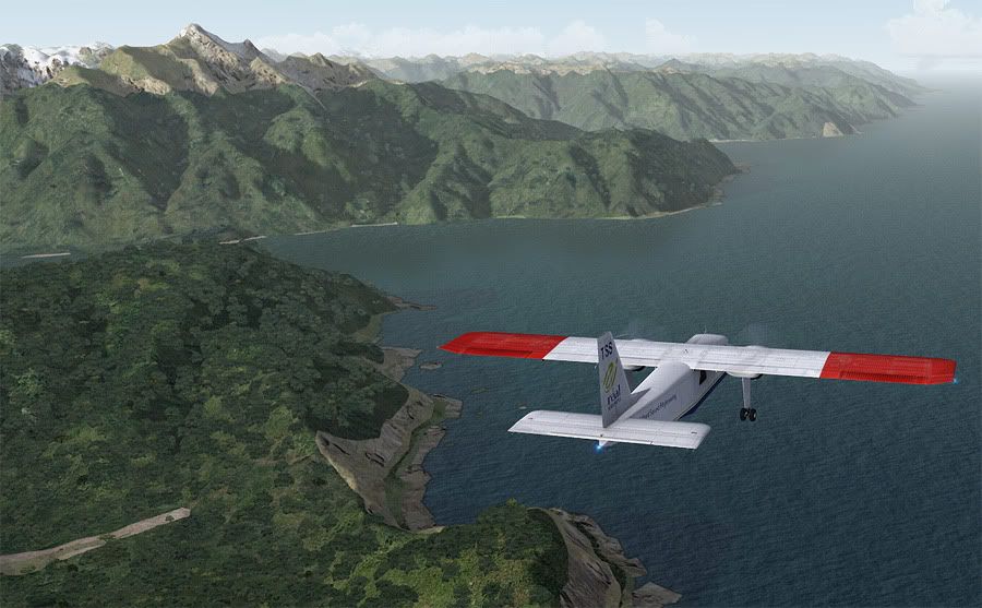
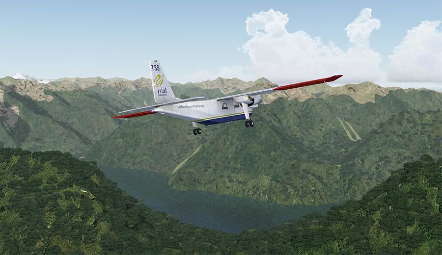
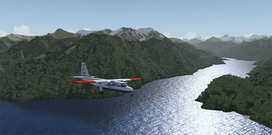
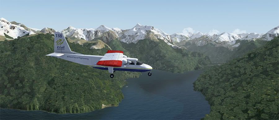
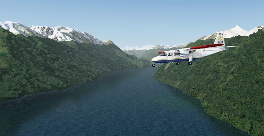
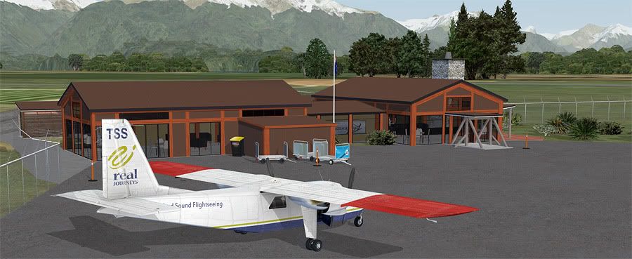
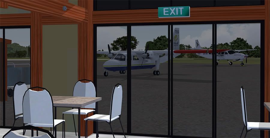
Whilst on the ground at Queenstown, I'd noticed the 'Real Journeys Milford Sound Flightseeing' company had a large fleet of Britten-Norman BN2A Islander aircraft based at the airport. This aircraft type is a common operator to the more remote strips throughout the country, and fly overhead my house in East Auckland hourly on the NZAA to Great Barrier Island route also. It had taken a few days persuasion, but finally I'd been able to get my type rating on the twin prop, and was now able to take it for a fly to NZMF, Milford Sound, under one condition.
Most of the flights between QN and MF were either early in the morning or mid afternoon, to meet the coach tours that complete the circuit back to Queenstown. These coach tours are about 5 hours each way, so many tourists opt to fly one way, and drive the other, meaning there are certain peak times at which NZMF becomes a very busy aerodrome. Late afternoon was not one of these times, and the condition of my flight from the operator was that I was to arrive no earlier than 1630 local, just to be clear of traffic at what is already a very tricky aerodrome to approach and land at to unfamiliar pilots.
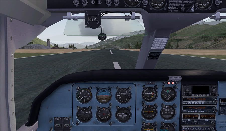
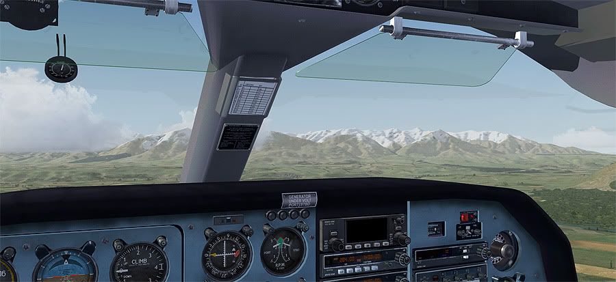
It was just after 4pm when I engaged the magnetos and got the two 300 hp Lycomings running. After receiving clearance to taxi, I made my from the scenic operator grass parking area towards the active runway, right in the shadow of the Remarkable Ranges.
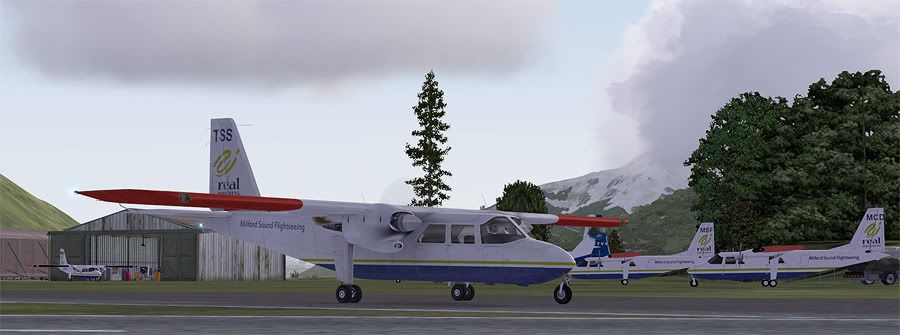
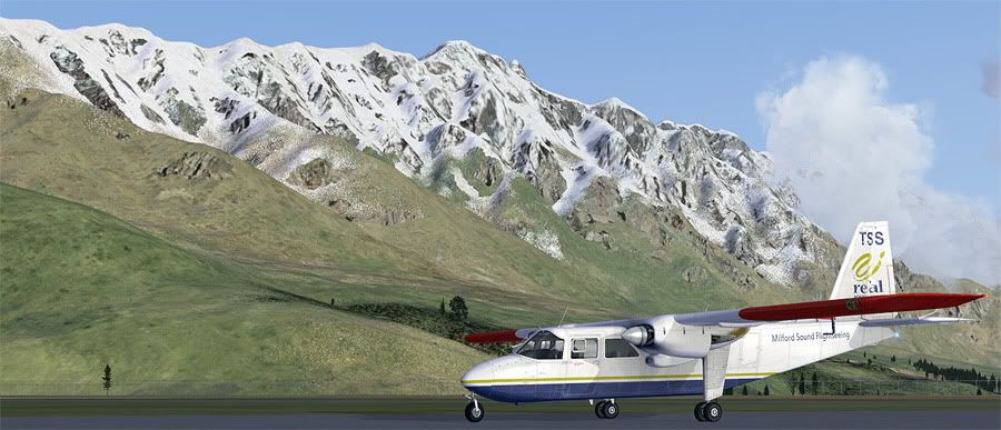
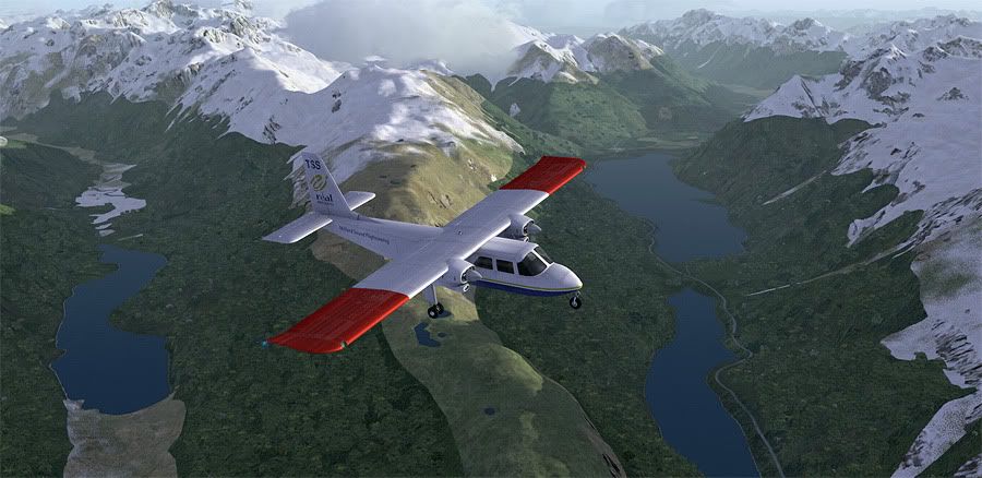
A steady crosswind was blowing across the active, but nothing the Islander couldn't handle. I was soon up and away from runway 23, retracting flaps at 200' AGL and climbing straight out above mighty Lake Wakatipu.
Queenstown central appeared out my righthand windows, nestled underneath a small patch of CU cloud. To remain visual, I banked left, crossing the lake to its southern side and continued a climb up towards 6500 feet.
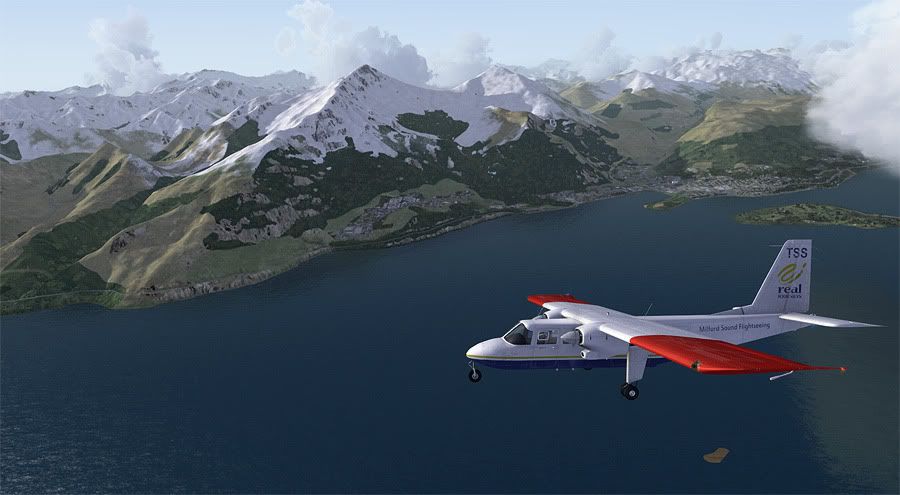
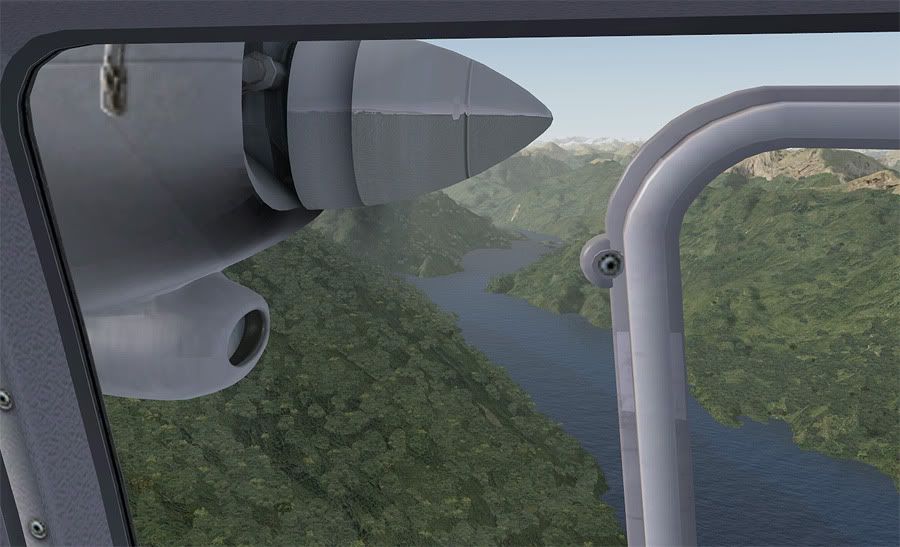
I'd flown down to Queenstown in the real world this time last year for a mountain flying course and built a few hours operating in the ranges directly to the left of my flight path. The VLC scenery addon has recreated these spot on- and I was able to pick out individual mountains that I'd flown around, and even Mount Nicholas Station where I'd practised a simulated forced landing.
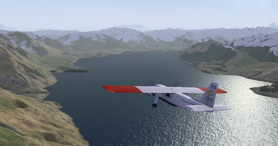
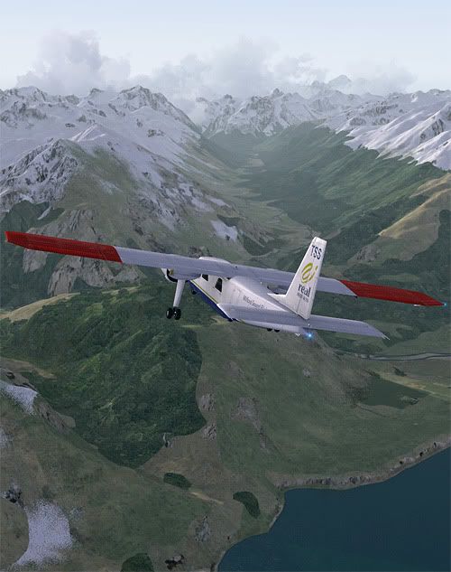
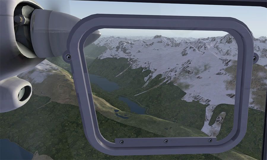
To keep this flight as realistic as possible, I'd followed the scenic flight path between Queenstown and Milford as prescribed on the Air Wakatipu website. Once clear of the cloud over the township, I navigated my way back to the northern side of the main lake, to fly past smaller 'Moke Lake', visible out my right hand window.
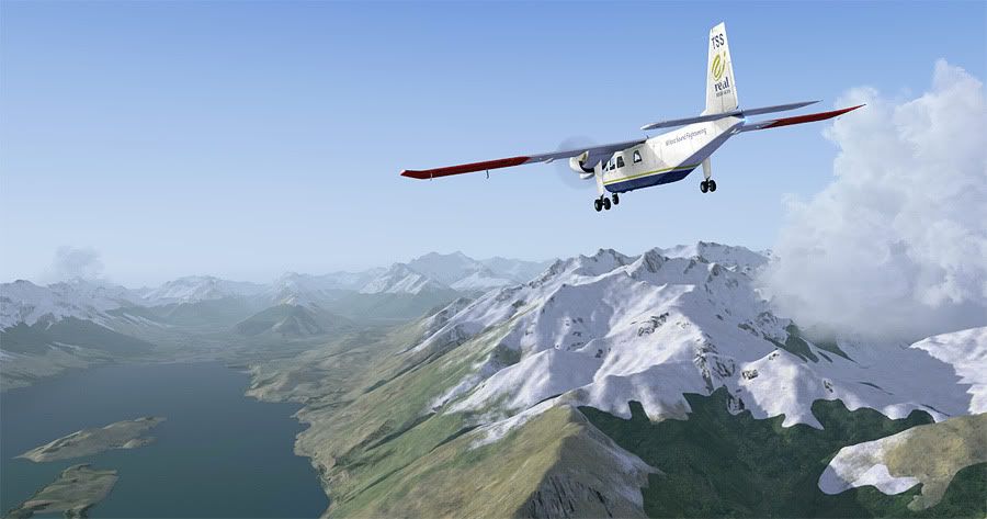
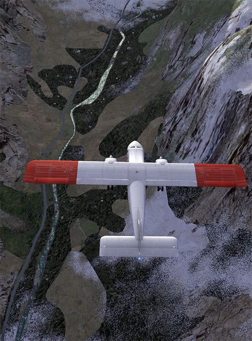
From this position, Lake Wakatipu makes a large 90 degree bend up to meet the mouth of the Dart River. I followed this shoreline up towards Pig and Pigeon Islands before banking west over the water to the Caples Valley entrance. Views out to the right were great again, and I was able to pick out the pyramid shaped Mount Alfred nearby the town of Glenorchy, from where my girlfriend and I had taken a horse trek down to the lake edge on another holiday in late 2011.
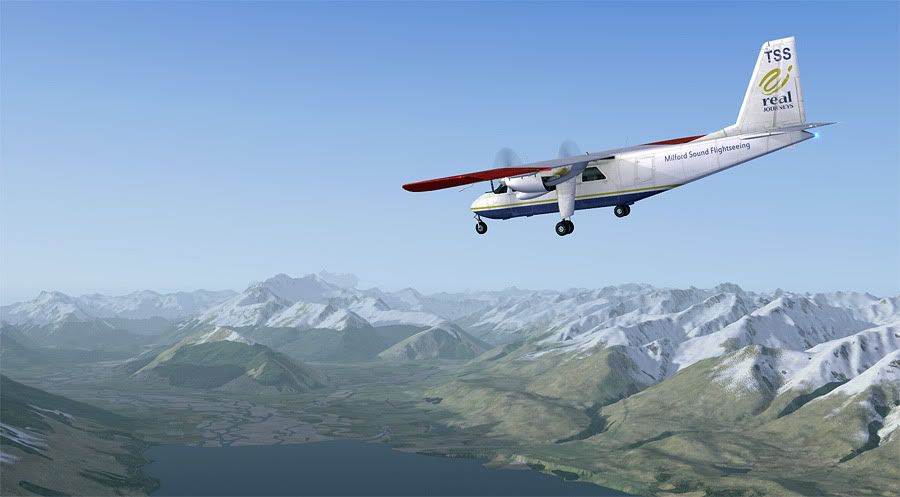
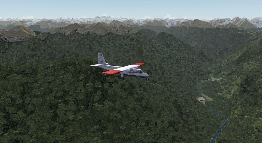
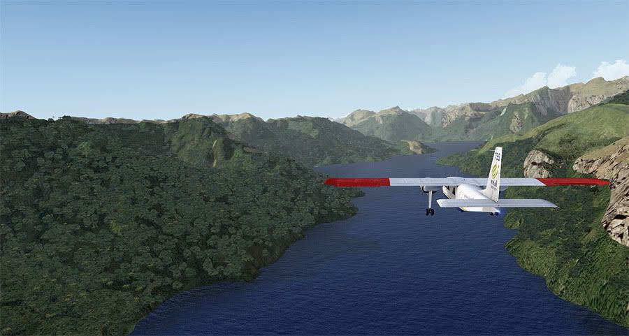
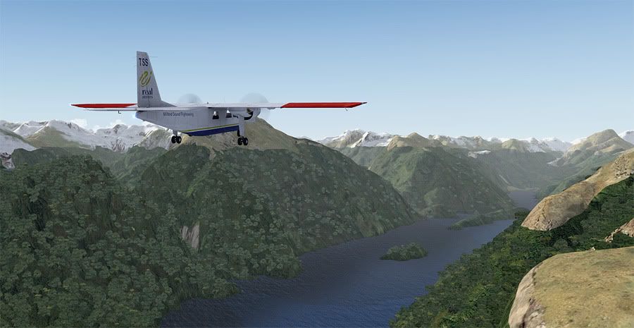
I was now the only aircraft on the area frequency and loving the late afternoon atmosphere. The valley wasn't a long one, but it's far end saddle marked the transition from Otago regional to the 12,500 km² Fiordland National Park.
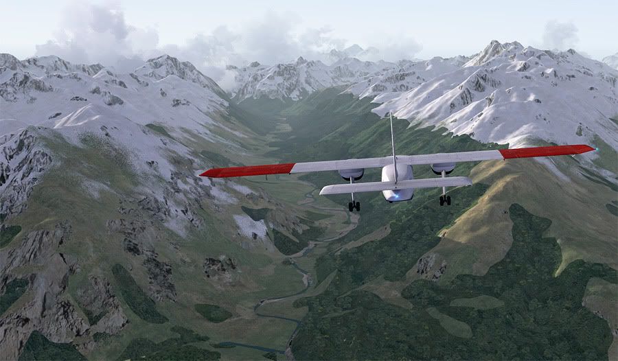
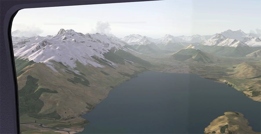
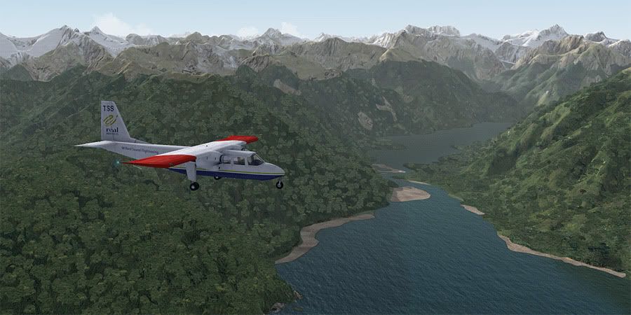
Below my aircraft, the rainforest rose right up the steep mountain slopes to meet the snowline, a very unique area of the world. As I navigated along the jagged white ridges, I knew that soon the twin water bodies of Lake Gunn and Lake Fegis would appear, and from there I'd be able to pick up State Highway 94 and follow it all the way to Milford airport.
I found the road easily, and banked to the east past a large cumulus build up sitting atop Mount Christina. The incline of the surrounding valley walls were incomprehensibly steep- something I'd witnessed myself first hand on a coach tour to the Sound on the above mentioned holiday.
All of a sudden, I lost sight of the road as it disappeared into the snow at eastern entrance to the Homer Tunnel. Nek minnit I was crossing over the Main Divide Saddle into the much lusher greenery of the Cleddau Valley, where I picked up the road again as it popped out the other side of the mountain, and followed it downhill towards the sea.
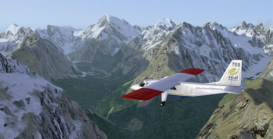
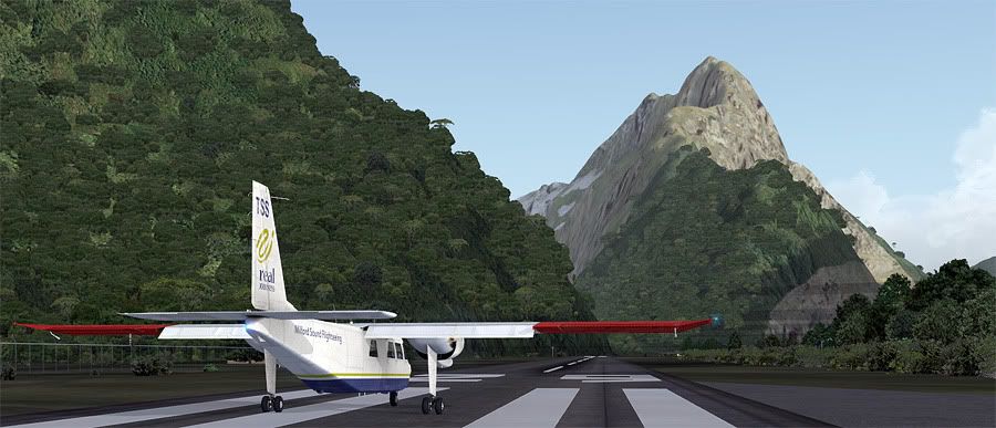
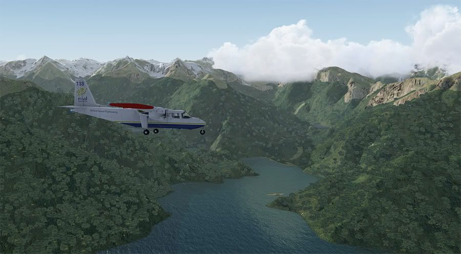
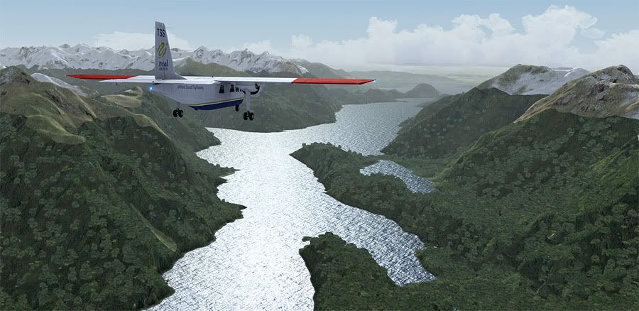
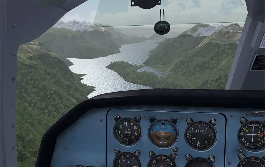
16km later, the postcard perfect landscape of Milford Sound came into view- famously quoted as being the 'eighth wonder of the world' by Rudyard Kipling.
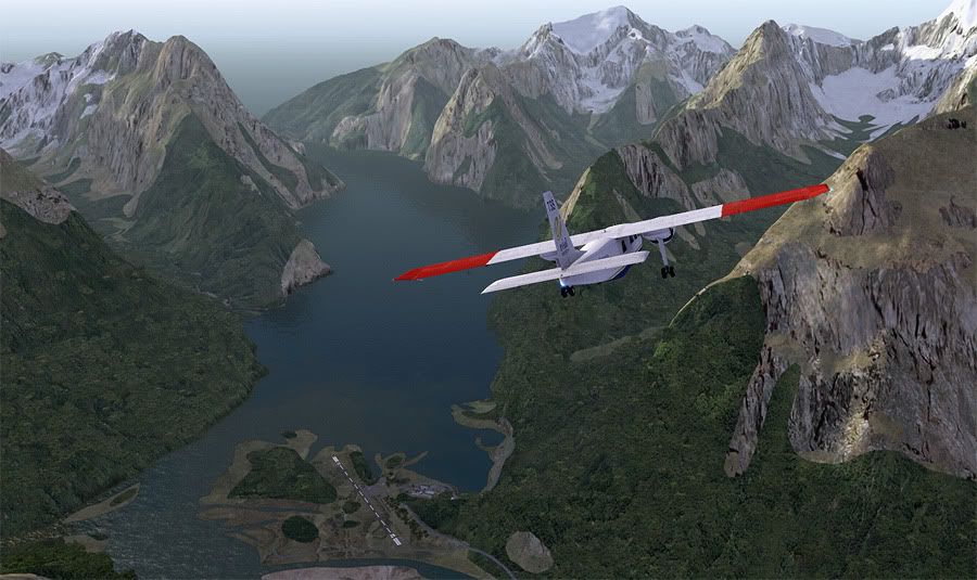
The airport is inconveniently situated at the inland end of the fiord, with the standard arrival procedure requiring a descent down to 3000 feet, then follow the northern edge of Sound, before executing a 180 degree turn at it's mouth and return back along the southern side for joining. The wind was light and I chose a straight in final leg for runway 29... I'll let the pictures do the talking:
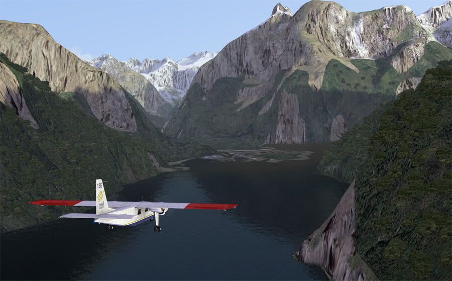
The dark shade of the fiord water really looked exactly as I remembered it from my 2010 visit, and made the whole approach feel very immersive. I look forward to exploring more of the giant national park in my final leg of this whole tour on my next flight!
The addons used in this leg (excluding the same addons from the previous legs above) were: Flight1 BN-2 Islander, Real Environment Xtreme v2, kcgb's NZQN AFCAD, and Jarred Yates' NZMF v3 scenery.
Leg Distance: 75nm, Leg Time: 0.38
Total Distance: 1538nm, Total Time: 11:09
Sorry for the delay between legs readers- some decent wx in the real world has seen me spending less time at the computer over the last two weeks! When I left off, you may remember me moaning about how I wasn't satisfied with the level of detail around NZQN in the sim- since then, I have attempted to build my own AFCAD for FSX, then in turn, found a better version from another member, and also purchased and installed REX 2. The textures that come with this are amazing. In fact I feel as though I should really start my whole tour again now my sim is running with the hi-def weather as it really does breathe a whole new lease of life into the visuals! Anyhow, on with the flight...
Whilst on the ground at Queenstown, I'd noticed the 'Real Journeys Milford Sound Flightseeing' company had a large fleet of Britten-Norman BN2A Islander aircraft based at the airport. This aircraft type is a common operator to the more remote strips throughout the country, and fly overhead my house in East Auckland hourly on the NZAA to Great Barrier Island route also. It had taken a few days persuasion, but finally I'd been able to get my type rating on the twin prop, and was now able to take it for a fly to NZMF, Milford Sound, under one condition.
Most of the flights between QN and MF were either early in the morning or mid afternoon, to meet the coach tours that complete the circuit back to Queenstown. These coach tours are about 5 hours each way, so many tourists opt to fly one way, and drive the other, meaning there are certain peak times at which NZMF becomes a very busy aerodrome. Late afternoon was not one of these times, and the condition of my flight from the operator was that I was to arrive no earlier than 1630 local, just to be clear of traffic at what is already a very tricky aerodrome to approach and land at to unfamiliar pilots.
It was just after 4pm when I engaged the magnetos and got the two 300 hp Lycomings running. After receiving clearance to taxi, I made my from the scenic operator grass parking area towards the active runway, right in the shadow of the Remarkable Ranges.
A steady crosswind was blowing across the active, but nothing the Islander couldn't handle. I was soon up and away from runway 23, retracting flaps at 200' AGL and climbing straight out above mighty Lake Wakatipu.
Queenstown central appeared out my righthand windows, nestled underneath a small patch of CU cloud. To remain visual, I banked left, crossing the lake to its southern side and continued a climb up towards 6500 feet.
I'd flown down to Queenstown in the real world this time last year for a mountain flying course and built a few hours operating in the ranges directly to the left of my flight path. The VLC scenery addon has recreated these spot on- and I was able to pick out individual mountains that I'd flown around, and even Mount Nicholas Station where I'd practised a simulated forced landing.
To keep this flight as realistic as possible, I'd followed the scenic flight path between Queenstown and Milford as prescribed on the Air Wakatipu website. Once clear of the cloud over the township, I navigated my way back to the northern side of the main lake, to fly past smaller 'Moke Lake', visible out my right hand window.
From this position, Lake Wakatipu makes a large 90 degree bend up to meet the mouth of the Dart River. I followed this shoreline up towards Pig and Pigeon Islands before banking west over the water to the Caples Valley entrance. Views out to the right were great again, and I was able to pick out the pyramid shaped Mount Alfred nearby the town of Glenorchy, from where my girlfriend and I had taken a horse trek down to the lake edge on another holiday in late 2011.
I was now the only aircraft on the area frequency and loving the late afternoon atmosphere. The valley wasn't a long one, but it's far end saddle marked the transition from Otago regional to the 12,500 km² Fiordland National Park.
Below my aircraft, the rainforest rose right up the steep mountain slopes to meet the snowline, a very unique area of the world. As I navigated along the jagged white ridges, I knew that soon the twin water bodies of Lake Gunn and Lake Fegis would appear, and from there I'd be able to pick up State Highway 94 and follow it all the way to Milford airport.
I found the road easily, and banked to the east past a large cumulus build up sitting atop Mount Christina. The incline of the surrounding valley walls were incomprehensibly steep- something I'd witnessed myself first hand on a coach tour to the Sound on the above mentioned holiday.
All of a sudden, I lost sight of the road as it disappeared into the snow at eastern entrance to the Homer Tunnel. Nek minnit I was crossing over the Main Divide Saddle into the much lusher greenery of the Cleddau Valley, where I picked up the road again as it popped out the other side of the mountain, and followed it downhill towards the sea.
16km later, the postcard perfect landscape of Milford Sound came into view- famously quoted as being the 'eighth wonder of the world' by Rudyard Kipling.
The airport is inconveniently situated at the inland end of the fiord, with the standard arrival procedure requiring a descent down to 3000 feet, then follow the northern edge of Sound, before executing a 180 degree turn at it's mouth and return back along the southern side for joining. The wind was light and I chose a straight in final leg for runway 29... I'll let the pictures do the talking:
The dark shade of the fiord water really looked exactly as I remembered it from my 2010 visit, and made the whole approach feel very immersive. I look forward to exploring more of the giant national park in my final leg of this whole tour on my next flight!
The addons used in this leg (excluding the same addons from the previous legs above) were: Flight1 BN-2 Islander, Real Environment Xtreme v2, kcgb's NZQN AFCAD, and Jarred Yates' NZMF v3 scenery.
QUOTE
Is that still the default Shade preset?[/quote]
Still is- it's working great for me!
Still is- it's working great for me!
Last edited by ardypilot on Thu Oct 27, 2011 12:50 pm, edited 1 time in total.
-
ardypilot - NZFF Pro
- Topic author
- Joined: Wed Apr 26, 2006 10:01 am
- Posts: 6802
- Location: Auckland


![]() by Naki » Thu Oct 27, 2011 7:21 am
by Naki » Thu Oct 27, 2011 7:21 am
Ian Warren wrote:QUOTE (Ian Warren @ Oct 27 2011,12:13 AM) <{POST_SNAPBACK}>GREAT VLC Flying .. Whoops VFR Flying
I say...the Islander look great too
-

Naki - NZFF Pro
- Joined: Sat Aug 05, 2006 10:03 pm
- Posts: 7175
- Location: Tauranga
![]() by brad63 » Thu Oct 27, 2011 8:34 am
by brad63 » Thu Oct 27, 2011 8:34 am
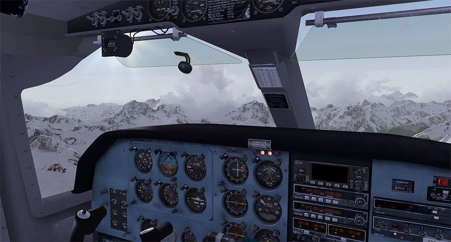
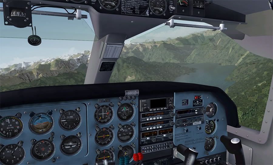
Nice. Really enjoying these.Is that a couple of Gen warning lights I see illuminated? 
B-RAD
i7 930 o/c 4.1 GHz
Gigabyte GA X58A UD3R
Kingston HyperX T1 PC12800/1600 CL9 12Gb
Sapphire Radeon HD5850
WD Caviar Blk 64mb cache 1TB Raid0
Antec P193,with 1200w dual channel PSU
Corsair H100 cooler
Win7 64bit
FSX SP2 Accel
Matrox TH2go
3 x Philips 170B 17inch LCDs
TrackIR
Saitek Pedals,Yoke and Quadrants
VLC,RealNZ,Godzone,fs-creations,FTX etc
- brad63
- Member
- Joined: Thu Mar 10, 2011 9:25 am
- Posts: 94
- Location: Whakatane
![]() by Ian Warren » Thu Oct 27, 2011 11:12 am
by Ian Warren » Thu Oct 27, 2011 11:12 am
Naki wrote:QUOTE (Naki @ Oct 27 2011,8:21 AM) <{POST_SNAPBACK}>I say...the Islander look great too
Have not brought that one yet but figured could get a DC-3 in there ...

-
Ian Warren - NZFF Pro
- Joined: Fri May 05, 2006 5:23 pm
- Posts: 41187
- Location: AREA 51
![]() by scaber » Thu Oct 27, 2011 11:31 pm
by scaber » Thu Oct 27, 2011 11:31 pm
Ian Warren wrote:QUOTE (Ian Warren @ Oct 27 2011,12:12 PM) <{POST_SNAPBACK}>Have not brought that one yet but figured could get a DC-3 in there ...
Damn, I was hoping that you might have forgotten by now! You're not going to let me forget are you?
|---------- Virtual Tour and Panoramic Photography ---------|
|-------------------- greg mckenzie, Christchurch -------------------|
-

scaber - Senior Member
- Joined: Mon Feb 08, 2010 9:51 am
- Posts: 1417
- Location: Christchurch
![]() by ardypilot » Thu Nov 03, 2011 10:34 am
by ardypilot » Thu Nov 03, 2011 10:34 am
Leg 11
Leg Distance: 129nm, Leg Time: 1.07
Total Distance: 1667nm, Total Time: 12:16
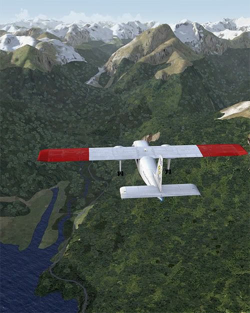
I'll just start off by saying that this leg was hands down my favourite flight of the entire tour. I knew the scenery for Fiordland would be good, but I had no idea it would be this good! Sorry for the excess of screenies
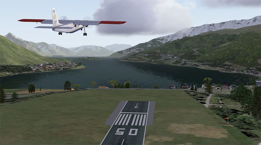
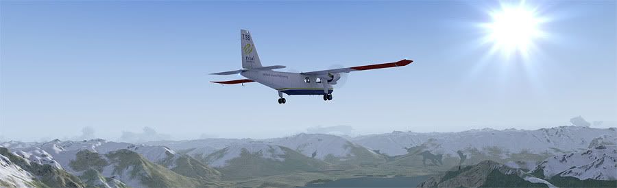
Back at NZMF, I started up the Islander for the very last time. Local time was bang on 0700 as I taxied out for runway 29, opening up a spot on the apron of the rush of tourist aircraft that would soon be bringing sightseers over the ranges from Queenstown.
I was #2 to depart, after a local Stationair on a similar operation. Holding on the brakes, I dropped the first 26 degree of flap and threw the throttles forward for a max performance takeoff- I was probably airborne in about two aircraft lengths with the aid of the westerly headwind.
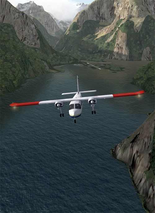
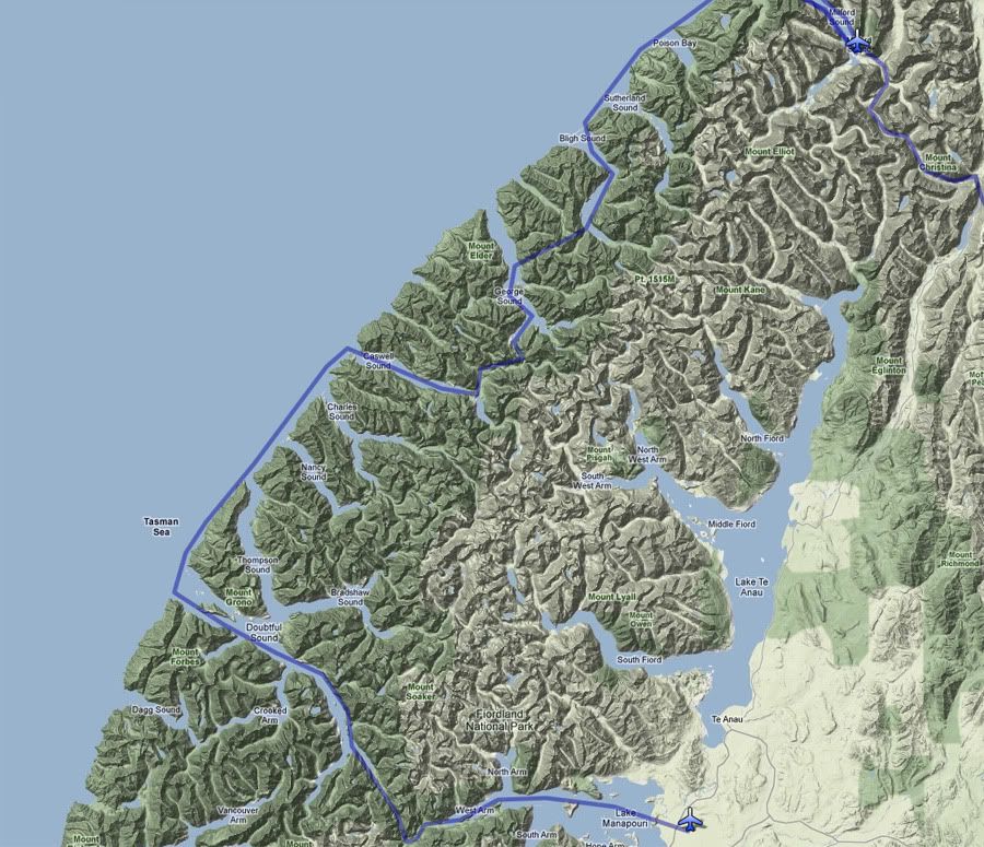
A positive ROC was achieved and I retracted the flaps, climbing out at a leisurely 80 knots for a gander at the spectacular scenery. Once I reached the mouth of the Sound, I banked left and continued climbing up to 4000', passing Transit River on my starboard side as I followed the rugged coast south.
The secluded waters of Poison Bay was the next inlet to appear on the left, followed not long after by Sutherland Sound as I cruised along at 120knots with 2400rpm set.
Bligh Sound was the third break in the coastline to greet me, and it was here that I banked left to follow its Z shaped water inlet back inland.
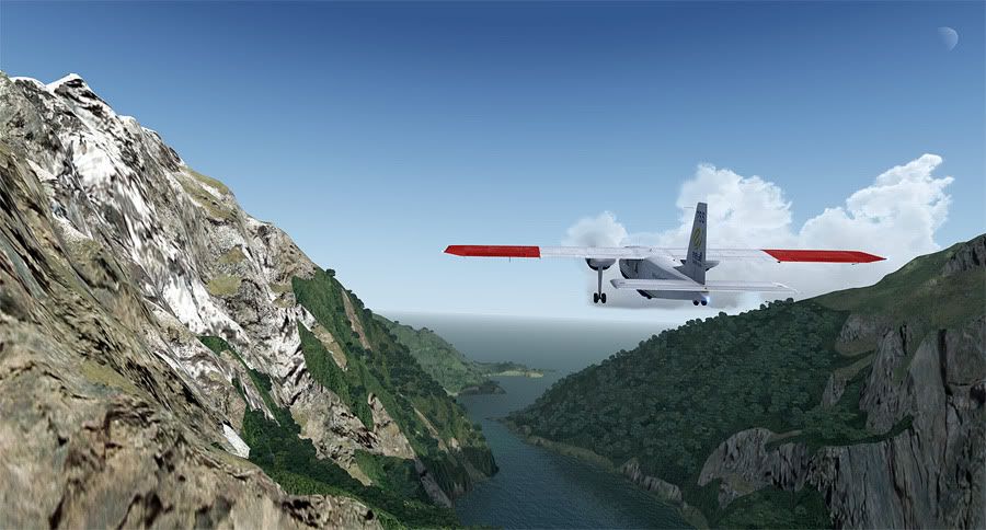
As I followed its path left, then right, then left again, a natural valley appeared at the end of the inlet, with an inviting low saddle guiding me towards it. There were no low cloudbase restricting my altitude, but I chose to stay relatively low at 4K and admire the terrain for a more immersive flight.
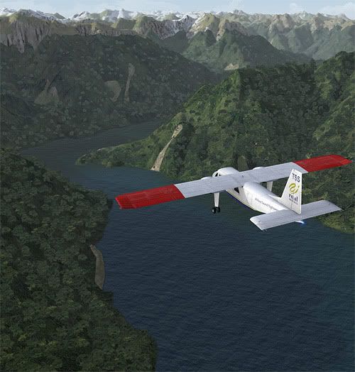
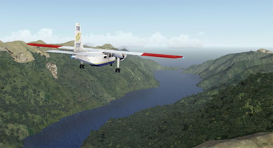
The short valley crossing led me into the next inland water body, George Sound, the 4th steep sided channel from the Tasman below Milford itself. It was here that I banked left one more time, to follow its passage inland again, deep along it's South West Arm towards the Stillwater River. This connected to Caswell Sound, which runs parallel to George about 10 miles away to the SE.
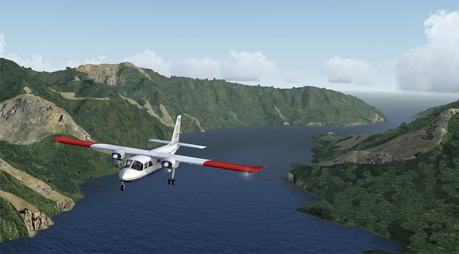
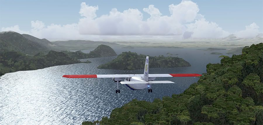
Once over the much bluer water of Caswell, I made a right hand turn for a change and tracked it back out to sea. From here I continued southbound along the Tasman Coast where I passed Charles Sound and Nancey Sound before reaching Thompson Sound- the feeder waterway for the much larger and more well known Doubtful Sound.
A little history lesson courtesy of Wikipedia- It was originally named 'Doubtful Harbour' in 1770 by Captain Cook, who did not enter the inlet as he was uncertain whether it was navigable under sail, hence the name. An expedition from España in 1793 saw its official charting and further naming, thus Febrero Point, Bauza Island, Pendulo Reach and Malaspina Reach became the only Spanish named locations in the entire country. It's actually a whopping 421 metres deep- the deepest of all the fiords and has a long distance of 40.4 kilometres from Deep Cove to the open sea.
A few aircraft from Queenstown also do scenic flights over this region, although far less than to Milford Sound due to the lack of road connections for coach tours. It just so happens to be represented beautifully in the sim thanks to VLC.
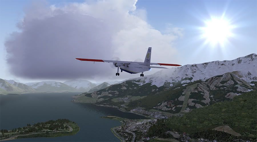
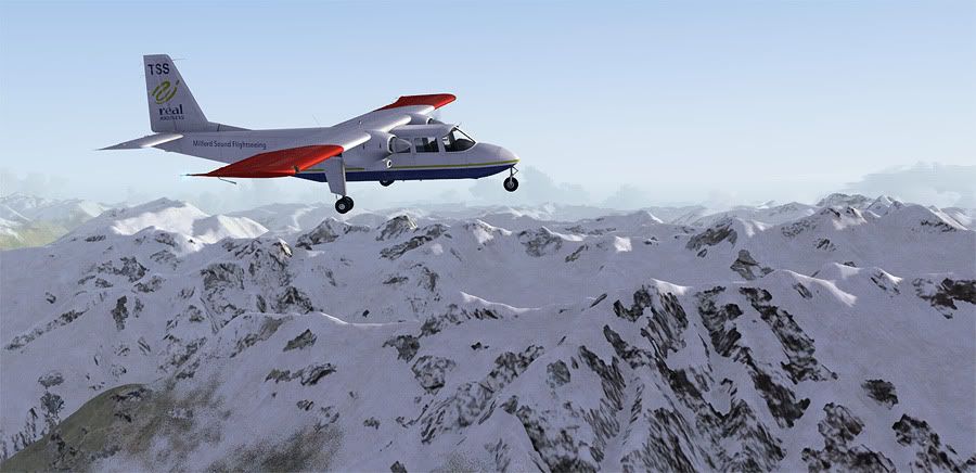
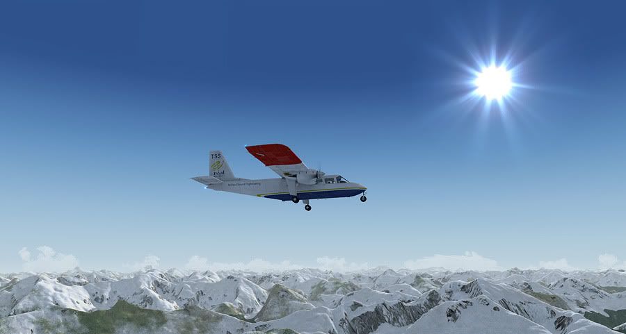
The slim chunks of Fegusson Island and Elizabeth Island guided me through to Deep Cove, where I expedited a climb up to 7000 feet to clear the snow capped peaks overhead the Wilmot Pass.
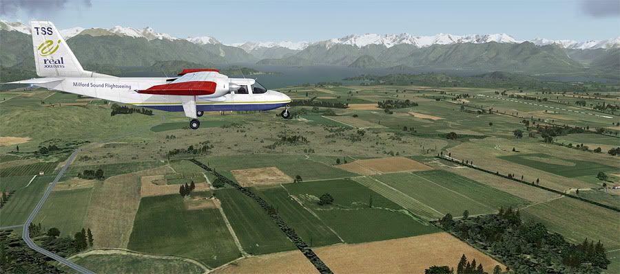
Shortly after, a glance out to the left showed Lake Manapouri opening up at the end of the Sprey River. This provided a nice wide valley for me to begin my descent over the inland water mass, towards my very final destination: NZMO.
This lake is another biggie- at 142 km², 444m deep and home to 33 islands and sheer cliff edged arms. I had to tune into Invercargill tour to request landing permission at the airport on the far side of the lake, and was instructed for a lefthand downwind join for 26.
The 'Cowboys Guide to BN-2 Islander' had taught me a handy rule- take your height above the aerodrome in thousands of feet, then multiply it by 3 to get TOD distance from destination in nautical miles. I was at about 6000ft AGL so started to descend from 18NM out, initially at something silly like 1500 fpm, reducing down to 800 fpm to bring me in for the circuit.
The mountains ahead of were looking different now- gone were the lush rainforest coated slopes of the West Coast. Back over this side of the main divide, the hillsides were bare and brown, much like the scenery from the rest of the tour enroute to NZQN.
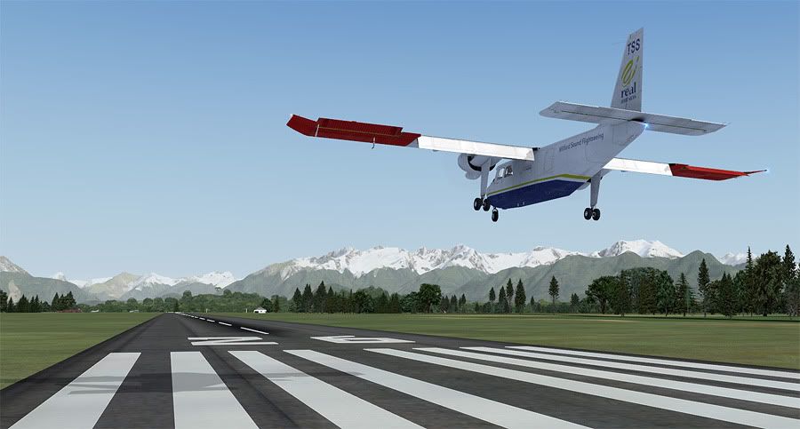
Flaps were lowered on base, overhead the usually flat terrain around the Mararoa River valley, and I was given landing clearance- #1 in the pattern. Touchdown was a breeze on the 1594m long sealed strip.
This airport was recently upgraded with a runway extension, lighting system and new terminal. Mount Cook Airways had previously served the lake with regular HS.748 flights but discontinued these from the late Eighties. Beginning next year, a BAe-146 will be bringing American tourists to the area on a frequent schedule based service.
It was at this new terminal that I shut the Islander down for the last time- now a firm favourite addon of mine that I am pleased I chose to use on this tour!
The addons used in this leg (excluding the same addons from the previous legs above) were: FS-Creations' Manapouri NZMO airport for FSX, built especially for this flight. Many thanks Mike for creating this for everyone to enjoy!
Cheers also to everyone else who's been reading along- seeing all the replies to my posts have made it even more enjoyable for me. If I you haven't already, don't be stupid- go and pick yourself up a copy of VLC from www.vectorlandclass.co.nz
Leg Distance: 129nm, Leg Time: 1.07
Total Distance: 1667nm, Total Time: 12:16
I'll just start off by saying that this leg was hands down my favourite flight of the entire tour. I knew the scenery for Fiordland would be good, but I had no idea it would be this good! Sorry for the excess of screenies
Back at NZMF, I started up the Islander for the very last time. Local time was bang on 0700 as I taxied out for runway 29, opening up a spot on the apron of the rush of tourist aircraft that would soon be bringing sightseers over the ranges from Queenstown.
I was #2 to depart, after a local Stationair on a similar operation. Holding on the brakes, I dropped the first 26 degree of flap and threw the throttles forward for a max performance takeoff- I was probably airborne in about two aircraft lengths with the aid of the westerly headwind.
A positive ROC was achieved and I retracted the flaps, climbing out at a leisurely 80 knots for a gander at the spectacular scenery. Once I reached the mouth of the Sound, I banked left and continued climbing up to 4000', passing Transit River on my starboard side as I followed the rugged coast south.
The secluded waters of Poison Bay was the next inlet to appear on the left, followed not long after by Sutherland Sound as I cruised along at 120knots with 2400rpm set.
Bligh Sound was the third break in the coastline to greet me, and it was here that I banked left to follow its Z shaped water inlet back inland.
As I followed its path left, then right, then left again, a natural valley appeared at the end of the inlet, with an inviting low saddle guiding me towards it. There were no low cloudbase restricting my altitude, but I chose to stay relatively low at 4K and admire the terrain for a more immersive flight.
The short valley crossing led me into the next inland water body, George Sound, the 4th steep sided channel from the Tasman below Milford itself. It was here that I banked left one more time, to follow its passage inland again, deep along it's South West Arm towards the Stillwater River. This connected to Caswell Sound, which runs parallel to George about 10 miles away to the SE.
Once over the much bluer water of Caswell, I made a right hand turn for a change and tracked it back out to sea. From here I continued southbound along the Tasman Coast where I passed Charles Sound and Nancey Sound before reaching Thompson Sound- the feeder waterway for the much larger and more well known Doubtful Sound.
A little history lesson courtesy of Wikipedia- It was originally named 'Doubtful Harbour' in 1770 by Captain Cook, who did not enter the inlet as he was uncertain whether it was navigable under sail, hence the name. An expedition from España in 1793 saw its official charting and further naming, thus Febrero Point, Bauza Island, Pendulo Reach and Malaspina Reach became the only Spanish named locations in the entire country. It's actually a whopping 421 metres deep- the deepest of all the fiords and has a long distance of 40.4 kilometres from Deep Cove to the open sea.
A few aircraft from Queenstown also do scenic flights over this region, although far less than to Milford Sound due to the lack of road connections for coach tours. It just so happens to be represented beautifully in the sim thanks to VLC.
The slim chunks of Fegusson Island and Elizabeth Island guided me through to Deep Cove, where I expedited a climb up to 7000 feet to clear the snow capped peaks overhead the Wilmot Pass.
Shortly after, a glance out to the left showed Lake Manapouri opening up at the end of the Sprey River. This provided a nice wide valley for me to begin my descent over the inland water mass, towards my very final destination: NZMO.
This lake is another biggie- at 142 km², 444m deep and home to 33 islands and sheer cliff edged arms. I had to tune into Invercargill tour to request landing permission at the airport on the far side of the lake, and was instructed for a lefthand downwind join for 26.
The 'Cowboys Guide to BN-2 Islander' had taught me a handy rule- take your height above the aerodrome in thousands of feet, then multiply it by 3 to get TOD distance from destination in nautical miles. I was at about 6000ft AGL so started to descend from 18NM out, initially at something silly like 1500 fpm, reducing down to 800 fpm to bring me in for the circuit.
The mountains ahead of were looking different now- gone were the lush rainforest coated slopes of the West Coast. Back over this side of the main divide, the hillsides were bare and brown, much like the scenery from the rest of the tour enroute to NZQN.
Flaps were lowered on base, overhead the usually flat terrain around the Mararoa River valley, and I was given landing clearance- #1 in the pattern. Touchdown was a breeze on the 1594m long sealed strip.
This airport was recently upgraded with a runway extension, lighting system and new terminal. Mount Cook Airways had previously served the lake with regular HS.748 flights but discontinued these from the late Eighties. Beginning next year, a BAe-146 will be bringing American tourists to the area on a frequent schedule based service.
It was at this new terminal that I shut the Islander down for the last time- now a firm favourite addon of mine that I am pleased I chose to use on this tour!
The addons used in this leg (excluding the same addons from the previous legs above) were: FS-Creations' Manapouri NZMO airport for FSX, built especially for this flight. Many thanks Mike for creating this for everyone to enjoy!
Cheers also to everyone else who's been reading along- seeing all the replies to my posts have made it even more enjoyable for me. If I you haven't already, don't be stupid- go and pick yourself up a copy of VLC from www.vectorlandclass.co.nz
QUOTE
Nice. Really enjoying these.Is that a couple of Gen warning lights I see illuminated?[/quote]
Good spotting Brad- I always like to start up my aircraft and operate them as realistically as possible, (no CTRL+E auto start nonsense), although I struggled a little with this one first time as the Flight1 manual isn't as comprehensive as I'd like. The above linked 'Cowboy's Guide' to flying the BN-2 really helped me though and I didn't have any red lights illuminated on my panel this leg
Good spotting Brad- I always like to start up my aircraft and operate them as realistically as possible, (no CTRL+E auto start nonsense), although I struggled a little with this one first time as the Flight1 manual isn't as comprehensive as I'd like. The above linked 'Cowboy's Guide' to flying the BN-2 really helped me though and I didn't have any red lights illuminated on my panel this leg
-
ardypilot - NZFF Pro
- Topic author
- Joined: Wed Apr 26, 2006 10:01 am
- Posts: 6802
- Location: Auckland
-

creator2003 - NZFF Pro
- Joined: Fri Jun 16, 2006 12:08 am
- Posts: 4633
- Location: Cant U C im LOCO
![]() by deeknow » Thu Nov 03, 2011 11:44 am
by deeknow » Thu Nov 03, 2011 11:44 am
More glorious scenery to behold, beaut shots, we are very lucky, so much great terrain about the place.
The cool thing about that part of NZ is you can take a few virtual risks in ways I guess you probably wouldnt when mountain flying for real, you get to see all the nooks and crannies (what the hell is a crannie anyway?)
The cool thing about that part of NZ is you can take a few virtual risks in ways I guess you probably wouldnt when mountain flying for real, you get to see all the nooks and crannies (what the hell is a crannie anyway?)
Last edited by deeknow on Thu Nov 03, 2011 11:45 am, edited 1 time in total.
Deans repaints: http://www.deeknow.com/
X570 Mini-ITX m/b - Ryzen7 5700X3D (8c/16t) - RTX 2060-super - 32GB 3600MHz DDR4 - Win10 - P3Dv5.3
X570 Mini-ITX m/b - Ryzen7 5700X3D (8c/16t) - RTX 2060-super - 32GB 3600MHz DDR4 - Win10 - P3Dv5.3
-
deeknow - NZFF Pro
- Joined: Tue Sep 18, 2007 10:15 pm
- Posts: 4484
- Location: NZHN
![]() by Ian Warren » Thu Nov 03, 2011 11:55 am
by Ian Warren » Thu Nov 03, 2011 11:55 am
deeknow wrote:QUOTE (deeknow @ Nov 3 2011,12:44 PM) <{POST_SNAPBACK}>(what the hell is a crannie anyway?)
a crinkly grannie ?
-
Ian Warren - NZFF Pro
- Joined: Fri May 05, 2006 5:23 pm
- Posts: 41187
- Location: AREA 51
![]() by ardypilot » Thu Nov 03, 2011 8:31 pm
by ardypilot » Thu Nov 03, 2011 8:31 pm
Ian Warren wrote:QUOTE (Ian Warren @ Nov 3 2011,11:46 AM) <{POST_SNAPBACK}>The Great New Zealand Journey , not complete yet is it
For now it is- although during the time I've been flying this one, decent addons for Wanganui and Nelson have been made available, so I'm thinking I'll be doing a return trip up north sometime in the future! Might as well take the ole BN-2A down to Stewart Island too me thinks
Aside from that, keep your eyes peeled for a flight simulation article + screenshots I've done for the NZ Aviation News, due to be published in the December edition.Last edited by ardypilot on Thu Nov 03, 2011 8:31 pm, edited 1 time in total.

-
ardypilot - NZFF Pro
- Topic author
- Joined: Wed Apr 26, 2006 10:01 am
- Posts: 6802
- Location: Auckland
39 posts
• Page 2 of 2 • 1, 2
Who is online
Users browsing this forum: No registered users and 30 guests