Page 1 of 2

Posted:
Mon May 21, 2007 4:52 pmby toprob
Posted:
Mon May 21, 2007 4:59 pmby ZK-Brock
Very nice Robin

Posted:
Mon May 21, 2007 5:10 pmby scon
Where do you get it from

Posted:
Mon May 21, 2007 5:32 pmby toprob
There's a beta available from the Avsim library. Bear in mind:
FSX only;
Need nice fast broadband.
EDIT: Maybe more of an explanation is required here.
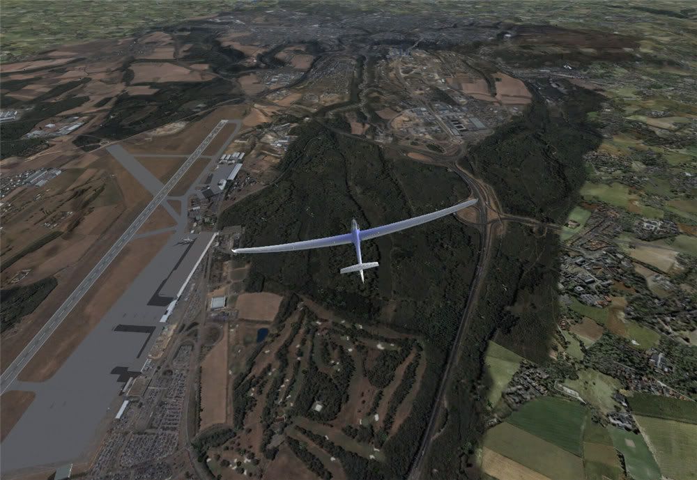
Tile Proxy is a program which 'streams' aerial imagery directly from any online aerial image source such as Google Earth or Virtual Earth. There's no scenery supplied with it -- you just set up your configuration depending on which server you wish to use, and TP will automatically load the images when you start a flight.
Posted:
Mon May 21, 2007 5:43 pmby Ian Warren
WHICKED ! Robin PIC no 7 ... The Russelly Hotel !
.. anyone in for a bitta Autogen

Posted:
Mon May 21, 2007 8:29 pmby Charl
Ian Warren wrote:WHICKED ! Robin PIC no 7 ... The Russelly Hotel !
.. anyone in for a bitta Autogen
Definitely very interesting...could one adapt existing autogen?
What about scenery objects?
Could one plop some hangers onto this, for example?

Posted:
Mon May 21, 2007 8:41 pmby Naki
Charl - that shot of yours is in Flight Sim with Tile Proxy? Amazing if it is.
Posted:
Mon May 21, 2007 8:44 pmby Charl
'Fraid not, though it is a tilted view from Google Earth so is comparable I suspect.
Posted:
Mon May 21, 2007 8:49 pmby Naki
Oh well -I guess that something like that is not too far away in the future and judging frrom Robins pics looks pretty close.
Posted:
Mon May 21, 2007 9:15 pmby toprob
Charl wrote:Definitely very interesting...could one adapt existing autogen?
What about scenery objects?
Could one plop some hangers onto this, for example?
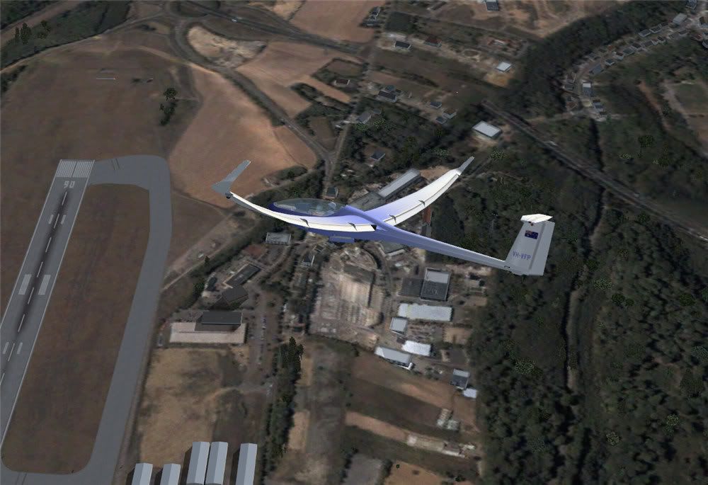
Here's default hangers on top of Tile Proxy.
I've seen some screenshots where someone took the autogen from a payware scenery and stuck it in the Tile Proxy texture folder, and it works fine. I will need to experiment with Marlborough -- it may be possible to remove the supplied 2.4 m/px scenery for use with 1.2 m/px from TP, but still retain my autogen.
Of course any addon scenery would sit on top.

Posted:
Mon May 21, 2007 10:22 pmby Charl
Plenty of tantalising possibilities.
You could rely on hi-res 2D down to really short distances, the autogen could actually be much more sparse, limited perhaps to major features generally, (airports and approach etc) without losing the "feel".
And easier to place?
The combination may be a killer app.
And, it's updated.
Posted:
Tue May 22, 2007 12:06 amby Cbris
Aerosoft are doing something similar... It's called "Aerosoft Photo Scenery" and it is a DIY tool more or less.
For Forum info:
go hereBasically you buy this app and download the Google satellite imagery to your own PC (something to do with Google's tough copyrights - fair dos). Then all you do is buy (Cheaper?) addons for various areas as they get developed - all these need to consist of then is the updated autogens and enhanced objects.
I am personally not to sure about this concept, because you won't get your home town made specially for you - you are still tied to buying a scenery project, but you now add "your own" photo tiles.
Here's some I took of Luxemburg (free demo)
Posted:
Tue May 22, 2007 8:02 amby towerguy
just some clarification please??
once you have done the flight are you able to save the downloaded tiles so you can refly the area offline? or is it only a case of being online every time?
I just wondered because if the cloud shows as a white area on the ground then you could only fly during fine periods. You would not be able to do an instrument approach and then break out to see scenery.
Posted:
Tue May 22, 2007 8:07 amby scon
towerguy wrote: just some clarification please??
once you have done the flight are you able to save the downloaded tiles so you can refly the area offline? or is it only a case of being online every time?
I just wondered because if the cloud shows as a white area on the ground then you could only fly during fine periods. You would not be able to do an instrument approach and then break out to see scenery.
I think you need to be online ALL the time
Posted:
Tue May 22, 2007 9:18 amby Cbris
towerguy wrote: just some clarification please??
once you have done the flight are you able to save the downloaded tiles so you can refly the area offline? or is it only a case of being online every time?
I just wondered because if the cloud shows as a white area on the ground then you could only fly during fine periods. You would not be able to do an instrument approach and then break out to see scenery.
For the Aerosoft "toy" yes - the tiles are saved to a scenery library. But the disadvantage is you only get a small area. No live feed during flight.
Swings and roundabouts.
Oh, and as for clouds, the Google satellite images aren't, AFAIK, live. They are usually static photos taken during one shuttle flight or another. Usually up to 4 or 5 years ago.
So you won't be able to get rid of clouds I'm afraid.
Posted:
Tue May 22, 2007 10:39 amby hinch
i know lots of people wondered if this was possible, and now it is! wow, fantastic. Microsoft's VE has amazing aerial photography for the UK, you can even see the slabs on my patio.
That is partly amazing because i live about 60miles from anywhere of any significance so thanks for them including us out in the sticks. It is also amazing because the patio has been covered by an extension for 18months.
Then again, looking at my old school it shows the astroturf in construction... that's been there since 2001.
www.flashearth.com
Posted:
Tue May 22, 2007 5:09 pmby deaneb
This is the way of the future - I prdeicted many years ago that we would eventually be flying thru an on-line 3d world. This looks like the first step. I believe MS have a team out taking (literally) millions of pics of one of the major US cities and they will be making 3d models of all the major buildings.
I have loaded Tile proxy, but the config of it looks complicated as the authors can't specifically tell how to set it up for Google earth.
Robin - are you able to share your config file entries ??
Deane
Posted:
Tue May 22, 2007 6:35 pmby toprob
deaneb wrote:Robin - are you able to share your config file entries ??
I found
this post VERY useful:)
In particular, the bit which says:
"the DEFAULT ProxyUser.ini works perfectly if you make two small changes: The "figurethisoutyourself" parts of the URLs just need to be replaced with v******e****.net (for Service Exapmple 1) and "g*****.com" (for Service Example 2). Then, under the heading, remember to remove the # sign from in front of the service you wish to try to activate it. IMPORTANT: Make sure to ADD a # sign to the non-functioning "Acme" example to DE-ACTIVATE it, i.e. so only ONE service remains without a # sign and thus "active"."
Posted:
Tue May 22, 2007 6:42 pmby toprob
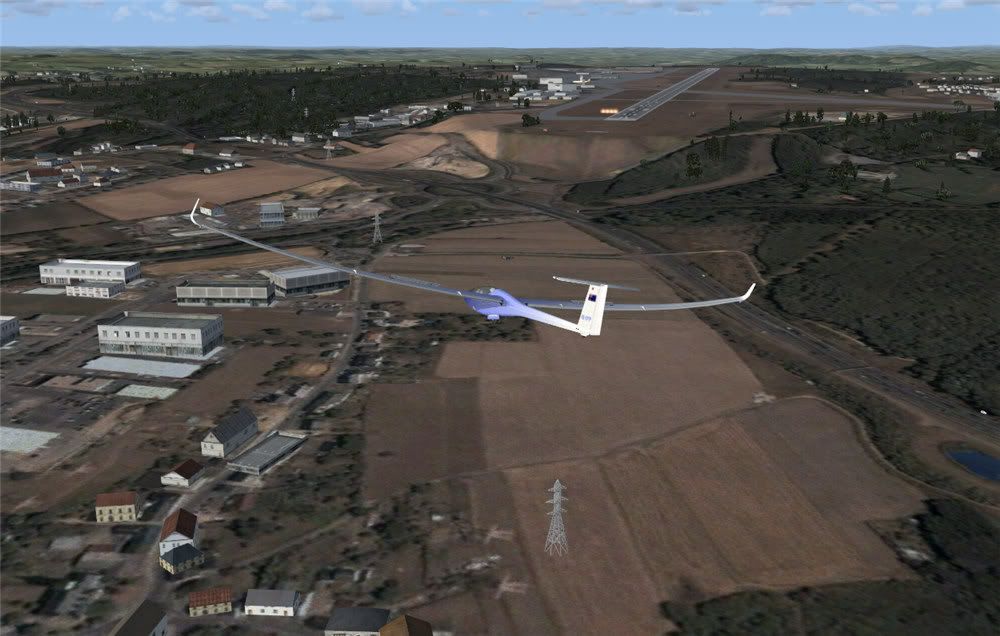
A couple more shots:


Posted:
Tue May 22, 2007 6:46 pmby Charl
Robin
What's your internet speed/load time for this stuff?
I imagine it's not really flyable in present incarnation, or is it?
And I assume the mesh just sits under the phototextures?


