Page 1 of 1

PostPosted: Mon Jul 10, 2006 5:58 pm
by Charl
The NASA South Island pic I posted previously has been my desktop background for a while, but it became time for a change.
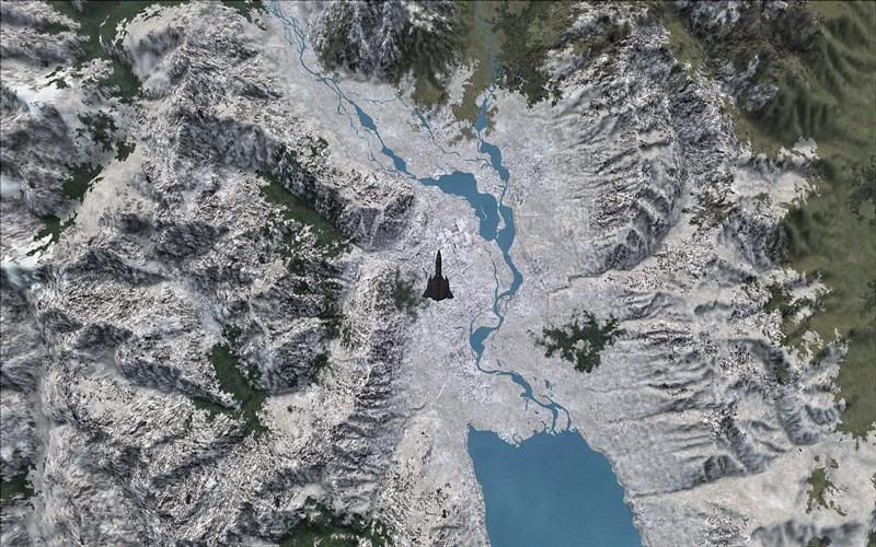
I couldn't find something to satisfy the requirement too quickly, and so I thought:
Well there is this software available...
user posted image
...which can show Lake Pukaki/Mt Cook from 50,000ft.
If you look carefully you can see the REAL subject, cruising along at Mach 3!

PostPosted: Mon Jul 10, 2006 6:28 pm
by Jimmy
kool..is it just my bad eye fr graphics or are the textures abit blury around the edges?

cruising along at Mach 3!


Mach three!! do your ground textures even get time to load as you fly along that fast , it must put a real load on the prossesor.

PostPosted: Mon Jul 10, 2006 7:56 pm
by Charl
Jimmy wrote:are the textures abit blury around the edges?


Mach three!!  do your ground textures even get  time to load

Yes the textures are blurry because FS only renders accurately within the preset sight distance from the Blackbird - beyond that you lose detail so your graphics card doesn't implode with data

And at 50,000 ft the ground moves slowly enough past your viewpoint so you still get detail directly below.

(Oh, and the Blackbird just became freeware over at Alphasim)

PostPosted: Tue Jul 11, 2006 10:38 pm
by ardypilot
Nice shot Charl!

That is Christian Stock's freeware landclass I persume?

And thanks for the info about the Blackbird- I was about to ask if you needed to pay for it or not :lol: