1. where to fly
2. what to fly
3. what weather to use
4. how long the tour should take
and i came up with...
1. every city in NZ in ascending latitudonal order (north to south) according to http://en.wikipedia.org/wiki/List_of_cities_in_New_Zealand
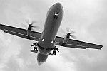
2. Cessna (non g1000(i've clocked up a few hours so im pretty used to it))
3. sunny, no wind (first tour. i know how to figure out HDG °C but i wanted it to be easy)
4. determined by 'where to fly' (turns out to be 14 hrs 07 mins over 1347.5 nm (not including climb speeds, decent speeds, acceleration, deceleration))
now sure, there are some flaws such as the flight plan looking like this...

causing a zig-zag across the north island and an east coast route along the south island. but i figure i can see more of the country that way
i also dont know the airspace rules and stuff but hey, once again, FIRST TOUR.
i'm going to try to use the gps as little as possible but if i have to then i will.
here is the itinary
NZWR
NZAA
NZTG
NZHN
NZRO
NZGS
NZNP
NZNR
NZHS
NZWU
NZPM
NZWN
NZNS
NZCH
NZDN
NZNV
i'm also only going to stop and save once on the ground at the airports.
so off i go. wish me luck and i'll keep you posted with some screenies!