FSX MULTIPLAYER NOTAM: FRIDAY 11/05/07

For everything about online flying around New Zealand

Postby ZK-TJL » Sun May 06, 2007 11:00 am

In the past couple of weeks I have noticed a vast improvement in many pilots on the server. While pilots are improving in all areas, one area in particular that interests me greatly is the use of VOR's (Very high frequency omni directional range), NDB's (Non specific directional beacon) and DME's (Distance measuring equipment) for IFR navigation. I have been helping a few pilots with this by way of joint cockpit tutorials and have been amazed at how quick these guys are learning. Let's try out these skills"¦"¦"¦.What better way to do it than with military operations. Try avoiding using GPS"¦"¦unless you have to"¦"¦see how you go.


Server Date and Time "“ 7pm Friday 11 May 2007
Flight Type "“ Military Op
Start Airport "“ NZWB (Woodbourne) - Spawn at gates
End Airport "“ SEE OPTIONS BELOW
Aircraft Type "“SEE OPTIONS BELOW
Shared Cockpits - None
Weather "“ Grey and Raining
ATC Roster "“
NZWB = Nik (ZK-TJL)
NZOH = Scott (nz787) (Scon)
NZWP = Tim (Zolutger)
NZWN = James (J Eden)
Additional Details "“ Woodbourne Runway in FSX is labeled incorrectly, I'll will refer to the runway by its real world numbering 06-24


Two options this week, read each one carefully then make your choice.

user posted image

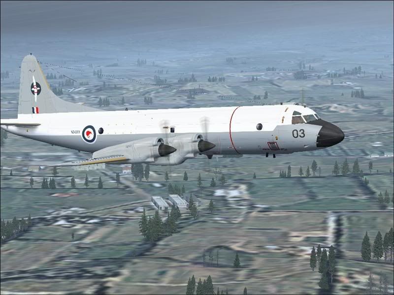
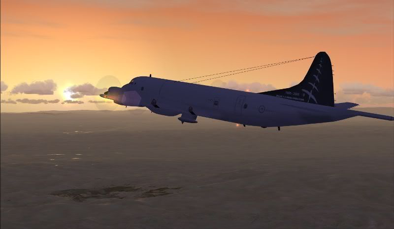
OPTION 1 - Lockheed P3 Orion

user posted image

Your mission is divided into three legs.


First leg IFR - Starting at Woodbourne (NZWB) you will head north to Ohakea (NZOH) and pick up a new weapons operator for training.

Recommended flight plan for NZWB to NZOH

IFR. NZWB-->NZOH. H472 TR H169 OH 7000feet RLCE (Request level change enroute, if required).

Brief description of flight plan:

H472 TR
Fly outbound from Woodbourne VOR/DME (WB) on the 026 radial (approximate heading 026). Once you have picked up Tory VOR/DME (TR) 206 radial (approximate heading 026), continue inbound on this radial until you cross Tory (TR).

H169 OH
From here fly the 018 radial (approximate heading 018) out bound from Tory (TR) until you reach PPN waypoint (44 DME Tory). By now you should be able to pick up the Ohakea VOR/DME (OH), fly the 211 inbound radial (approximate heading 031) to Ohakea (OH).


Second leg IFR- From NZOH you'll fly to Whenuapai (NZWP).

Recommended flight plan for NZOH to NZWP

IFR. NZOH-->NZWP. H182 WP 19000feet (Flight level 190)

Brief description of flight plan:

H182 WP
Fly outbound from Ohakea VOR/DME (OH) on the 335 radial (approximate heading 335). Once you have picked up the Taumarunai NDB (TM.) fly the inbound 155 track (approximate heading 335) until you cross Taumarunai (TM.).Upon crossing Taumarunai fly outbound on the 327 track (approximate heading 327), crossing LEGER waypoint. Once you have picked up the Auckland VOR/DME (AA) fly inbound on the 148 radial (approximate heading 328) until you cross Auckland. By this stage you should have picked up Whenuapai VOR/DME (WP). Upon Crossing the Auckland VOR/DME fly the 126 radial inbound (approximate heading 306) to Whenuapai.


Third leg VFR - After refueling and taking on further crew and equipment at Whenuapai you will track the west coast north bound on maritime patrol (1000 feet MSL), then round the top of the North Island and track south along the east coast, then back to NZWP.


OPTION 2 - Lockheed C130 Hercules, Beech King Air 350 or Boeing C17 Globemaster.

user posted image

user posted image

user posted image

Your mission is divided into three legs.


First leg IFR - Starting at Woodbourne (NZWB) you will head north to Ohakea (NZOH) and pick up supplies, vehicles and personnal to be transported to Whenuapai.

Recommended flight plan for NZWB to NZOH

IFR. NZWB-->NZOH. H472 TR H169 OH 7000feet RLCE (Request level change enroute, if required).

Brief description of flight plan:

H472 TR
Fly outbound from Woodbourne VOR/DME (WB) on the 026 radial (approximate heading 026). Once you have picked up Tory VOR/DME (TR) 206 radial (approximate heading 026), continue inbound on this radial until you cross Tory (TR).

H169 OH
From here fly the 018 radial (approximate heading 018) out bound from Tory (TR) until you reach PPN waypoint (44 DME Tory). By now you should be able to pick up the Ohakea VOR/DME (OH), fly the 211 inbound radial (approximate heading 031) to Ohakea (OH).


Second leg IFR- From NZOH you'll fly to Whenuapai (NZWP).

Recommended flight plan for NZOH to NZWP

IFR. NZOH-->NZWP. H182 WP 19000feet (Flight level 190)

Brief description of flight plan:

H182 WP
Fly outbound from Ohakea VOR/DME (OH) on the 335 radial (approximate heading 335). Once you have picked up the Taumarunai NDB (Tm.) fly the inbound 155 track (approximate heading 335) until you cross Taumarunai (Tm.).Upon crossing Taumarunai fly outbound on the 327 track (approximate heading 327), crossing LEGER waypoint. Once you have picked up the Auckland VOR/DME (AA) fly inbound on the 148 radial (approximate heading 328) until you cross Auckland. By this stage you should have picked up Whenuapai VOR/DME (WP). Upon Crossing the Auckland VOR/DME fly the 126 radial inbound (approximate heading 306) to Whenuapai.


Third leg IFR - From NZWP its south, to NZWN.

Recommended flight plan for NZWP to NZWN

IFR. NZWP-->NZWN. H182 AA H384 TR M639 28000feet (Flight level 280)

Brief description of flight plan:

H182 AA
Fly inbound to Auckland VOR/DME (AA) on the 306 radial (approximate heading 126).

H384 TR
Upon crossing Auckland VOR/DME (AA) fly the 174 outbound radial (approximate heading 174) towards NEW Plymouth VOR/DME (NP). Once you've picked up New Plymouth VOR/DME (NP), continue inbound on the 354 radial (approximate heading 174). Upon crossing the New Plymouth VOR/DME (NP), fly the outbound 155 radial (approximate heading 155) passing the AKAVI waypoint at 60DME and the SWUTH waypoint at 106 DME. Once you've picked it the Tory VOR/DME (TR), fly the inbound 334 radial (approximate heading 154).

M639 WN
Upon crossing Tory VOR/DME (TR) fly the outbound 091 radial (approximate heading 091). You should then be able to pick up the Wellington VOR/DME. Once you picked up Wellington VOR/DME continue inbound on the 271 radial (approximate heading 091).


Required Frequencies.

Communication Frequencies
Woodbourne Tower "“ 122.80 MHz
Ohakea Tower "“ 134.50 MHz
Whenuapai Tower "“ 119.90 MHz
Wellington Tower "“ 118.80 MHz
Unicom "“ 130.00 MHz

ATIS Frequencies (It is highly likely that these won't work, ATC will enter the ATIS for their zone in the chat box)
Woodbourne "“ 128.20 MHz
Ohakea "“ 135.00 MHz
Whenuapai "“ 128.30 MHz
Wellington "“ 126.90 MHz

Navigation Frequencies
WB = Woodbourne VOR/DME "“ 115.60 MHz
TR = Tory VOR/DME "“ 114.60 MHz
OH = Ohakea VOR/DME "“ 109.00 MHz
TM = Taumarunai NDB "“ 1630.0 kHz
AA = Auckland VOR/DME "“114.80 MHz
WP = Whenuapai VOR/DME "“ 108.80 MHz
NP = New Plymouth VOR/DME "“ 114.40 MHz
WN = Wellington VOR/DME "“ 112.30 MHz

ILS (Instrument landing system) Frequencies
Ohakea runway 09 "“ 110.70 MHz. Heading 088
Ohakea runway 27 "“ 111.10 MHz. Heading 267
Whenuapai runway 03 "“ 110.70 MHz. Heading 034
Whenuapai runway 21"“ 111.10 MHz. Heading 214
Wellington runway 16 "“ 110.30 MHz. Heading 161
Wellington runway 34 "“ 109.90 MHz. Heading 341

Aircraft

All pilots will be required to have all of these downloads installed (or you won't see the correct models)

Hercules from RNZAF site http://www.airforce.mil.nz/downloads/zi ... rcules.zip

Globemaster from http://www.pmstone.com/BoeingC17.htm (globemaster)
The Repaint for the Globemaster http://www.flightsim.com/cgi/kdl/main/6 ... p?jGatA050 If you struggle to get this link to work go to www.flightsim.com and search for our very own Hamish harvey. You'll have to log in to flightsim.com

Orion from RNZAF site http://www.airforce.mil.nz/downloads/zip/p3k_orion.zip

Another Orion (This one has Virtual Cockpit) from AVSIM site http://library.avsim.net/download.php?DLID=98446 (another Orion with Virtual Cockpit)
user posted image

The repaint for the Orion with Virtual Cockpit http://library.avsim.net/download.php?DLID=70296
user posted image

King Air 350 repaint http://library.avsim.net/esearch.php?DLID=102650

Charts

Here are the relevant links to the AIP site. Its up to you to print off the charts that you think would be useful. I recommend having a good look over the charts so theres no unexpected surprises from ATC.

http://www.aip.net.nz/NavWalk.aspx?sect ... Woodbourne No one will be landing at Woodbourne so don't waste paper printing off any approach plates for this air base, However standard instrument departures (SID's) may be used so it would be a good idea to print off the SID's for NZWB.

http://www.aip.net.nz/NavWalk.aspx?sect ... ree=Ohakea
Instrument approaches (including ILS) and SID's may be in use at NZOH at the controllers discretion.

http://www.aip.net.nz/NavWalk.aspx?sect ... =Whenuapai
Instrument approaches (including ILS) and SID's may be in use at NZWP at the controllers discretion.

http://www.aip.net.nz/NavWalk.aspx?sect ... Wellington Standard terminal arrival routes (STAR's) may be in use at NZWN as well as Instrument approaches (including ILS) at the controllers discretion.

Visual departures and approaches will be approved if requested at all towers (saves printing off paper for those of you who'd rather not try these instrument procedures).

Bit of home work there for some people (hence the very early posting of this NOTAM)"¦"¦"¦.but it should be worth it. If you would like some help using VOR's, NDB's or ILS before Friday then send me a PM and we'll sort out a joint cockpit practice session for you. The GPS is always there as a back up on the day for those that need it.


Server Password: RNZAF (case sensitive)

A couple of tips for this week;
1) Printing this NOTAM off might be a good idea
2) Make sure you have a pen and paper at the ready for ATC instructions etc...
3) Download the aircraft early in the week......pick your aircraft and become familar with it.


:clap:
Last edited by ZK-TJL on Sun May 13, 2007 5:22 pm, edited 1 time in total.
ZK-TJL
Forum Addict
 
Topic author
Joined: Sun Jan 07, 2007 12:20 pm
Posts: 490
Location: Christchurch

Postby scon » Sun May 06, 2007 11:24 am

YAY good on ya Nik :thumbup: :thumbup: :bow: . This will be the night before my B-day :)
scon
Sim-holic
 
Joined: Mon Oct 16, 2006 7:16 pm
Posts: 963
Location: NZ

Postby ZK-TJL » Sun May 06, 2007 11:30 am

Good stuff Scott, I thought you'd like this one. :thumbup: What ya gonna fly?
ZK-TJL
Forum Addict
 
Topic author
Joined: Sun Jan 07, 2007 12:20 pm
Posts: 490
Location: Christchurch

Postby scon » Sun May 06, 2007 11:42 am

I reckon the good ole herk :wub: had it at the airshow will stick with it now.


I can't get this link to work

http://www.flightsim.com/cgi/kdl/main/6 ... p?jGatA050


could you just give me the zip name
scon
Sim-holic
 
Joined: Mon Oct 16, 2006 7:16 pm
Posts: 963
Location: NZ

Postby ZK-TJL » Sun May 06, 2007 12:17 pm

ZK-TJL wrote: The Repaint for the Globemaster http://www.flightsim.com/cgi/kdl/main/6 ... p?jGatA050 If you struggle to get this link to work go to www.flightsim.com and search for our very own Hamish harvey. You'll have to log in to flightsim.com

Hi there scott. Try this......this should get ya sorted :thumbup:

I thought you'd go with the herc, I believe the herc in the show was of a lower quality to help frame rates....if you download it fresh from the RNZAF site I think it will be of a higher quality.....plus it will include both repaints.

I think I go with the king air once I get everyone airbourne out of NZWB. :plane:
Last edited by ZK-TJL on Thu May 10, 2007 6:39 pm, edited 1 time in total.
ZK-TJL
Forum Addict
 
Topic author
Joined: Sun Jan 07, 2007 12:20 pm
Posts: 490
Location: Christchurch

Postby Zöltuger » Sun May 06, 2007 3:45 pm

this is going to be a great event >nzflag<
Last edited by Zöltuger on Sun May 06, 2007 3:46 pm, edited 1 time in total.
Zöltuger
 

Postby ardypilot » Sun May 06, 2007 3:55 pm

Sounds like a load of fun- good on ya for doing all the planning Nik!

I sure wish I had FSX when reading posts like these..
User avatar
ardypilot
NZFF Pro
 
Joined: Wed Apr 26, 2006 10:01 am
Posts: 6802
Location: Auckland

Postby ZK-TJL » Sun May 06, 2007 3:57 pm

Cheers Trolly. A fair amount of planning and thought went into this one. :thumbup:
ZK-TJL
Forum Addict
 
Topic author
Joined: Sun Jan 07, 2007 12:20 pm
Posts: 490
Location: Christchurch

Postby Jimmy » Sun May 06, 2007 4:15 pm

What an improvment :clap: Thats excalent Nik, really well put together.

(Very high frequency omni directional range)


So is it that or "Very high frequency omni directional radio range"? Some times the range is droped.. Interesting..


Looks like it could be quite realistic, all you need now is a way of filling flight plans, and tower controlers with slightly more realisatic airspace :lol: I reakon a chc control would make it way more realistic.. ah well..

James
Jimmy
 

Postby ZK-TJL » Sun May 06, 2007 4:19 pm

Jimmy wrote: What an improvment  :clap:   Thats excalent Nik, really well put together.

(Very high frequency omni directional range)


So is it that or "Very high frequency omni directional radio range"? Some times the range is droped.. Interesting..


Looks like it could be quite realistic, all you need now is a way of filling flight plans, and tower controlers with slightly more realisatic airspace :lol: I reakon a chc control would make it way more realistic.. ah well..

James

Its simply different Jimmy, each person has their own spin on what is best, some guys prefer VFR, some jets, some military. I've simply outlined the routes abit for those guys that have been working on using NAVAID's.

As I told you many times now we will not be operating a centre for some time yet, hence airspace being the way it is........but you already know this. In terms of filing flight plains its as easy as typing it in the chat box. If you don't type it in the chat box the ATC will assume you will be using the recommended route, and clear you as such (or clear you for an amended route). I do recommend filing your flight plan in Flight simulator when you join the server, it will then appear on your GPS, and hopefully SP1 will have it appear in the ATC aircraft info window.......I have seen this occur only when I control overseas, also to further add to this, all the ATIS's appear to work overseas.......poor old NZ.
Last edited by ZK-TJL on Sun May 06, 2007 10:17 pm, edited 1 time in total.
ZK-TJL
Forum Addict
 
Topic author
Joined: Sun Jan 07, 2007 12:20 pm
Posts: 490
Location: Christchurch

Postby troub1eboy » Sun May 06, 2007 6:49 pm

You do realise that most of the downloads are for FS 2004
troub1eboy
 

Postby scon » Sun May 06, 2007 6:52 pm

Yes they are for 04 but they work in X


I have put this togeather for all of the textures that don't have thumbnails, just add it to the texture folder that you want an make sure the name is " thumbnail "


user posted image


The airforce logo is copyright of the RNZAF
Last edited by scon on Sun May 06, 2007 6:55 pm, edited 1 time in total.
scon
Sim-holic
 
Joined: Mon Oct 16, 2006 7:16 pm
Posts: 963
Location: NZ

Postby ZK-TJL » Sun May 06, 2007 7:00 pm

troub1eboy wrote: You do realise that most of the downloads are for FS 2004

Sure do :) . All of the shots in the NOTAM were taken in FSX. The Orion with VC is an FSX model (but I think it works in FS9) and of course the default King air 350 is an FSX model LOL.

Cool Scott, I might just use that :thumbup:
Last edited by ZK-TJL on Sun May 06, 2007 7:01 pm, edited 1 time in total.
ZK-TJL
Forum Addict
 
Topic author
Joined: Sun Jan 07, 2007 12:20 pm
Posts: 490
Location: Christchurch

Postby ZK-KAG » Sun May 06, 2007 7:51 pm

Looks great Nik! :clap:

Thanks for all the effort you put into this one!! :bow:

See you all at Ohakea :D

~ZK-KAG~ aka 'Ohakea Tower' >nzflag<
"ZK-KAG"
"We who fly do so for the love of flying. We are alive in the air with this miracle that lies in our hands and beneath our feet"

Image
Check out all the multiplayer action @ ARNZX "FNF"
ZK-KAG
Sim-holic
 
Joined: Sun Oct 01, 2006 8:20 pm
Posts: 729
Location: Palmerston North / Auckland

Postby scon » Sun May 06, 2007 8:06 pm

How do you do a radial??? Will my VOR Gauge tell me
Last edited by scon on Sun May 06, 2007 8:09 pm, edited 1 time in total.
scon
Sim-holic
 
Joined: Mon Oct 16, 2006 7:16 pm
Posts: 963
Location: NZ

Postby ZK-TJL » Sun May 06, 2007 9:21 pm

scon wrote: How do you do a radial???    Will my VOR Gauge tell me

ok.....I often have trouble explaining this one. VOR radials extend from the VOR station. There are 360 (1 per degree). I always try think of it by looking at my current position 'from' the VOR station. Heres some examples.

"Dunedin Tower, King Air 83 with Bravo, at 5000. Inbound swampy on the 020 radial, DME 23"

Ok....so I now know that this king air is 'inbound' towards swampy. I know that he is on the 020 radial. With this in mind I know that his approximate heading will be 200 (simply add 180 if the radial was below 180.......or minus 180 if the radial was above 180). This means hes currently to the north of Swampy. I also know that he is 'DME 23'.........so he is 23 nautical miles out from Swampy.

heres a different example.

"Dunedin Tower, King Air 83 passing 5000 for 9000. Outbound swampy on the 350 radial, DME 35"

Because hes out bound on the radial his heading will approximately match it (non wind corrected).

So flying out bound from a VOR is quite simple.....set the course knob to the desired radial, tune the nav radio correctly and fly the radial (similar to ILS approaches), your autopilot can do this. When flying inbound you set the 'tail' of the needle to the radial.

So if I want to fly 'inbound' on the 360 radial my approximate heading will be 180 (360-180=180) (heading south). I will set my course knob to 180. (the tail of the needle will point to the radial 360)

are ya still with me? :blink:

So if continue flying inbound on the 360 radial, once I cross the VOR station and continue outbound (in the same direction) I will be on the 180 radial (still with a heading of 180 (approx).

When I give ATC instructions its very rare that I will need to state a radial, perhaps if there was an aircraft coming to NZDN from the north, inbound on swampy and one going out bound to the north I may give them two different radials to track along (remember theres no vectoring at NZDN)...until they are well clear of one another. It is more common that I may ask a pilot to report at a certain DME, and to a greater extent when they are 'crossing the NAVAID'. This helps me to plan what I will do next with the aircraft I have to deal with. It helps to build up a picture of whats happening and this in turn helps when making decisions.....do I have time to get this aircraft away first? Shall I hold this aircraft? Which aircraft will be here next? of course I'll get info from the pilots where I can. You'll often hear me ask for reports from pilots, in particular 'crossing' a specific point, marker or altitude.

"TGM, report outer marker"

"FPG, report crossing swampy"

or if VFR

"TGM, report crossing taieri river"

Another one is time estimates. Time is a great tool that helps me to build this picture.

"SCT, your estimate for Berridale and Swampy please"

"Dunedin Tower, SCT estimate Berridale at time 51 and Swampy on the hour"

I'm not sure I have explained this well. PM me if you'd like to sort out a time for some joint cockpit stuff and I'll try help ya then if your keen. :D

Heres a good link, this tute was put togeather by nzav8tor.....it's really well done http://z11.invisionfree.com/nzff/index. ... topic=2917 It focuses on an ARC DME approach into NZNS but also explains enroute navigation from NZWN to NZNS using airways and VOR's. In FSX the VOR's 'reach' for miles and miles. nzav8tor talks about this in his tute, explaining minimum reception attitudes MRA's.

There's also a couple of lessons in FSX I think. One of which is a seperate lesson on holding patterns (many of which are based at NAVAIDS)

Have a look at this link first, if your still unsure PM me.

For those that think they have it figured out heres a real world photo I grabbed at NZDN. (Note there is a small circle on holding point Alpha (just out of shot), to which this sign applies)
user posted image

This shot shows the 'small circle' through which the 211 Radial passes.
user posted image

As you can see the sign states the VOR frequency (for swampy) and the radial that cuts through the small circle. So based on the info, if we wanted to head direct to Swampy from holding point alpha what heading (approx) would we fly? and what radial would we be on?

Heading 031 and on the 211 radial.

Take a flight into Dave's Ridge (if you have it installed) you'll find a similar sign there, where you can try this again.

Craig or nzav8tor if your out there reading this, jump in any time. :D

:plane: :thumbup:
Last edited by ZK-TJL on Mon May 07, 2007 1:26 pm, edited 1 time in total.
ZK-TJL
Forum Addict
 
Topic author
Joined: Sun Jan 07, 2007 12:20 pm
Posts: 490
Location: Christchurch

Postby Ian Warren » Sun May 06, 2007 10:17 pm

MARITIME PATROL user posted image
New Plane , New Scenery ... James Edens Shackelton over Tim 'Timmo' Barnes latest scenery, good plan to get some NAV Education and procedure since all mornings will not look like this
user posted image
user posted image
We want the day to look a little like this , Greg Hux's early RNZAF P3 paint
user posted image
But weather turns pooh as you head out to the western coast
user posted image
SWAT over papers , or what you think is needed , follow NIK's NOTAM to the letter , you can't go wrong , :) I'll look at seeing if this is compatiable
user posted image
user posted image
Image
User avatar
Ian Warren
NZFF Pro
 
Joined: Fri May 05, 2006 5:23 pm
Posts: 41187
Location: AREA 51

Postby Ian Warren » Sun May 06, 2007 10:33 pm

Recent ? SIMPLE MAN TERMS ... Radial sounds really Hi tec for some ...

A Circle is 360 Degs ... the CENTER is called SWAMPY .. each line heading away from the CENTER is a Radial ( radius )

EDIT
:)
Last edited by Ian Warren on Sun May 06, 2007 10:36 pm, edited 1 time in total.
Image
User avatar
Ian Warren
NZFF Pro
 
Joined: Fri May 05, 2006 5:23 pm
Posts: 41187
Location: AREA 51

Postby ZK-TJL » Sun May 06, 2007 10:39 pm

We will base a 'FRIDAY NIGHT FLIGHT' around Tims scenery........don't you worry :D . Not sure exactly what we'll do.......but we'll cook something up (Timmo flick me a PM if you have a specific idea). Other stuff is on the cards to of course. Dean's Fletcher, Scott's Great Barrier, and NZUN, the Saab 2000 by BSMP, Didn't know about the Shackelton :blink: . We'll work our way through em :thumbup:
Last edited by ZK-TJL on Sun May 06, 2007 11:18 pm, edited 1 time in total.
ZK-TJL
Forum Addict
 
Topic author
Joined: Sun Jan 07, 2007 12:20 pm
Posts: 490
Location: Christchurch

Postby ZK-TJL » Sun May 06, 2007 10:43 pm

Ian Warren wrote: Recent ?    SIMPLE MAN TERMS      ... Radial sounds really Hi tec for some  ...

A Circle is 360 Degs  ... the CENTER is called SWAMPY  ..  each line heading away from the CENTER is a Radial ( radius )

EDIT                                 
:)

Yip :thumbup: . The centre of that circle is SWAMPY. Thats a good way to think of it. Just be aware you can fly 'inbound' on radials to. :)
Last edited by ZK-TJL on Sun May 06, 2007 11:21 pm, edited 1 time in total.
ZK-TJL
Forum Addict
 
Topic author
Joined: Sun Jan 07, 2007 12:20 pm
Posts: 490
Location: Christchurch

Next

Return to Multiplayer

Who is online

Users browsing this forum: No registered users and 6 guests